Category:Marshes of Devon
Jump to navigation
Jump to search
Ceremonial counties of England: Cornwall · Cumbria · Devon · East Riding of Yorkshire · Essex · Greater London · Isle of Wight · Kent · Lancashire · Lincolnshire · Norfolk · Shropshire · Suffolk · West Sussex ·
City-counties:
Former historic counties:
Other former counties:
City-counties:
Former historic counties:
Other former counties:
Subcategories
This category has the following 2 subcategories, out of 2 total.
- Saltmarshes in Devon (18 F)
B
- Bowling Green Marsh (18 F)
Media in category "Marshes of Devon"
The following 137 files are in this category, out of 137 total.
-

-
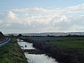
 A waterway on Braunton Marsh - geograph.org.uk - 1174792.jpg 480 × 640; 65 KB
-

-
 Across the bog - Slapton Leys NNR - May 2015 - panoramio.jpg 4,000 × 3,000; 1.56 MB
-
 Across the reedbeds at Slapton - May 2015 - panoramio.jpg 4,000 × 3,000; 2.02 MB
-
 Bideford viewed across the Torridge - geograph.org.uk - 1359450.jpg 640 × 480; 105 KB
-
 Birch trees near Jetty Marsh - geograph.org.uk - 1052915.jpg 480 × 640; 97 KB
-
 Blaxton Meadow - geograph.org.uk - 1247201.jpg 640 × 428; 80 KB
-
 Boat in the reeds, Hackney - geograph.org.uk - 1371514.jpg 640 × 469; 105 KB
-
 Boggy ground, near Kersbrook - geograph.org.uk - 1180394.jpg 640 × 480; 102 KB
-
 Braunton Marsh - geograph.org.uk - 716976.jpg 640 × 380; 320 KB
-
 Braunton Marshes and swans - geograph.org.uk - 126661.jpg 640 × 480; 59 KB
-
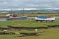 Brauton Burrows view of boats by creek - geograph.org.uk - 292665.jpg 640 × 427; 110 KB
-

-
 Cattle on Exminster Marshes - geograph.org.uk - 949685.jpg 640 × 480; 103 KB
-
 Cattle on West Charleton Marsh - geograph.org.uk - 309651.jpg 640 × 480; 107 KB
-
 Claypark Plantation - geograph.org.uk - 292615.jpg 640 × 480; 119 KB
-
 Cockwood Marsh - geograph.org.uk - 138306.jpg 640 × 480; 128 KB
-
 Cockwood Marsh and Cofton Hill - geograph.org.uk - 1623088.jpg 640 × 427; 281 KB
-
 Cockwood Marsh near Middlewood - geograph.org.uk - 1621196.jpg 640 × 427; 419 KB
-

-
 Courtlands Lymptone - geograph.org.uk - 1118625.jpg 640 × 471; 95 KB
-
 Creek, near the Axe estuary - geograph.org.uk - 1263201.jpg 640 × 480; 95 KB
-
 Drain, Exminster marshes - geograph.org.uk - 1219284.jpg 480 × 640; 85 KB
-
 Drain, Exminster Marshes - geograph.org.uk - 1222837.jpg 640 × 480; 97 KB
-
 Drain, Exminster Marshes - geograph.org.uk - 1222852.jpg 480 × 640; 97 KB
-
 Drain, Milbury Lane - geograph.org.uk - 1219272.jpg 640 × 480; 87 KB
-

-
 Drainage ditch in the Gara valley - geograph.org.uk - 235125.jpg 640 × 480; 135 KB
-
 Edge of Exminster Marshes - geograph.org.uk - 1222826.jpg 640 × 480; 109 KB
-
 Edge of Slapton Ley - geograph.org.uk - 1359017.jpg 640 × 480; 94 KB
-
 Edge of Slapton Ley - geograph.org.uk - 1362298.jpg 640 × 480; 104 KB
-
 Edge of Slapton Ley - geograph.org.uk - 1362304.jpg 640 × 480; 110 KB
-
-
 Evening at Slapton - May 2015 - panoramio.jpg 3,000 × 4,000; 2.5 MB
-
 Evening at Slapton Leys NNR - May 2015 - panoramio.jpg 3,000 × 4,000; 2.06 MB
-
 Exe Reed Beds nature reserve - geograph.org.uk - 1158754.jpg 640 × 480; 142 KB
-

-
 Exminster marshes - geograph.org.uk - 1285830.jpg 640 × 480; 75 KB
-
 Exminster marshes - geograph.org.uk - 1285852.jpg 640 × 480; 87 KB
-
 Exminster Marshes - geograph.org.uk - 282133.jpg 640 × 480; 41 KB
-
 Exminster Marshes - geograph.org.uk - 957896.jpg 640 × 480; 73 KB
-
 Exminster Marshes - geograph.org.uk - 957960.jpg 640 × 480; 71 KB
-
 Exminster Marshes.jpg 3,824 × 2,720; 3.09 MB
-
 Far end of the nature reserve - Slapton - May 2015 - panoramio.jpg 4,000 × 3,000; 2.08 MB
-
 Flooding, on Exminster Marshes - geograph.org.uk - 1159077.jpg 640 × 480; 98 KB
-
 Footbridge, on Exminster Marshes - geograph.org.uk - 1656533.jpg 640 × 480; 122 KB
-
 Footpath to Exminster - geograph.org.uk - 1224333.jpg 640 × 480; 106 KB
-
 Former pond by Templar Way - geograph.org.uk - 1052574.jpg 640 × 480; 164 KB
-
 Grassland by the Templar Way - geograph.org.uk - 1052545.jpg 640 × 480; 135 KB
-
 Hawkesdown Hill and Axmouth - geograph.org.uk - 815858.jpg 640 × 427; 216 KB
-
 Higher Ley, Slapton - geograph.org.uk - 1361452.jpg 640 × 480; 118 KB
-
 Higher Ley, Slapton - geograph.org.uk - 824231.jpg 430 × 640; 68 KB
-
 Horsey Island - geograph.org.uk - 1305056.jpg 640 × 480; 101 KB
-
 Horsey Island - geograph.org.uk - 1397931.jpg 640 × 480; 125 KB
-
 Horsey Island - geograph.org.uk - 717796.jpg 640 × 314; 214 KB
-
 Horsey Island near Braunton - geograph.org.uk - 31630.jpg 640 × 487; 127 KB
-
 Inland from Coombe Cellars - geograph.org.uk - 1189853.jpg 640 × 480; 78 KB
-
 Ireland Farm across the reddbed - Slapton - May 2015 - panoramio.jpg 4,000 × 2,000; 1.41 MB
-
 Island in Blaxton Meadow.jpg 3,720 × 2,848; 5.38 MB
-

-
 Japanese Knotweed by the Tavy - geograph.org.uk - 1044861.jpg 640 × 480; 130 KB
-
 Japanese Knotweed by the Tavy - geograph.org.uk - 1045246.jpg 640 × 480; 140 KB
-
 Jetty Marsh Local Nature Reserve - geograph.org.uk - 900593.jpg 640 × 480; 125 KB
-
 Kingford Fen - geograph.org.uk - 425363.jpg 640 × 426; 160 KB
-
 Lake, Cockwood - geograph.org.uk - 772962.jpg 640 × 484; 84 KB
-
 Looking across Warleigh Marsh - geograph.org.uk - 476278.jpg 640 × 428; 76 KB
-
 M5 Motorway over Floodplain - geograph.org.uk - 1080426.jpg 640 × 471; 136 KB
-
 Man Sands seen from Southdown Cliff.jpg 6,347 × 2,834; 15.74 MB
-

-
 Marsh in Maristow Park.jpg 4,080 × 2,848; 5.04 MB
-
 Marsh Walkway - geograph.org.uk - 1316887.jpg 427 × 640; 144 KB
-
 Marsh, Broadnymett, North Tawton, Devon - geograph.org.uk - 449400.jpg 640 × 480; 131 KB
-
 Marshes in the Lower Otter Estuary - geograph.org.uk - 1112556.jpg 640 × 430; 53 KB
-
 Marshland beside Slapton Ley - geograph.org.uk - 1358792.jpg 640 × 480; 131 KB
-
 Marshland by the Start Stream - geograph.org.uk - 1362763.jpg 640 × 480; 112 KB
-
 Marshland in the Torridge estuary - geograph.org.uk - 1355608.jpg 640 × 480; 115 KB
-
 Marshland on the Powderham Estate - geograph.org.uk - 990123.jpg 640 × 480; 79 KB
-
 Marshland, on Powderham Estate - geograph.org.uk - 988966.jpg 480 × 640; 104 KB
-
 Marshland, Slapton Ley - geograph.org.uk - 824291.jpg 640 × 430; 93 KB
-

-
 Marshy ground near Mansands beach - geograph.org.uk - 1010451.jpg 640 × 427; 60 KB
-
 Marshy ground, Powderham - geograph.org.uk - 988930.jpg 640 × 480; 78 KB
-
 Marshy land, on Downland Farm - geograph.org.uk - 1196490.jpg 640 × 459; 91 KB
-
 Otter floodplain - geograph.org.uk - 1139295.jpg 640 × 427; 198 KB
-
 Panorama of Man Sands - geograph.org.uk - 443474.jpg 640 × 212; 54 KB
-
 Queen's Marsh - geograph.org.uk - 1007869.jpg 640 × 480; 101 KB
-
 Queen's Marsh - geograph.org.uk - 1011451.jpg 640 × 480; 132 KB
-
 Queen's Marsh and Cycle Path - geograph.org.uk - 1316926.jpg 640 × 427; 111 KB
-
 Rainbow over Fleet Mill valley - geograph.org.uk - 1062741.jpg 640 × 480; 81 KB
-
 Reclaimed land, Maristow - geograph.org.uk - 1045231.jpg 640 × 480; 119 KB
-

-

-

-

-

-

-
 Reed beds by the Templer Way - geograph.org.uk - 1052597.jpg 640 × 480; 120 KB
-
 Reed beds, Slapton Ley - geograph.org.uk - 1361994.jpg 640 × 480; 105 KB
-
 Reed beds, Slapton Ley. - geograph.org.uk - 824248.jpg 640 × 430; 92 KB
-
 Reed beds, Slapton Ley. - geograph.org.uk - 824744.jpg 640 × 430; 101 KB
-
 Reedbed and marsh, below Holbeton - geograph.org.uk - 292609.jpg 640 × 480; 96 KB
-
 Reedbed near Erme estuary - geograph.org.uk - 292601.jpg 640 × 480; 122 KB
-
 Reedbeds and river , Thurlstone - geograph.org.uk - 413409.jpg 640 × 480; 94 KB
-
 Reedbeds in Summer - geograph.org.uk - 1438510.jpg 640 × 426; 109 KB
-
 Reedbeds under the M5 - geograph.org.uk - 1285945.jpg 640 × 480; 64 KB
-
 Reeds by Alphin Brook - geograph.org.uk - 292333.jpg 640 × 480; 106 KB
-
 Reeds in the tidal lagoon - geograph.org.uk - 1062746.jpg 465 × 640; 129 KB
-
 Reeds near Courtlands - geograph.org.uk - 1137860.jpg 426 × 640; 174 KB
-
 Reeds on the foreshore near Exton - geograph.org.uk - 1270795.jpg 640 × 480; 60 KB
-
 Reeds, Hackney Marshes - geograph.org.uk - 1764443.jpg 640 × 499; 138 KB
-
 River, Hackney Marshes (2) - geograph.org.uk - 1370402.jpg 640 × 480; 141 KB
-
 River, Hackney Marshes - geograph.org.uk - 1370387.jpg 640 × 480; 133 KB
-
 Road alongside marshland, Powderham - geograph.org.uk - 1224377.jpg 640 × 480; 73 KB
-
 Slapton, path by marsh and woods - geograph.org.uk - 960248.jpg 640 × 427; 256 KB
-
 Slapton, towards Hartshorn Plantation - geograph.org.uk - 960256.jpg 640 × 427; 245 KB
-
 Stream and Salt Pool Duck Pond - geograph.org.uk - 808716.jpg 640 × 350; 88 KB
-
 Tamar valley - geograph.org.uk - 681912.jpg 640 × 480; 89 KB
-
 The Marsh Behind South Milton Sands - geograph.org.uk - 1436859.jpg 640 × 426; 110 KB
-
 The Old Sludge Beds Nature Reserve - geograph.org.uk - 1158461.jpg 640 × 480; 139 KB
-
 The Retreat. Topsham - geograph.org.uk - 1158769.jpg 640 × 480; 107 KB
-

-
 Vegetation around Higher Slapton Ley - geograph.org.uk - 824748.jpg 640 × 430; 87 KB
-
 View at Morwellham - geograph.org.uk - 411724.jpg 640 × 480; 212 KB
-
 View east from car park, Seaton - geograph.org.uk - 1640561.jpg 640 × 407; 96 KB
-
 View towards Exminster Marshes - geograph.org.uk - 988808.jpg 640 × 480; 98 KB
-
 Warleigh Marsh - geograph.org.uk - 476270.jpg 640 × 480; 136 KB
-
 Water channel, Slapton Higher Ley - geograph.org.uk - 1362008.jpg 640 × 525; 109 KB
-
 Way onto Hackney Marshes - geograph.org.uk - 942483.jpg 640 × 480; 135 KB
-
 West Charleton Marsh - geograph.org.uk - 309552.jpg 480 × 640; 122 KB
-
 West Charleton Marsh - geograph.org.uk - 309590.jpg 640 × 480; 101 KB
-
 West Charleton Marsh - geograph.org.uk - 309629.jpg 640 × 480; 108 KB
-
 West Charleton Marsh - geograph.org.uk - 309640.jpg 640 × 480; 86 KB
-
 Wetland behind Man Sands - geograph.org.uk - 1267714.jpg 640 × 390; 73 KB
-
 Wetland meadow - June 2012 - panoramio.jpg 4,000 × 3,000; 5.07 MB
-
 Wetlands - Slapton Leys - June 2012 - panoramio.jpg 4,000 × 3,000; 3.92 MB
-
 Wetlands of the Axe estuary - geograph.org.uk - 1285509.jpg 640 × 480; 80 KB


_-_geograph.org.uk_-_1370402.jpg)


