Category:Markt 70, Gouda
Jump to navigation
Jump to search
| Object location | | View all coordinates using: OpenStreetMap |
|---|
 | |||||
| Upload media | |||||
| Instance of |
| ||||
|---|---|---|---|---|---|
| Location | Gouda, South Holland, Netherlands | ||||
| Street address |
| ||||
| Heritage designation |
| ||||
 | |||||
|
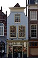
This is a category about rijksmonument number 16860
|
| Address |
|
Media in category "Markt 70, Gouda"
The following 4 files are in this category, out of 4 total.
-
 Markt 70 in Gouda.jpg 1,777 × 2,870; 3.04 MB
-
 Markt 70, Gouda.jpg 2,048 × 3,072; 1.87 MB
-
 Overzicht - Gouda - 20082546 - RCE.jpg 1,200 × 804; 195 KB
-
 Overzicht voorgevels - Gouda - 20358840 - RCE.jpg 1,192 × 1,200; 338 KB


