Category:Markt 7, Gouda
Jump to navigation
Jump to search
| Object location | | View all coordinates using: OpenStreetMap |
|---|
 | |||||
| Upload media | |||||
| Instance of |
| ||||
|---|---|---|---|---|---|
| Location | Gouda, South Holland, Netherlands | ||||
| Street address |
| ||||
| Heritage designation |
| ||||
 | |||||
|
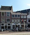
This is a category about rijksmonument number 16848
|
| Address |
|
Media in category "Markt 7, Gouda"
The following 5 files are in this category, out of 5 total.
-
 Markt 7, Gouda (2).jpg 2,432 × 2,864; 3.11 MB
-
 Markt 7, Gouda.jpg 2,029 × 3,026; 2.54 MB
-
 Overzicht van de voorgevels - Gouda - 20379906 - RCE.jpg 1,200 × 1,147; 220 KB
-
 Overzicht voorgevels - Gouda - 20358585 - RCE.jpg 1,197 × 1,200; 289 KB
-
 Voorgevel - Gouda - 20082505 - RCE.jpg 936 × 1,200; 247 KB
.jpg)


