Category:Markt 13, Goedereede
Jump to navigation
Jump to search
| Object location | | View all coordinates using: OpenStreetMap |
|---|
| Upload media | |||||
| Instance of |
| ||||
|---|---|---|---|---|---|
| Location | Goedereede, Goedereede | ||||
| Street address |
| ||||
| Located on street |
| ||||
| Heritage designation |
| ||||
 | |||||
|
This is a category about rijksmonument number 16181
|
|
This is a category about rijksmonument number 16187
|
| Address |
|
Media in category "Markt 13, Goedereede"
The following 13 files are in this category, out of 13 total.
-
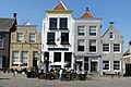
 Exterieur VOORGEVEL - Goedereede - 20299991 - RCE.jpg 1,200 × 1,200; 301 KB
-
 Goedereede GoudenLeeuw.jpg 1,680 × 2,240; 1.4 MB
-
 Markt Goedereede P1060678.jpg 4,000 × 2,672; 6.03 MB
-
 Markt Goedereede P1060700.jpg 2,672 × 4,000; 5.75 MB
-
 Markt Goedereede P1060703.jpg 2,672 × 4,000; 5.58 MB
-
 Markt Goedereede P1060803.jpg 4,000 × 2,672; 5.9 MB
-
 Markt Goedereede P1060805.jpg 4,000 × 2,672; 5.72 MB
-
 Overzicht - Goedereede - 20079047 - RCE.jpg 1,190 × 1,200; 247 KB
-

-
-
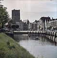
 Overzicht van de haven naar het noord-westen - Goeree - 20079278 - RCE.jpg 1,200 × 956; 279 KB
-
 RM16181 Goedereede - Markt 13.jpg 1,944 × 2,592; 1.07 MB
-
 Voorgevels - Goedereede - 20079156 - RCE.jpg 809 × 1,200; 162 KB


