Category:Markie Water
Jump to navigation
Jump to search
Media in category "Markie Water"
The following 21 files are in this category, out of 21 total.
-
 Bridge over Markie Water - geograph.org.uk - 1212716.jpg 640 × 480; 128 KB
-
 Bridge over Markie Water - geograph.org.uk - 1217051.jpg 640 × 471; 91 KB
-
 Downstream Markie Water - geograph.org.uk - 1212729.jpg 640 × 480; 124 KB
-
 Downstream Markie Water - geograph.org.uk - 1217029.jpg 640 × 487; 100 KB
-
 Downstream Markie Water - geograph.org.uk - 1217053.jpg 640 × 480; 133 KB
-
 Downstream Markie Water - geograph.org.uk - 1217124.jpg 640 × 494; 121 KB
-
 Footbridge over Markie Water - geograph.org.uk - 1217137.jpg 640 × 480; 99 KB
-
 Lounge by Markie Water - geograph.org.uk - 1217026.jpg 640 × 480; 123 KB
-
 Market Hill and Markie Water - geograph.org.uk - 1235663.jpg 640 × 427; 290 KB
-
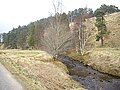 Markie Water - geograph.org.uk - 1217044.jpg 640 × 480; 115 KB
-
 Markie Water - geograph.org.uk - 1235553.jpg 640 × 427; 273 KB
-
 Markie Water - geograph.org.uk - 1235598.jpg 640 × 427; 277 KB
-
 Markie Water - geograph.org.uk - 526768.jpg 640 × 480; 156 KB
-
 Markie Water meandering - geograph.org.uk - 1217132.jpg 640 × 480; 136 KB
-
 Markie Water near 'The Burn' - geograph.org.uk - 1217128.jpg 640 × 480; 52 KB
-
 Road by Markie Water - geograph.org.uk - 1217048.jpg 640 × 480; 73 KB
-
 Upstream Markie Water - geograph.org.uk - 1212723.jpg 640 × 480; 125 KB
-
 Upstream Markie Water - geograph.org.uk - 1217040.jpg 640 × 480; 79 KB
-
 Upstream Markie Water - geograph.org.uk - 1217054.jpg 640 × 480; 117 KB
-
 Upstream Markie Water - geograph.org.uk - 1217119.jpg 640 × 480; 94 KB
-
 View across Markie Water - geograph.org.uk - 1217144.jpg 640 × 480; 79 KB


