Category:Markers in the United States
Jump to navigation
Jump to search
- Markers — a type of monument and/or sign in the United States.
Subcategories
This category has the following 14 subcategories, out of 14 total.
Media in category "Markers in the United States"
The following 123 files are in this category, out of 123 total.
-

-

-
 20120616 01 Control Monument (8434173000).jpg 2,816 × 2,112; 1.16 MB
-
 45x90 01.jpg 680 × 680; 189 KB
-
 45x90 02.jpg 2,048 × 2,048; 629 KB
-

-

-
 A dry marker and blue skies in LaJunta, CO (c9c9e3f115cc4de78fd68948b6e19d3a).JPG 1,880 × 2,816; 2.26 MB
-

-
-
-

-

-

-

-

-
-

-

-

-

-

-

-
-
-
-

-
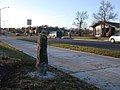
 Alt. Marker 2 635 SF at 3 Trails Corridor (1b70ce7283174694a2ee634d7a5e1e84).JPG 2,048 × 1,536; 361 KB
-
 Alt. Marker 3 705 SF at 3 Trails Corridor (83e74437987744f7aa809405d6650069).JPG 2,048 × 1,536; 352 KB
-
 Alt. Marker 5 801 SF at 3 Trails Corridor (e97abf7b4aa645c8b5585ec3f2e7c284).JPG 2,048 × 1,536; 349 KB
-
 Alt. Marker 6 817 SF at 3 Trails Corridor (06234cfe60ea4b068d0da373ccc7b02b).JPG 2,048 × 1,536; 377 KB
-
 Alt. Marker 8 940 SF at 3 Trails Corridor (b7fc5916fe6f4d4f96d452cd05bf0c36).JPG 2,048 × 1,536; 376 KB
-
 Alt. Marker 9 1104 SF 5JPG at 3 Trails Corridor (334ec965b60c44a8be53d8924149140b).JPG 2,048 × 1,536; 381 KB
-
 Alt. Marker 9 1104 SF 9JPG at 3 Trails Corridor (f3d3dab865f6446c9f6fa625f30f2209).JPG 2,048 × 1,536; 370 KB
-
 Alt. Marker 9 1104 SF Badge at 3 Trails Corridor (ee6b8b9aa248407da6d0f3617cc53491).JPG 2,048 × 1,536; 361 KB
-

-
 An NTIR Sign at Cimarron, NM rest stop (864502301c344289a257b7153a28025b).JPG 3,872 × 2,592; 3.91 MB
-
 An NTIR vehicle stoppped at Cimarron, NM kiosk area (fc8870bc9c1b4526a4de05020e84b47c).JPG 3,872 × 2,592; 4.07 MB
-

-

-
 Autograph Rock marker, wayside and donation box (7b37fcfb13cf4ba0b12915107a5c4c2f).JPG 2,816 × 1,880; 3.23 MB
-
 Autograph Rock marker, wayside and NTIR sign (7777764bdeb842fa8857f4500f14515b).JPG 2,816 × 1,880; 3.13 MB
-

-

-

-
 Cimarron Plaza and Well in Cimarron, NM (6c60844363a745ff8cc201afaddc74ff).JPG 4,224 × 2,376; 2.48 MB
-
 Cimarron Plaza and Well in Cimarron, NM (d87b2967210640a6ad04963540089e6c).JPG 1,728 × 1,152; 1.46 MB
-

-

-

-

-

-
-

-

-
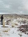
 Limestone marker on the prairie in Elkhart, KS. (a3fd788cfe1a4c0eb8f754e499a617a6).JPG 1,880 × 2,816; 2.65 MB
-

-

-

-

-
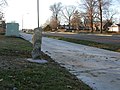
 Marker 10 11800 Harrison at 3 Trails Corridor (e039528ce72a40d3942c1d347a110588).JPG 2,048 × 1,536; 295 KB
-
 Marker 11 11822 Holmes at 3 Trails Corridor (1c68142a809743b599a70a2bd6d6ee3b).JPG 2,048 × 1,536; 340 KB
-
 Marker 12 11822 Holmes at 3 Trails Corridor (2ce43efb16fe465286ef90248d303bf5).JPG 2,048 × 1,536; 302 KB
-
 Marker 13 11822 Holmes at 3 Trails Corridor (52df7cd2841a406089a7eb0d1a2226cb).JPG 2,048 × 1,536; 365 KB
-
 Marker 14 11822 Holmes at 3 Trails Corridor (4da7b425e9914bc8806aaf0bda4d50b6).JPG 2,048 × 1,536; 324 KB
-
 Marker 15 11841 Locust at 3 Trails Corridor (3fa673f20cbf41b5bcf92fa2d6b6f560).JPG 2,048 × 1,536; 332 KB
-
 Marker 2 1213 118th 98 at 3 Trails Corridor (5fa10d956804424c8abdf28eda0a55f8).JPG 2,048 × 1,536; 307 KB
-
 Marker 2 1213 118th 99 at 3 Trails Corridor (6edb2d4bd1c549619958c0949ed64073).JPG 2,048 × 1,536; 336 KB
-
 Marker 3 1109 118th at 3 Trails Corridor (28d622494b2e4eec91ee46475b644fd6).JPG 2,048 × 1,536; 329 KB
-
 Marker 4 11801 Troost at 3 Trails Corridor (bfa3517b2e42412d980cb3b2c8973833).JPG 2,048 × 1,536; 377 KB
-
 Marker 5 1008 118th Terr at 3 Trails Corridor (e3b3de64873d48008a3b58053c727563).JPG 2,048 × 1,536; 378 KB
-
 Marker 7 915 118th Terr 17 at 3 Trails Corridor (29c757453caf4aa5988a251fb8908a1d).JPG 2,048 × 1,536; 358 KB
-
 Marker 7 915 118th Terr 19 at 3 Trails Corridor (8c4c9f7627b64b2ba27e6ae8b919cca8).JPG 2,048 × 1,536; 372 KB
-
 Marker 7 915 118th Terr 21 at 3 Trails Corridor (3e192bd2f8624de6b39a1b041efd923d).JPG 2,048 × 1,536; 338 KB
-
 Marker 8 815 118th Terr at 3 Trails Corridor (a86f773861634be6a5edd8a7c26c2743).JPG 2,048 × 1,536; 348 KB
-
 Marker 8 915 118th Terr at 3 Trails Corridor (611b16c91cdb452fb5bc061a96882d47).JPG 2,048 × 1,536; 370 KB
-
 Marker 9 801 118th Terr at 3 Trails Corridor (5b94f82a47df46918f53d957aeb15df2).JPG 2,048 × 1,536; 380 KB
-

-

-

-

-

-
 Milepost 4, Blue Ridge Parkway (60389b993c694de9978bc78c029e87ba).tif 2,448 × 1,567; 10.98 MB
-

-

-

-
-
 Non-NTIR Sign at Comanche National Grassland (69dcabd104b9453ebf7a8404404d89ac).JPG 2,816 × 1,880; 2.48 MB
-

-
-
 NPS boundary marker near Puckett Cabin (aebd85f87fab4c57b357db5016aaa1da).tif 2,448 × 1,557; 10.91 MB
-
-
 NTIR Sign, waysides, and Kiosks at Cimarron, NM (d29d458f50804f22b8edcfd4af5af3a4).JPG 3,872 × 2,592; 3.63 MB
-
-
 NTIR Staff reading a wayside at Cimarron, NM (99c8c1962f574f57ac4126140fadfbde).JPG 3,872 × 2,592; 4.52 MB
-

-
 Old Jail in Cimarron, NM (88128fe51e274787856706dab09598f5).JPG 3,568 × 2,376; 4.08 MB
-

-

-
 Red Bridge Marker Two at 3 Trails Corridor (3b6fa3bfca0743389c23b233fa1b9df0).JPG 2,048 × 1,536; 354 KB
-
 Red Bridge Mon. Sign 1 at 3 Trails Corridor (45552750f1c1497d9a413cf088c51b4c).JPG 2,048 × 1,536; 339 KB
-
 Reverend Paul Cuffee Grave-3.jpg 3,648 × 2,736; 2.04 MB
-

-

-

-

-

-
-

-

-

-

-

-

-
 Section 2-B, Milepost 234, Blue Ridge Parkway (19cc6215fddd40fe8b7fdaa9f484729b).tif 2,425 × 1,501; 10.41 MB
-
 Sign for George Washington National Forest (0b478e10922a40eaa0c808bd70e05576).tif 2,448 × 1,567; 10.98 MB
-

-

-

-

-

-
 VT Route 107 1933 StoneMarker 20220909.jpg 3,072 × 4,608; 2.36 MB
-
 Wm. Minor Mon. Sign 3 at 3 Trails Corridor (a893aa6e8780460095963c33c62df6c1).JPG 2,048 × 1,536; 363 KB
.JPG)
.JPG)
.jpg)


.JPG)
.JPG)
.JPG)
.JPG)
.JPG)
.JPG)
.JPG)
.JPG)
.JPG)
.JPG)
.JPG)
.JPG)
.JPG)
.JPG)
.JPG)
.JPG)
.JPG)
_(719f1f73635148e586b50ff75afca3fe).JPG)
.JPG)
.JPG)
.JPG)
.JPG)
.JPG)
.JPG)
.JPG)
.JPG)
.JPG)
.JPG)
.JPG)
.JPG)
.JPG)
.JPG)
.JPG)
.JPG)
.JPG)
.JPG)
.jpg)
.JPG)
.JPG)
.JPG)
.JPG)
.JPG)
.JPG)
.JPG)
.jpg)
.JPG)
.JPG)
.JPG)
.JPG)
.JPG)
.JPG)
.jpg)
.JPG)
.JPG)
.JPG)
.JPG)
.JPG)
.JPG)
.JPG)
.JPG)
.JPG)
.JPG)
.JPG)
.JPG)
.JPG)
.JPG)
.JPG)
.JPG)
.JPG)
.JPG)
.JPG)
.JPG)
.JPG)
.JPG)
.JPG)
.JPG)
.JPG)
.JPG)
.JPG)
.JPG)
.JPG)
_(d45b7ebc7dfc4f22bcb31f7c953539c1).JPG)
.JPG)
.JPG)
.JPG)
.JPG)
.JPG)
.JPG)
.JPG)
.JPG)
.JPG)

.JPG)
.JPG)
_(fb08f5853c19427a88c4e15d8877328d).JPG)
.JPG)
.JPG)
.JPG)
.JPG)
_(77de8dba979549d180ec2ccf86012f71).JPG)
.JPG)
.JPG)
.JPG)
.JPG)
.JPG)
.JPG)
.JPG)
.JPG)
.JPG)

.JPG)
.JPG)
.JPG)