Category:Marienbrunnen (Eichstätt)
Jump to navigation
Jump to search
| Object location | | View all coordinates using: OpenStreetMap |
|---|
 | |||||
| Upload media | |||||
| Instance of | |||||
|---|---|---|---|---|---|
| Location | Eichstätt, Upper Bavaria, Bavaria, Germany | ||||
| Street address |
| ||||
| Architectural style | |||||
| Architect | |||||
| Heritage designation | |||||
| Inception |
| ||||
 | |||||
This is the category of the Bavarian Baudenkmal (cultural heritage monument) with the ID D-1-76-123-229 (Wikidata)
|
Subcategories
This category has only the following subcategory.
P
Media in category "Marienbrunnen (Eichstätt)"
The following 55 files are in this category, out of 55 total.
-
 AaIMG 1215 Eichstätt Maria.jpg 1,757 × 3,274; 908 KB
-
 Residenzplatz Marienbrunnen Eichstaett-2.jpg 1,914 × 2,442; 704 KB
-
 Residenzplatz Marienbrunnen Eichstaett-3.jpg 1,944 × 2,592; 751 KB
-
 D-1-76-123-229, Eichstätt, Residenzplatz, Marienbrunnen 001.jpg 3,024 × 4,565; 1.19 MB
-
 D-1-76-123-229, Eichstätt, Residenzplatz, Marienbrunnen 002.jpg 3,264 × 4,928; 695 KB
-
 D-1-76-123-229, Eichstätt, Residenzplatz, Marienbrunnen 003.jpg 4,928 × 3,264; 819 KB
-
 D-1-76-123-229, Eichstätt, Residenzplatz, Marienbrunnen 004.jpg 4,928 × 3,264; 638 KB
-
 D-1-76-123-229, Eichstätt, Residenzplatz, Marienbrunnen 005.jpg 4,928 × 3,264; 605 KB
-
 D-1-76-123-229, Eichstätt, Residenzplatz, Marienbrunnen 006.jpg 4,928 × 3,264; 544 KB
-
 Marienbrunnen Eichstätt -1.jpg 2,048 × 1,536; 1,012 KB
-
 Marienbrunnen Eichstätt -2.jpg 1,536 × 2,048; 1,010 KB
-
 Marienbrunnen Eichstätt -3.jpg 2,048 × 1,536; 944 KB
-
 Mariensäule Eichstätt -1.jpg 1,536 × 2,048; 911 KB
-
 Eichst. Mariensäule.jpg 2,560 × 1,920; 1.09 MB
-
 Eichstaett Marienbrunnen.JPG 2,160 × 1,440; 2.12 MB
-
 Eichstätt - Residenzplatz - Mariensäule.jpg 3,008 × 2,000; 4.35 MB
-
 Eichstätt Dom 01.jpg 1,270 × 952; 830 KB
-
 Eichstätt Marienbrunnen (9261686429).jpg 3,000 × 4,000; 2.17 MB
-
 Eichstätt Place de la Résidence.JPG 4,000 × 3,000; 2.32 MB
-
 Eichstätt, Mariensäule, 26.jpeg 3,000 × 4,000; 1.92 MB
-
 Eichstätt, Residenzplatz 1-20160816-001.jpg 5,996 × 4,003; 9.33 MB
-
 Eichstätt, Residenzplatz, Marienbrunnen-20160816-001.jpg 4,002 × 5,995; 11.25 MB
-
 Eichstätt, Residenzplatz, Mariensäule-20160816-002.jpg 4,003 × 5,996; 10.17 MB
-
 GER Eichstätt, Residenzplatz 005.jpg 900 × 1,600; 257 KB
-
 GER Eichstätt, Residenzplatz 006.jpg 4,032 × 3,024; 1.87 MB
-
 GER Eichstätt, Residenzplatz 007.jpg 2,928 × 3,904; 534 KB
-
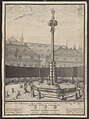
 Mariensäule Pedettizeichnung.jpg 868 × 1,197; 797 KB
-
 Marienbrunnen Eichstätt -Ostern 2016 (1).jpg 1,536 × 2,048; 1.03 MB
-
 Marienbrunnen Eichstätt -Ostern 2016 (2).jpg 1,536 × 2,048; 1.01 MB
-
 Marienbrunnen Eichstätt -Ostern 2016 (3).jpg 2,048 × 1,536; 919 KB
-
 Marienbrunnen Eichstätt 01.jpg 3,968 × 2,645; 4.24 MB
-
 Marienbrunnen Eichstätt 02.jpg 3,968 × 2,645; 3.76 MB
-
 Marienbrunnen Eichstätt 03.jpg 3,968 × 2,232; 3.38 MB
-
 Mariensäule Eichstätt -2.jpg 1,536 × 2,048; 1,010 KB
-
 Mariensäule Eichstätt -3.jpg 1,536 × 2,048; 975 KB
-
 Mariensäule Eichstätt -4.jpg 1,536 × 2,048; 979 KB
-
 Mariensäule Eichstätt -5.jpg 1,536 × 2,048; 975 KB
-
 Mariensäule Eichstätt -6.jpg 1,536 × 2,048; 839 KB
-
 Mariensäule Eichstätt -Herbst 2015 (1).jpg 1,536 × 2,048; 1.17 MB
-
 Mariensäule Eichstätt -Herbst 2015 (2).jpg 1,536 × 2,048; 1.09 MB
-
 Mariensäule Eichstätt -Herbst 2015 (3).jpg 1,536 × 2,048; 1.01 MB
-
 Mariensäule Eichstätt -Herbst 2015 (4).jpg 1,536 × 2,048; 1.04 MB
-
 Mariensäule Eichstätt 01.JPG 4,000 × 6,000; 4.41 MB
-
 Mariensäule Eichstätt 02.JPG 4,000 × 6,000; 4.32 MB
-
 Mariensäule Eichstätt 03.JPG 4,000 × 6,000; 4.56 MB
-
 Mariensäule Eichstätt 04.JPG 4,000 × 6,000; 4.24 MB
-
 Mariensäule Eichstätt 05.JPG 4,000 × 6,000; 5.96 MB
-
 Residenzplatz Eichstätt -Kanonikatshöfe, Marienbrunnen.jpg 2,048 × 1,536; 910 KB
-
 Residenzplatz Eichstätt -Marienbrunnen 2015-01.jpg 2,048 × 1,536; 894 KB
-
 Residenzplatz Marienbrunnen Eichstaett-1.jpg 1,944 × 2,454; 784 KB
-
 Stich - Eichstätt - Resdenzplatz - Mariensäule - M Pedetti.jpg 6,050 × 8,115; 6.77 MB
-
 Eichstätt Residenzplatz 509-10Ld.jpg 2,491 × 1,954; 1 MB
-
 Marienbrunnen Eichstätt -4.jpg 1,536 × 2,048; 906 KB
-
 Residenzplatz Eichstätt Blick nach Osten.jpg 1,536 × 2,048; 958 KB
-
 Residenzplatz Eichstätt Platzabschluss und Marienbrunnen.jpg 2,048 × 1,536; 966 KB


.jpg)


.jpg)
.jpg)
.jpg)


.jpg)
.jpg)
.jpg)
.jpg)


