Category:Maria-oord (Vught)
Jump to navigation
Jump to search
| Object location | | View all coordinates using: OpenStreetMap |
|---|
.JPG) | |||||
| Upload media | |||||
| Instance of | |||||
|---|---|---|---|---|---|
| Location | Vught, North Brabant, Netherlands | ||||
| Street address |
| ||||
| Located on street |
| ||||
| Architect | |||||
| Heritage designation |
| ||||
| Date of official opening |
| ||||
 | |||||
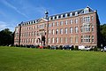
Nederlands: Maria-oord, Vught
|
This is a category about rijksmonument number 521341
|
| Address |
|
Media in category "Maria-oord (Vught)"
The following 6 files are in this category, out of 6 total.
-
 521341 Kostschool Mariaoord 2.jpg 3,000 × 2,000; 5.51 MB
-
 521341 Kostschool Mariaoord.jpg 3,000 × 2,000; 4.92 MB
-
 Mariaoord-Vught (2).JPG 3,008 × 2,000; 959 KB
-

-
 Overzicht voorgevel voormalig kloosterinternaat - Vught - 20347841 - RCE.jpg 1,200 × 1,136; 315 KB
-
 Voorgevel "Maria oord" - Vught - 20247849 - RCE.jpg 1,200 × 788; 237 KB


