Category:Maria-Antoinette
Jump to navigation
Jump to search
| Object location | | View all coordinates using: OpenStreetMap |
|---|
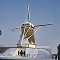
windmill in Deurne, Netherlands  | |||||
| Upload media | |||||
| Instance of | |||||
|---|---|---|---|---|---|
| Location | Deurne, North Brabant, Netherlands | ||||
| Street address |
| ||||
| Located on street |
| ||||
| Has use | |||||
| Heritage designation |
| ||||
| Source of energy | |||||
 | |||||
|
This is a category about rijksmonument number 12380
|
| Address |
|
Media in category "Maria-Antoinette"
The following 23 files are in this category, out of 23 total.
-
 Beltmolen tijdens restauratie in 1964 - Deurne - 20461676 - RCE.jpg 631 × 891; 87 KB
-
 Deurne - molen Maria-Antoinette in verval.jpg 1,000 × 1,500; 780 KB
-
 Deurne - molen Maria-Antoinette met kaalgezette roeden.jpg 1,000 × 1,500; 666 KB
-
 Korenmolen - Zeilberg - 20221277 - RCE.jpg 773 × 1,200; 132 KB
-
 Korenmolen - Zeilberg - 20221283 - RCE.jpg 1,200 × 1,176; 230 KB
-
 Korenmolen in restauratie - Zeilberg - 20221281 - RCE.jpg 1,200 × 1,177; 230 KB
-
 Korenmolen in restauratie - Zeilberg - 20221282 - RCE.jpg 1,200 × 1,188; 230 KB
-

-

-
 Korenmolen Maria Antoinette - Zeilberg - 20221286 - RCE.jpg 797 × 1,200; 207 KB
-
 Korenmolen, na restauratie - Zeilberg - 20221284 - RCE.jpg 1,200 × 1,186; 191 KB
-
 Korenmolen, na restauratie - Zeilberg - 20221285 - RCE.jpg 1,200 × 1,183; 188 KB
-
 Korenmolen, wacht op restauratie - Zeilberg - 20221278 - RCE.jpg 779 × 1,200; 146 KB
-
-
 Maria Antoinette van achteren gefotografeerd - Deurne - 20369860 - RCE.jpg 1,197 × 1,200; 225 KB
-
 Mill maria antoinette in full new glory.jpg 3,000 × 4,000; 1.36 MB
-
 Molen - Zeilberg - 20221287 - RCE.jpg 1,200 × 788; 158 KB
-
 Molen - Zeilberg - 20221288 - RCE.jpg 788 × 1,200; 176 KB
-
 Molen - Zeilberg - 20221289 - RCE.jpg 788 × 1,200; 170 KB
-
 Overzicht van de achterkant - Deurne - 20421304 - RCE.jpg 803 × 1,200; 119 KB
-
 Overzicht van de zijkant - Deurne - 20421303 - RCE.jpg 803 × 1,200; 124 KB
-

-


