Category:Mariä Opferung (Laaberberg)
Jump to navigation
Jump to search
| Camera location | | View all coordinates using: OpenStreetMap |
|---|
building in Rohr in Niederbayern, Lower Bavaria, Germany  | |||||
| Upload media | |||||
| Instance of | |||||
|---|---|---|---|---|---|
| Location | Rohr in Niederbayern, Kelheim, Lower Bavaria, Bavaria, Germany | ||||
| Street address |
| ||||
| Architectural style | |||||
| Heritage designation | |||||
 | |||||
This is the category of the Bavarian Baudenkmal (cultural heritage monument) with the ID D-2-73-165-30 (Wikidata)
|
Media in category "Mariä Opferung (Laaberberg)"
The following 19 files are in this category, out of 19 total.
-
 Laaberberg Mariä Opferung - Chorraum.jpg 2,304 × 1,728; 1.25 MB
-
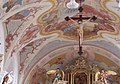 Laaberberg Mariä Opferung - Deckenfresko.jpg 2,099 × 1,468; 912 KB
-
 Laaberberg Mariä Opferung - Grablegechristus.jpg 2,228 × 1,670; 862 KB
-
 Laaberberg Mariä Opferung - Hochaltar Auszug.jpg 2,294 × 1,720; 1.12 MB
-
 Laaberberg Mariä Opferung - Hochaltar.jpg 2,304 × 1,728; 1.45 MB
-
 Laaberberg Mariä Opferung - Innenraum.jpg 2,304 × 1,728; 1.19 MB
-
 Laaberberg Mariä Opferung - Kapelle.jpg 3,264 × 2,448; 2.16 MB
-
 Laaberberg Mariä Opferung - Kreuzaltar.jpg 2,274 × 1,704; 818 KB
-
 Laaberberg Mariä Opferung - Nordwand.jpg 2,304 × 1,728; 1.03 MB
-
 Laaberberg Mariä Opferung - Stuhlwangen.jpg 2,304 × 1,728; 1.03 MB
-
 Laaberberg Mariä Opferung - Südwand.jpg 2,304 × 1,728; 919 KB
-
 Laaberberg Mariä Opferung - Treppenaufgang.jpg 3,264 × 2,448; 2.33 MB
-
 Laaberberg Mariä Opferung 988.jpg 4,896 × 3,264; 10.99 MB
-
 Laaberberg Mariä Opferung 989.jpg 3,264 × 4,896; 8.98 MB
-
 Laaberberg Mariä Opferung 990.jpg 4,896 × 3,264; 8.58 MB
-
 Laaberberg Mariä Opferung 991.jpg 3,264 × 4,896; 8.4 MB
-
 Laaberberg Mariä Opferung 992.jpg 3,264 × 4,896; 7.3 MB
-
 Laaberberg Mariä Opferung 993.jpg 3,264 × 4,896; 8.83 MB
-
 Rohr-Laaberberg-Kirchweg-9-Kirche-Mariä-Opferung.JPG 3,264 × 2,448; 1.32 MB


