Category:Marchington
Jump to navigation
Jump to search
English: Marchington is a village in East Staffordshire, England. It lies between the towns of Burton upon Trent and Uttoxeter. Marchington has a Post Office/small shop, a first school, 2 churches and 2 pubs. The railway between Stoke-on-Trent and Derby runs to the north of Marchington but the station closed in the 1960s.
village in the United Kingdom  | |||||
| Upload media | |||||
| Instance of | |||||
|---|---|---|---|---|---|
| Location | East Staffordshire, Staffordshire, West Midlands, England | ||||
| Population |
| ||||
 | |||||
Subcategories
This category has the following 7 subcategories, out of 7 total.
Media in category "Marchington"
The following 157 files are in this category, out of 157 total.
-
 'Woodlands at Marchington Woodlands' - geograph.org.uk - 1154814.jpg 587 × 401; 69 KB
-
 Another Track into Private Woodlands - geograph.org.uk - 2668064.jpg 640 × 428; 116 KB
-
 B5017, Marchington - geograph.org.uk - 5340538.jpg 640 × 427; 108 KB
-
 Bag Lane, Marchington - geograph.org.uk - 2263427.jpg 1,496 × 1,122; 981 KB
-
 Barn, Hanging Wicket Farm - geograph.org.uk - 5564566.jpg 640 × 480; 57 KB
-
 Bend in the B5017 - geograph.org.uk - 3929187.jpg 2,267 × 1,669; 1.89 MB
-
 Brand New Fingerpost and Stile - geograph.org.uk - 2537158.jpg 640 × 428; 76 KB
-

-
 Church Lane, Marchington - geograph.org.uk - 1403993.jpg 640 × 480; 92 KB
-
 Close up, Elizabeth II postbox on Church Lane, Marchington - geograph.org.uk - 5099525.jpg 2,344 × 2,990; 1.06 MB
-
 Country Crossroads near Woodcrofts Farm - geograph.org.uk - 2686703.jpg 640 × 428; 115 KB
-
 Country lane near Swilcarlawn Farm - geograph.org.uk - 5564648.jpg 640 × 480; 88 KB
-
 Country lane, Marchington Woodlands - geograph.org.uk - 5564608.jpg 640 × 480; 124 KB
-
 Crop of maize - geograph.org.uk - 1035954.jpg 640 × 480; 97 KB
-

-
 Dove Valley near Marchington - geograph.org.uk - 396367.jpg 640 × 427; 96 KB
-
 Dovefields Railway Crossing - geograph.org.uk - 3929200.jpg 3,796 × 2,706; 1.64 MB
-

-

-
 Entering Marchington on Church Lane - geograph.org.uk - 2685304.jpg 428 × 640; 59 KB
-
 Entrance to Bag Lane, Marchington - geograph.org.uk - 2685346.jpg 640 × 428; 91 KB
-
 Entrance to Riddings Farm - geograph.org.uk - 5097719.jpg 640 × 480; 59 KB
-

-

-

-

-
-

-
 Farmhouses at Marchington Woodland - geograph.org.uk - 2119551.jpg 640 × 480; 89 KB
-
 Farmland east of New Thorntree Farm - geograph.org.uk - 5859082.jpg 1,024 × 768; 166 KB
-
 Farmland near Birch Cross - geograph.org.uk - 396343.jpg 640 × 427; 85 KB
-
 Farmland south-east of Moat Spring Farm - geograph.org.uk - 5859752.jpg 1,024 × 768; 287 KB
-
 Farmland west of Roper's Hill Farm - geograph.org.uk - 5859319.jpg 1,024 × 768; 246 KB
-
 Farmland, Gorsty Hill - geograph.org.uk - 5564590.jpg 640 × 480; 50 KB
-
 Farmland, Marchington Woodlands - geograph.org.uk - 5859360.jpg 1,024 × 768; 276 KB
-
 Farmyard, Hanging Wicket Farm - geograph.org.uk - 5564567.jpg 640 × 480; 52 KB
-
 Field Edge at Hound Hill - geograph.org.uk - 5052932.jpg 4,000 × 3,000; 3.93 MB
-
 Field entrance off Hobb Lane - geograph.org.uk - 5564579.jpg 640 × 480; 83 KB
-
-
 Field gate, Green Lane, Marchington - geograph.org.uk - 396376.jpg 640 × 427; 111 KB
-
 Fields towards Forest Gate Farm - geograph.org.uk - 5564617.jpg 640 × 480; 49 KB
-
 Footpath crossing the railway near Riddings Farm - geograph.org.uk - 5579743.jpg 1,600 × 1,200; 393 KB
-
 Footpath from Green Lane to Church Lane - geograph.org.uk - 2935752.jpg 640 × 425; 135 KB
-

-
 Footpath Near Marchington - geograph.org.uk - 1404001.jpg 640 × 480; 95 KB
-
 Footpath towards Field Farm, west of Marchington - geograph.org.uk - 5579744.jpg 1,600 × 1,200; 439 KB
-

-

-
 Fruit of the yew - geograph.org.uk - 1036026.jpg 640 × 480; 145 KB
-
 Gated farm track, Birchwood Bower - geograph.org.uk - 5564593.jpg 640 × 480; 67 KB
-
 Glasshouse Farm - geograph.org.uk - 2537183.jpg 640 × 428; 106 KB
-
 Gorsty Hill Farm - geograph.org.uk - 2537165.jpg 640 × 428; 68 KB
-
 Grass triangle at Gorsty Hill crossroads - geograph.org.uk - 5859340.jpg 1,024 × 768; 188 KB
-
 Grassland near Hanging Wicket Farm - geograph.org.uk - 5564569.jpg 640 × 480; 57 KB
-
 Grassland near Wrenpark - geograph.org.uk - 1035946.jpg 640 × 480; 62 KB
-

-
 Grazing at Forestside Farm - geograph.org.uk - 2119572.jpg 640 × 480; 105 KB
-
 Grazing near Glasshouse Farm - geograph.org.uk - 5564586.jpg 640 × 480; 66 KB
-
 Grazing Scounslow Green - geograph.org.uk - 5564570.jpg 640 × 480; 50 KB
-
 Grazing towards Woodford Hall Farm - geograph.org.uk - 5097715.jpg 640 × 480; 49 KB
-
 Grazing, Marchington - geograph.org.uk - 5097727.jpg 640 × 432; 62 KB
-
 Grazing, Marchington Woodlands - geograph.org.uk - 5564605.jpg 640 × 480; 52 KB
-
 Grazing, Riddings Farm - geograph.org.uk - 5097718.jpg 640 × 480; 56 KB
-
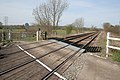 Green Lane Crossing, Marchington - geograph.org.uk - 396402.jpg 640 × 427; 120 KB
-

-
 Green Lane, Marchington - geograph.org.uk - 1914220.jpg 2,000 × 1,500; 1.1 MB
-
 Hanging Wicket Farm - geograph.org.uk - 5564568.jpg 640 × 480; 59 KB
-
 Heading east towards Marchington. - geograph.org.uk - 5097716.jpg 640 × 480; 77 KB
-
 Hobb Lane, heading east from New Thorntree Farm - geograph.org.uk - 5859076.jpg 1,024 × 767; 147 KB
-
 Hobb Lane, heading south-east to Gorsty Hill - geograph.org.uk - 5859312.jpg 1,024 × 768; 202 KB
-
 Hobb Lane, heading west from New Thorntree Farm - geograph.org.uk - 5859087.jpg 1,024 × 576; 161 KB
-
 Hodge Lane at Gorsty Hill - geograph.org.uk - 5859330.jpg 1,024 × 768; 155 KB
-
 Hound Hill - geograph.org.uk - 888479.jpg 640 × 390; 51 KB
-
 Houndhill - geograph.org.uk - 5097742.jpg 640 × 480; 63 KB
-
 House at Marchington Woodlands - geograph.org.uk - 2668080.jpg 640 × 428; 96 KB
-
 House on Houndhill - geograph.org.uk - 5097741.jpg 640 × 480; 57 KB
-
 House on Quee Lane, Scounslow Green - geograph.org.uk - 5564576.jpg 640 × 480; 55 KB
-
 House on the B5017 - geograph.org.uk - 3929180.jpg 2,215 × 1,874; 1.69 MB
-
 House on Tinker's Lane - geograph.org.uk - 5564598.jpg 640 × 480; 43 KB
-

-
 House, Gorsty Hill - geograph.org.uk - 5564578.jpg 640 × 480; 79 KB
-
 Houses on Moisty Lane, Marchington - geograph.org.uk - 5097723.jpg 640 × 480; 57 KB
-
 Houses on Moisty Lane, Marchington - geograph.org.uk - 5097729.jpg 640 × 480; 45 KB
-
 Houses on The Square, Marchington - geograph.org.uk - 5097733.jpg 640 × 480; 56 KB
-
 Lane Near Marchington Woodlands - geograph.org.uk - 2263420.jpg 1,496 × 1,122; 615 KB
-
 Lane, Gorsty Hill - geograph.org.uk - 5564591.jpg 640 × 480; 50 KB
-
 Large house, Houndhill - geograph.org.uk - 5097740.jpg 640 × 480; 58 KB
-
 Livestock near the River Dove - geograph.org.uk - 3929164.jpg 4,000 × 3,000; 1.79 MB
-
 Looking down Stubby Lane - geograph.org.uk - 2666432.jpg 640 × 428; 78 KB
-
 Looking East towards Birch Cross - geograph.org.uk - 2686636.jpg 640 × 428; 117 KB
-

-
 Maize crop off Moisty Lane - geograph.org.uk - 5097713.jpg 640 × 480; 68 KB
-
 Marchington Village Shop - geograph.org.uk - 5099527.jpg 3,648 × 2,736; 1.52 MB
-
 Marchington Woodlands - a green landscape - geograph.org.uk - 5859760.jpg 1,024 × 768; 263 KB
-
 Marchington, St Peter - geograph.org.uk - 6366980.jpg 3,000 × 4,000; 4.2 MB
-
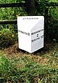 Milepost at SK1033930878.jpg 492 × 701; 78 KB
-
 Milepost at SK1185530464.jpg 492 × 701; 73 KB
-
 Milepost at SK1310030094.jpg 640 × 480; 306 KB
-

-
 Moisty Lane - geograph.org.uk - 5097714.jpg 640 × 480; 77 KB
-
 Moisty Lane - geograph.org.uk - 5097721.jpg 640 × 480; 82 KB
-
 Moisty Lane approaching Marchington - geograph.org.uk - 2935745.jpg 640 × 425; 113 KB
-
 Moisty Lane, Marchington - geograph.org.uk - 5097725.jpg 640 × 480; 55 KB
-
 Muddy track, Gorsty Hill - geograph.org.uk - 5564588.jpg 640 × 480; 60 KB
-
 New Thorn Tree Farm - geograph.org.uk - 2537144.jpg 640 × 428; 68 KB
-

-
 Ordnance Survey Cut Mark with Pivot - geograph.org.uk - 5052914.jpg 4,000 × 3,000; 4.83 MB
-

-
 Pasture land near Hawkshill Farm - geograph.org.uk - 1035965.jpg 640 × 480; 129 KB
-
 Pastures at Forest Banks - geograph.org.uk - 2119568.jpg 640 × 480; 134 KB
-
 Pill box and River Dove, near Uttoxeter - geograph.org.uk - 396352.jpg 640 × 427; 149 KB
-

-
 Quee Lane, Scounslow Green - geograph.org.uk - 5564572.jpg 640 × 480; 105 KB
-
 River Dove from Aston Bridge - geograph.org.uk - 396417.jpg 640 × 427; 93 KB
-
 River Plain and Dovefields Farm - geograph.org.uk - 3933016.jpg 3,846 × 2,782; 1.09 MB
-

-
 Semi derelict farm in Marchington - geograph.org.uk - 2935747.jpg 640 × 425; 91 KB
-

-

-
 Six Roads End - geograph.org.uk - 198894.jpg 640 × 480; 74 KB
-

-

-
-

-

-
 The Church of St Peter at Marchington - geograph.org.uk - 5052890.jpg 4,000 × 3,000; 2.41 MB
-
 The Dog ^ Partridge, Marchington - geograph.org.uk - 5097736.jpg 640 × 480; 48 KB
-
 Thorney Lanes - geograph.org.uk - 5564585.jpg 640 × 480; 60 KB
-
 Thorney Lanes, heading north-west - geograph.org.uk - 5859763.jpg 1,024 × 768; 283 KB
-
 Thorney Lanes, Marchington Woodlands - geograph.org.uk - 5859354.jpg 1,024 × 768; 266 KB
-
 Tinker's Lane, Birchwood Bower - geograph.org.uk - 5564594.jpg 640 × 480; 50 KB
-
 Tomlinson's Corner Wood - geograph.org.uk - 5564629.jpg 640 × 480; 45 KB
-
 Towards Green Acres from Moisty Lane - geograph.org.uk - 3929177.jpg 3,864 × 2,810; 1.4 MB
-

-

-
 Track (footpath) to Knypersley Hall - geograph.org.uk - 5564582.jpg 640 × 480; 85 KB
-
 Track into Private Woodlands - geograph.org.uk - 2668061.jpg 640 × 428; 123 KB
-
 Track towards the road east of Hound Hill - geograph.org.uk - 5583553.jpg 1,600 × 1,200; 309 KB
-

-
-
 Trig point on Hound Hill - geograph.org.uk - 5579748.jpg 1,600 × 1,200; 457 KB
-
 Twenty Acres near Gorsty Hill - geograph.org.uk - 2668099.jpg 640 × 428; 78 KB
-
 Victorian postbox, Marchington Woodlands - geograph.org.uk - 5564613.jpg 480 × 640; 110 KB
-
 View to St. John's from Gorsty Hill - geograph.org.uk - 1035983.jpg 640 × 365; 53 KB
-
 View towards Gorsty Hill - geograph.org.uk - 1035974.jpg 640 × 480; 112 KB
-
 Whitehall Bank Farm, Forest Road - geograph.org.uk - 198865.jpg 640 × 480; 62 KB
-
 Woodford - geograph.org.uk - 396350.jpg 640 × 427; 143 KB
-
 Woodland with a Disused Stile - geograph.org.uk - 2668091.jpg 428 × 640; 131 KB
-
 Woodroffe's Cliff - geograph.org.uk - 5564621.jpg 640 × 480; 121 KB
-
 Deepcut Road, off Stubby Lane - geograph.org.uk - 402930.jpg 640 × 480; 171 KB
-
 Footbridge, Green Lane, Marchington - geograph.org.uk - 396374.jpg 640 × 427; 196 KB
-
 Green Lane Crossing, Marchington - geograph.org.uk - 396391.jpg 640 × 427; 145 KB
-
 Green Lane Crossing, Marchington - geograph.org.uk - 396398.jpg 640 × 427; 113 KB
-
 Lane in Needwood Forest - geograph.org.uk - 198862.jpg 640 × 480; 92 KB
-
 Marchington Industrial Estate - geograph.org.uk - 198851.jpg 640 × 480; 87 KB
-
 Sowley, Forest Road - geograph.org.uk - 198849.jpg 640 × 480; 94 KB
-


_to_Knypersley_Hall_-_geograph.org.uk_-_5564582.jpg)


