Category:March 2016 in Kent
Jump to navigation
Jump to search
Ceremonial counties of England: Bedfordshire · Berkshire · Buckinghamshire · Cambridgeshire · Cheshire · Cornwall · Cumbria · Derbyshire · Devon · Dorset · Durham · East Riding of Yorkshire · East Sussex · Essex · Gloucestershire · Greater London · Greater Manchester · Hampshire · Hertfordshire · Kent · Lancashire · Leicestershire · Lincolnshire · Merseyside · Norfolk · North Yorkshire · Northamptonshire · Nottinghamshire · Oxfordshire · Shropshire · Somerset · South Yorkshire · Suffolk · Surrey · West Midlands · West Sussex · West Yorkshire ·
City-counties: Bristol ·
Former historic counties:
Other former counties:
City-counties: Bristol ·
Former historic counties:
Other former counties:
Deutsch: Bilder, die im März 2016 in Kent aufgenommen worden sind. Bitte beachten Sie, dass dies weder das Datum des Uploads noch das Datum des Scannens eines Fotos ist.
English: Images/pictures taken in Kent during March 2016. Note this is not the date of the upload, nor the date a photo was scanned.
Español: Fotografías o imágenes tomadas en Kent durante marzo 2016. No es la fecha de subida ni escaneo, sino la fecha en que las fotografías o imágenes se crearon.
Esperanto: Bildoj faritaj en Kent en marto 2016. Tio ne estas la dato, kiam la bildoj estis alŝutitaj aŭ skanitaj.
Français : Photographies ou images prises en Kent durant mars 2016. Ce n'est pas la date du téléchargement ou du scan.
Galego: Fotografías ou imaxes tomadas en Kent durante marzo 2016. Non é a data de subida nin escaneamento, senón a data na que se crearon as fotografías ou imaxes.
Italiano: Fotografie o immagini scattate a Kent nel marzo 2016. Nota bene: la data non si riferisce né a quella di upload né a quella in cui la foto è stata digitalizzata.
Norsk bokmål: Bilder tatt i Kent i løpet av mars 2016. Merk at dette ikke er datoen for opplasting, eller når et bilde har blitt skannet.
Norsk nynorsk: Bilete teke i Kent i løpet av mars 2016. Merk at dette ikkje er datoen for opplasting, eller når eit bilete har vorte skanna.
Русский: Изображения, сделанные в Kent в течение март 2016 (не дата загрузки изображения).
Українська: Зображення, зроблені в Kent протягом березень 2016. Зауважте, що це не дата завантаження чи дата сканування фотографії.
| March 2015 | ← | March 2016 | → | March 2017 | |||||||
| Jan | Feb | Mar | Apr | May | Jun | Jul | Aug | Sep | Oct | Nov | Dec |
| 125 | 17 | 88 | 73 | 494 | 29 | 60 | 511 | 15 | 29 | 113 | 83 |
|---|---|---|---|---|---|---|---|---|---|---|---|
Media in category "March 2016 in Kent"
The following 88 files are in this category, out of 88 total.
-
 88, Grosvenor Rd - geograph.org.uk - 4965007.jpg 426 × 640; 75 KB
-
 Albion House - geograph.org.uk - 4957555.jpg 426 × 640; 63 KB
-
 Archway to The Priory - geograph.org.uk - 4957466.jpg 640 × 426; 82 KB
-
 ASK, Monson Rd - geograph.org.uk - 4957515.jpg 640 × 426; 73 KB
-
 Beulah Rd - geograph.org.uk - 4957426.jpg 640 × 426; 69 KB
-
 Bishops Down, Tunbridge Wells - geograph.org.uk - 4853468.jpg 3,264 × 2,448; 1.73 MB
-
 BP filling station - geograph.org.uk - 4965475.jpg 640 × 414; 67 KB
-
 Byng Hall - geograph.org.uk - 4965490.jpg 426 × 640; 88 KB
-
 Campbell Road, Tunbridge Wells - geograph.org.uk - 4853500.jpg 3,264 × 2,448; 1.91 MB
-
 Church of Christ - geograph.org.uk - 5122150.jpg 640 × 426; 66 KB
-
 Church of Christ - geograph.org.uk - 5204558.jpg 640 × 426; 82 KB
-
 Clifton Rd, Sandhurst Rd junction - geograph.org.uk - 5204554.jpg 640 × 426; 70 KB
-
 Clock, Calverley House - geograph.org.uk - 4957443.jpg 374 × 640; 51 KB
-
 Cosmo - geograph.org.uk - 4957578.jpg 640 × 426; 61 KB
-
 Costa, Fiveways - geograph.org.uk - 4957568.jpg 640 × 426; 71 KB
-
 Culverden Avenue, Tunbridge Wells - geograph.org.uk - 4853497.jpg 3,264 × 2,448; 1.71 MB
-
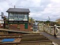
 Cuxton signal box and level crossing - 25969729321.jpg 4,828 × 3,365; 5.89 MB
-
 Dale St - geograph.org.uk - 4957433.jpg 640 × 426; 66 KB
-
-
 Decorative pollarding - geograph.org.uk - 4965484.jpg 640 × 426; 75 KB
-
 Dental practice opening soon - geograph.org.uk - 4957535.jpg 640 × 426; 56 KB
-
 Electrical Sub-station - geograph.org.uk - 4945868.jpg 640 × 426; 61 KB
-
 Ely Court - geograph.org.uk - 4957520.jpg 640 × 426; 73 KB
-
 Farmers' Market - geograph.org.uk - 5296460.jpg 640 × 426; 83 KB
-
 Flats by Grosvenor Bridge - geograph.org.uk - 4945870.jpg 640 × 426; 62 KB
-
 Former St Luke's Infants' School - geograph.org.uk - 5021464.jpg 640 × 426; 72 KB
-
 Former St Luke's Infants' School - geograph.org.uk - 5204562.jpg 640 × 426; 61 KB
-
 Grosvenor Bridge - geograph.org.uk - 4957411.jpg 640 × 426; 73 KB
-
 Grosvenor Lodge - geograph.org.uk - 4964999.jpg 640 × 426; 60 KB
-
 Hadley Court, Tunbridge Wells - geograph.org.uk - 4856440.jpg 3,264 × 2,448; 1.98 MB
-
 Holy Trinity Church Hall - geograph.org.uk - 4957485.jpg 640 × 426; 92 KB
-
 HSBC - geograph.org.uk - 4957558.jpg 640 × 426; 65 KB
-
 Huntleys Park, Tunbridge Wells - geograph.org.uk - 4856436.jpg 3,264 × 2,448; 1.86 MB
-
 John Street, Tunbridge Wells - geograph.org.uk - 4856473.jpg 3,264 × 2,448; 1.64 MB
-
 Lakeman Way - geograph.org.uk - 5021473.jpg 640 × 426; 64 KB
-
 Lakeman Way - geograph.org.uk - 5204563.jpg 640 × 426; 75 KB
-
 Langton Road, Tunbridge Wells - geograph.org.uk - 4853455.jpg 3,264 × 2,448; 1.85 MB
-
 London Road, near Southborough - geograph.org.uk - 4852847.jpg 3,264 × 2,448; 2.15 MB
-
 London Road, near Southborough - geograph.org.uk - 4852852.jpg 3,264 × 2,448; 2.4 MB
-
 Major Yorke, Tunbridge Wells - geograph.org.uk - 4853463.jpg 2,725 × 1,813; 1.01 MB
-
 Millennium Clock, Fiveways - geograph.org.uk - 4957450.jpg 405 × 640; 59 KB
-
 Pedestrianised zone - geograph.org.uk - 4957538.jpg 640 × 426; 92 KB
-
 Pierre Loti Cafe - geograph.org.uk - 5204559.jpg 640 × 426; 80 KB
-
 Quarry Hill - geograph.org.uk - 4957417.jpg 640 × 426; 69 KB
-
 Quarry Hill - geograph.org.uk - 4957419.jpg 640 × 426; 66 KB
-
 Rose and Crown - geograph.org.uk - 4957579.jpg 640 × 426; 68 KB
-
 Royal Victoria Place - geograph.org.uk - 4957563.jpg 640 × 426; 72 KB
-
 Saint Johns Yard - geograph.org.uk - 4966132.jpg 640 × 468; 62 KB
-
 Sheep grazing, Forge Farm - geograph.org.uk - 4950705.jpg 640 × 426; 39 KB
-
 Shell filling station - geograph.org.uk - 4965465.jpg 640 × 426; 62 KB
-
 Skinners' School - geograph.org.uk - 5775751.jpg 640 × 426; 52 KB
-
 St Luke's Rd - geograph.org.uk - 4957396.jpg 640 × 426; 84 KB
-
 St Raphael's Lodge - geograph.org.uk - 4965524.jpg 426 × 640; 70 KB
-
 Tea Garden Lane, Rusthall - geograph.org.uk - 4855899.jpg 3,264 × 2,448; 2.42 MB
-
 Telecom Building, St John's Rd - geograph.org.uk - 4965454.jpg 640 × 426; 61 KB
-
 Tesco Express - geograph.org.uk - 4957573.jpg 640 × 426; 49 KB
-
 The Beacon, Rusthall - geograph.org.uk - 4855906.jpg 3,264 × 2,448; 2.18 MB
-
 The Co-operative Food - geograph.org.uk - 5021469.jpg 640 × 426; 70 KB
-
 The Crystal Palace - geograph.org.uk - 4957436.jpg 640 × 489; 74 KB
-
 The George Hotel, Tunbridge Wells - geograph.org.uk - 4853483.jpg 2,418 × 1,867; 890 KB
-
 The Hastings Line - geograph.org.uk - 4957414.jpg 640 × 426; 88 KB
-
 The Local - geograph.org.uk - 5204560.jpg 640 × 426; 61 KB
-
 The Mead School - geograph.org.uk - 5775520.jpg 640 × 426; 89 KB
-
 The Pitcher ^ Piano - geograph.org.uk - 4957476.jpg 640 × 426; 67 KB
-
 The Skinners' School Crest - geograph.org.uk - 4965496.jpg 640 × 426; 72 KB
-
 Theatre Royal, Margate - geograph.org.uk - 4872582.jpg 640 × 480; 98 KB
-
 Town centre, Tunbridge Wells - geograph.org.uk - 4957507.jpg 640 × 426; 79 KB
-
 Trinity Arts Centre - geograph.org.uk - 4957490.jpg 640 × 509; 114 KB
-
 Trinity Arts Centre - geograph.org.uk - 4957498.jpg 344 × 640; 68 KB
-
 Trinity Arts Centre - geograph.org.uk - 4957501.jpg 374 × 640; 57 KB
-

-
 Tunbridge Wells War Memorial - geograph.org.uk - 4957465.jpg 640 × 426; 77 KB
-
 Velo Shop - geograph.org.uk - 4965452.jpg 640 × 426; 70 KB
-
 Wall at the bottom of Queen's Rd - geograph.org.uk - 4957402.jpg 640 × 426; 85 KB
-
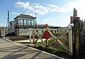
 Waterinbury signal box and level crossing - 25295250314.jpg 4,896 × 3,422; 6.71 MB
-
 Waterinbury signal box and level crossing - 25295314974.jpg 4,896 × 3,444; 5.7 MB
-
 Waterinbury signal box and level crossing - 25299223003.jpg 4,836 × 3,590; 5.46 MB
-
 Waterinbury signal box and level crossing - 25299264423.jpg 4,896 × 3,672; 7.22 MB
-
 Waterinbury signal box and level crossing - 25627350510.jpg 4,896 × 2,954; 6.16 MB
-
 Waterinbury signal box and level crossing - 25832973041.jpg 4,868 × 2,776; 4 MB
-
 Waterinbury signal box and level crossing - 25902105656.jpg 4,896 × 3,285; 6.32 MB
-
 Waterinbury signal box and level crossing - 25927999025.jpg 4,896 × 3,672; 5.59 MB
-
 Waterinbury signal box and level crossing - 25928049835.jpg 4,896 × 3,061; 6.42 MB
-
 Westcombe House - geograph.org.uk - 4965008.jpg 640 × 635; 79 KB
-
 William Street, Tunbridge Wells - geograph.org.uk - 4856484.jpg 3,264 × 2,448; 1.57 MB
-
 Wood St - geograph.org.uk - 4957432.jpg 640 × 426; 71 KB
-
 Woodlands Rd - geograph.org.uk - 5021471.jpg 640 × 426; 74 KB
-
 YMCA - geograph.org.uk - 4957532.jpg 640 × 426; 63 KB


_-_geograph.org.uk_-_4965511.jpg)


