Category:March 2012 in County Tyrone
Jump to navigation
Jump to search
English: Images taken in County Tyrone, Northern Ireland in this month of 2012 (not the date of the upload).
| Jan | Feb | Mar | Apr | May | Jun | Jul | Aug | Sep | Oct | Nov | Dec | ||
| ← | 18 | 11 | 39 | 6 | 7 | 0 | 11 | 14 | 35 | 35 | 64 | 17 | → |
|---|
Media in category "March 2012 in County Tyrone"
The following 39 files are in this category, out of 39 total.
-
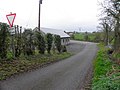
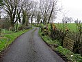 A bend in a country road, Rakeeragh - geograph.org.uk - 2839905.jpg 640 × 480; 86 KB
-
 A multi-trunked tree, Rakeeragh - geograph.org.uk - 2839930.jpg 640 × 480; 81 KB
-
 Blackfort Avenue - geograph.org.uk - 2850795.jpg 640 × 480; 72 KB
-
 Blackfort Avenue, Blackfort - geograph.org.uk - 2850780.jpg 640 × 480; 83 KB
-
 Blackfort Avenue, Blackfort - geograph.org.uk - 2850785.jpg 640 × 480; 67 KB
-
 Blackfort Road, Blackfort - geograph.org.uk - 2850572.jpg 640 × 480; 44 KB
-
 Blackfort Road, Blackfort - geograph.org.uk - 2850794.jpg 640 × 480; 89 KB
-
 Blackfort Road, Blackfort - geograph.org.uk - 2850798.jpg 640 × 480; 72 KB
-
 Bridge at Rakeeragh - geograph.org.uk - 2840279.jpg 640 × 480; 66 KB
-
 Carntall More - geograph.org.uk - 2849307.jpg 640 × 480; 44 KB
-
 Chopped trees, Rakeeragh - geograph.org.uk - 2839903.jpg 640 × 480; 108 KB
-
 Copes Stone, Killyfaddy - geograph.org.uk - 2849313.jpg 640 × 480; 35 KB
-
 Crucknamona Road, Rakeeragh - geograph.org.uk - 2839876.jpg 640 × 480; 65 KB
-
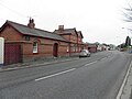 Fivemiletown former Railway Station - geograph.org.uk - 2848087.jpg 640 × 480; 44 KB
-
 Fivemiletown former Railway Station - geograph.org.uk - 2848093.jpg 640 × 480; 43 KB
-
 Lesser Celandine, Rakeeragh - geograph.org.uk - 2840271.jpg 640 × 480; 68 KB
-
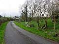
 Loughmuck Road, Rakeeragh - geograph.org.uk - 2839848.jpg 640 × 480; 52 KB
-
 Loughmuck Road, Rakeeragh - geograph.org.uk - 2840258.jpg 640 × 480; 82 KB
-
 Minor road at Rakeeragh - geograph.org.uk - 2840104.jpg 640 × 480; 85 KB
-
 Minor road, Rakeeragh - geograph.org.uk - 2839916.jpg 640 × 480; 72 KB
-
 Minor road, Rakeeragh - geograph.org.uk - 2839927.jpg 640 × 480; 88 KB
-
 Minor road, Rakeeragh - geograph.org.uk - 2840128.jpg 640 × 480; 87 KB
-
 Minor road, Rakeeragh - geograph.org.uk - 2840252.jpg 640 × 480; 80 KB
-
 Minor road, Rakeeragh - geograph.org.uk - 2840255.jpg 640 × 480; 61 KB
-
 Mucky lane, Rathfraggan - geograph.org.uk - 2850561.jpg 640 × 480; 56 KB
-
 Mucky road, Rakeeragh - geograph.org.uk - 2840109.jpg 640 × 480; 81 KB
-
 Puddles, Rakeeragh - geograph.org.uk - 2840263.jpg 640 × 480; 59 KB
-
 Railway station detail, Fivemiletown - geograph.org.uk - 2848097.jpg 640 × 480; 51 KB
-
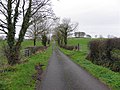
 Rakeeragh Townland - geograph.org.uk - 2839844.jpg 640 × 480; 68 KB
-
 Rakeeragh Townland - geograph.org.uk - 2839910.jpg 640 × 480; 76 KB
-
 Rakeeragh Townland - geograph.org.uk - 2840141.jpg 640 × 480; 74 KB
-
 Rakeeragh Townland - geograph.org.uk - 2840249.jpg 640 × 480; 77 KB
-
 Rakeeragh Townland - geograph.org.uk - 2840257.jpg 640 × 480; 55 KB
-
 Rakeeragh Townland - geograph.org.uk - 2840261.jpg 640 × 480; 75 KB
-
 Road at Carntall More - geograph.org.uk - 2849316.jpg 640 × 480; 67 KB
-
 Rushes, Rathfraggan - geograph.org.uk - 2850566.jpg 640 × 480; 69 KB
-
 Small bridge, Rakeeragh - geograph.org.uk - 2839912.jpg 640 × 480; 87 KB
-
 Whins in a field, Rakeeragh - geograph.org.uk - 2839854.jpg 640 × 480; 75 KB
-
 Wooded area, Rakeeragh - geograph.org.uk - 2839933.jpg 640 × 480; 98 KB


