Category:March 2010 in York
Jump to navigation
Jump to search
Deutsch: Bilder, die im März 2010 in York aufgenommen worden sind. Bitte beachten Sie, dass dies weder das Datum des Uploads noch das Datum des Scannens eines Fotos ist.
English: Images/pictures taken in York during March 2010. Note this is not the date of the upload, nor the date a photo was scanned.
Español: Fotografías o imágenes tomadas en York durante marzo 2010. No es la fecha de subida ni escaneo, sino la fecha en que las fotografías o imágenes se crearon.
Esperanto: Bildoj faritaj en York en marto 2010. Tio ne estas la dato, kiam la bildoj estis alŝutitaj aŭ skanitaj.
Français : Photographies ou images prises en York durant mars 2010. Ce n'est pas la date du téléchargement ou du scan.
Galego: Fotografías ou imaxes tomadas en York durante marzo 2010. Non é a data de subida nin escaneamento, senón a data na que se crearon as fotografías ou imaxes.
Italiano: Fotografie o immagini scattate a York nel marzo 2010. Nota bene: la data non si riferisce né a quella di upload né a quella in cui la foto è stata digitalizzata.
Norsk bokmål: Bilder tatt i York i løpet av mars 2010. Merk at dette ikke er datoen for opplasting, eller når et bilde har blitt skannet.
Norsk nynorsk: Bilete teke i York i løpet av mars 2010. Merk at dette ikkje er datoen for opplasting, eller når eit bilete har vorte skanna.
Русский: Изображения, сделанные в York в течение март 2010 (не дата загрузки изображения).
Українська: Зображення, зроблені в York протягом березень 2010. Зауважте, що це не дата завантаження чи дата сканування фотографії.
| March 2009 | ← | March 2010 | → | March 2011 | |||||||
| Jan | Feb | Mar | Apr | May | Jun | Jul | Aug | Sep | Oct | Nov | Dec |
| 35 | 271 | 298 | 131 | 284 | 39 | 154 | 189 | 296 | 138 | 122 | 110 |
|---|---|---|---|---|---|---|---|---|---|---|---|
Media in category "March 2010 in York"
The following 200 files are in this category, out of 298 total.
(previous page) (next page)-

-
 Acomb Court Jewellers - York Road - geograph.org.uk - 1742575.jpg 484 × 640; 76 KB
-
 Acomb Cycle Centre - Beaconsfield Street - geograph.org.uk - 1741116.jpg 640 × 572; 110 KB
-
 Acomb Dental Practice - Front Street - geograph.org.uk - 1742172.jpg 640 × 489; 50 KB
-
 Acomb Green - geograph.org.uk - 1742435.jpg 640 × 435; 52 KB
-
 Acomb Medical Practice - Acomb Road - geograph.org.uk - 1742885.jpg 640 × 434; 55 KB
-
 Acomb News - Front Street - geograph.org.uk - 1742275.jpg 430 × 640; 65 KB
-

-
 Acomb Picture Framing - Green Lane - geograph.org.uk - 1741093.jpg 480 × 640; 62 KB
-
 Acomb Road Guest House - Acomb Road - geograph.org.uk - 1742906.jpg 406 × 640; 79 KB
-
 Acomb Travel - Front Street - geograph.org.uk - 1742280.jpg 480 × 640; 64 KB
-
 Acomb War Memorial - The Green - geograph.org.uk - 1742431.jpg 415 × 640; 65 KB
-

-
 St Stephen's Church - off York Road - geograph.org.uk - 1742563.jpg 640 × 480; 120 KB
-
 St Stephen's Church Path - York Road - geograph.org.uk - 1742298.jpg 480 × 640; 77 KB
-
 St Stephen's Graveyard - off York Road - geograph.org.uk - 1742567.jpg 640 × 480; 103 KB
-

-
 Acorn Meat Products - Front Street - geograph.org.uk - 1742137.jpg 467 × 640; 71 KB
-
 Across the Hungate site (geograph 1787274).jpg 640 × 480; 115 KB
-
 Age Concern - Front Street - geograph.org.uk - 1742125.jpg 537 × 640; 103 KB
-
 Ali Barbers - Front Street - geograph.org.uk - 1742294.jpg 480 × 640; 48 KB
-
 Ascot Lodge Guest House - Acomb Road - geograph.org.uk - 1742921.jpg 640 × 457; 75 KB
-
 Ascot Way - Kingsway West - geograph.org.uk - 1739380.jpg 640 × 480; 61 KB
-
 Ashton Lane - Holgate Road - geograph.org.uk - 1745721.jpg 640 × 480; 79 KB
-
 Ashtons - Front Street - geograph.org.uk - 1742108.jpg 480 × 640; 64 KB
-
 Aztec Hair - Front Street - geograph.org.uk - 1742291.jpg 516 × 640; 97 KB
-
 Barclays - York Road - geograph.org.uk - 1742579.jpg 480 × 640; 73 KB
-
 Barnardos - Front Street - geograph.org.uk - 1741340.jpg 424 × 640; 53 KB
-

-
 Bathstore - York Road - geograph.org.uk - 1742805.jpg 640 × 494; 67 KB
-
 Beaconsfield Street - Green Lane - geograph.org.uk - 1741107.jpg 640 × 480; 59 KB
-
 Beck - St Helen's Road - geograph.org.uk - 1739017.jpg 480 × 640; 131 KB
-
 Beech Grove - York Road - geograph.org.uk - 1742577.jpg 640 × 480; 77 KB
-

-
 Bishops B and B - Holgate Road - geograph.org.uk - 1745747.jpg 640 × 480; 82 KB
-
 Blockbuster - York Road - geograph.org.uk - 1742710.jpg 640 × 480; 72 KB
-
 Bonmarche - Front Street - geograph.org.uk - 1742143.jpg 480 × 640; 64 KB
-
 Boots Pharmacy - Front Street - geograph.org.uk - 1741185.jpg 480 × 640; 66 KB
-
 Branded Bargains - Front Street - geograph.org.uk - 1742139.jpg 480 × 640; 69 KB
-
 Bridge EMM4-7 - St Helen's Road - geograph.org.uk - 1739032.jpg 640 × 480; 54 KB
-
 Bridleway toward Pool Bridge Farm - geograph.org.uk - 2374120.jpg 3,264 × 2,448; 2.71 MB
-
 British Heart Foundation - York Road - geograph.org.uk - 1742614.jpg 480 × 640; 72 KB
-
 Broad Highway - geograph.org.uk - 2373927.jpg 3,264 × 2,448; 1.49 MB
-
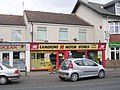 Camerons Motor Stores - Acomb Green - geograph.org.uk - 1742453.jpg 640 × 480; 77 KB
-
 Carr Lane - York Road - geograph.org.uk - 1742588.jpg 640 × 480; 59 KB
-
 Cartridge World - Front Street - geograph.org.uk - 1742239.jpg 480 × 640; 82 KB
-
 Castlegate, York - geograph.org.uk - 1756401.jpg 1,856 × 2,784; 1.21 MB
-
 Catholic Church of Our Lady - Gale Lane - geograph.org.uk - 1739950.jpg 640 × 480; 111 KB
-
 Cee Cee's Cafe - Holgate Road - geograph.org.uk - 1746149.jpg 480 × 640; 82 KB
-
 CGTV Technology - Acomb Road - geograph.org.uk - 1744622.jpg 480 × 640; 87 KB
-
 Chaloners Road - Thanet Road - geograph.org.uk - 1739210.jpg 640 × 480; 82 KB
-
 Chancery Rise - Holgate Road - geograph.org.uk - 1745727.jpg 640 × 480; 110 KB
-
 Cheque Centre - Front Street - geograph.org.uk - 1742136.jpg 428 × 640; 63 KB
-
 Chiropractic 1st - Holgate Road - geograph.org.uk - 1746153.jpg 640 × 526; 69 KB
-

-
 Churchills - Front Street - geograph.org.uk - 1742119.jpg 480 × 640; 76 KB
-
 Circle Cleaners - Green Lane Circle - geograph.org.uk - 1739963.jpg 522 × 640; 80 KB
-
 Clifton Bridge, York - geograph.org.uk - 1751361.jpg 1,024 × 683; 222 KB
-
 Cock and Bottle Public House, Skeldergate, York - geograph.org.uk - 1751539.jpg 1,024 × 683; 181 KB
-
 Cooplands Bakers - York Road - geograph.org.uk - 1742593.jpg 480 × 640; 74 KB
-
 Cornlands Road - Gale Lane - geograph.org.uk - 1739951.jpg 640 × 480; 100 KB
-
 Cottage Salon - Front Street - geograph.org.uk - 1742245.jpg 480 × 640; 64 KB
-
 Country Fayre - Front Street - geograph.org.uk - 1742131.jpg 432 × 640; 64 KB
-
 Country Lane toward Wheldrake - geograph.org.uk - 2373955.jpg 3,264 × 2,448; 1.88 MB
-
 Croftside - Wetherby Road - geograph.org.uk - 1742414.jpg 640 × 480; 80 KB
-

-
 Danebury Drive - Wetherby Roadr - geograph.org.uk - 1742439.jpg 640 × 480; 66 KB
-
 Danesfort Avenue - Gale Lane - geograph.org.uk - 1739948.jpg 640 × 480; 94 KB
-
 Danesfort Avenue - Kingsway West - geograph.org.uk - 1739383.jpg 640 × 480; 67 KB
-
 David Dowley Optician - Front Street - geograph.org.uk - 1741295.jpg 460 × 640; 87 KB
-
 Dijon Avenue - Green Lane - geograph.org.uk - 1741030.jpg 640 × 455; 70 KB
-

-
 Elite Nails - Green Lane - geograph.org.uk - 1741081.jpg 480 × 640; 58 KB
-
 Elmer Estates - Front Street - geograph.org.uk - 1742272.jpg 480 × 640; 74 KB
-
 Entering Wheldrake from the East - geograph.org.uk - 2366597.jpg 3,264 × 2,448; 1.81 MB
-
 Entering Wheldrake from the West - geograph.org.uk - 2379299.jpg 3,264 × 2,448; 1.6 MB
-
 Entrance to Bishopthorpe Crematorium - geograph.org.uk - 2375936.jpg 3,264 × 2,448; 1.75 MB
-

-
 Ex-Cat Shop - Front Street - geograph.org.uk - 1742109.jpg 640 × 484; 61 KB
-
 Fairfax Close - York Road - geograph.org.uk - 1742812.jpg 640 × 480; 63 KB
-
 Falconer Street - Acomb Road - geograph.org.uk - 1744645.jpg 640 × 480; 69 KB
-
 Farm Roads from Wheldrake Lane - geograph.org.uk - 2374051.jpg 3,264 × 2,448; 1.58 MB
-
 Farm Track from Naburn to Highfield Farm - geograph.org.uk - 2376057.jpg 3,264 × 2,448; 1.85 MB
-
 Farm Tracks near Highfield Farm - geograph.org.uk - 2376061.jpg 3,264 × 2,448; 1.35 MB
-
 Farmfoods - Front Street - geograph.org.uk - 1741347.jpg 640 × 480; 79 KB
-
 Fieldside Footpath alongside Bland's Plantation - geograph.org.uk - 2374242.jpg 3,264 × 2,448; 1.74 MB
-
 Fieldside Footpath toward Sparrow Hall Farm. - geograph.org.uk - 2373994.jpg 3,264 × 2,448; 1.96 MB
-
 Fleetways Taxis Ltd - Queen Street - geograph.org.uk - 1746159.jpg 640 × 447; 72 KB
-

-
 Floral Elegance - Front Street - geograph.org.uk - 1742260.jpg 480 × 640; 69 KB
-
 Footpath to Warren House Farm - geograph.org.uk - 2379242.jpg 3,264 × 2,448; 1.72 MB
-
 Fossgate York - geograph.org.uk - 1751686.jpg 1,024 × 683; 178 KB
-
 Foxwood Lane - Gale Lane - geograph.org.uk - 1739262.jpg 640 × 480; 63 KB
-
 Friends Meeting House - Acomb Green - geograph.org.uk - 1742436.jpg 640 × 544; 73 KB
-
 Front Street - viewed from Gale Lane - geograph.org.uk - 1742237.jpg 640 × 392; 58 KB
-

-

-
 Front Street Surgery - Front Street - geograph.org.uk - 1742169.jpg 640 × 480; 63 KB
-
 Fulford Arms Public House on Fulford Road York - geograph.org.uk - 1751613.jpg 1,024 × 683; 100 KB
-
 Fulford Cross, York - geograph.org.uk - 1744943.jpg 427 × 640; 77 KB
-
 Fulford Hall - geograph.org.uk - 2374335.jpg 3,264 × 2,448; 2.32 MB
-
 Fulford Ings looking South - geograph.org.uk - 2374327.jpg 3,264 × 2,448; 3.22 MB
-
 Fulford Road, York - geograph.org.uk - 1744953.jpg 640 × 427; 76 KB
-
 Fulford Road, York - geograph.org.uk - 1744968.jpg 640 × 427; 75 KB
-
 Fulford Street - geograph.org.uk - 2374320.jpg 3,264 × 2,448; 1.86 MB
-
 Fultons Foods - York Road - geograph.org.uk - 1742608.jpg 480 × 640; 104 KB
-
 G and G Hair Design - Front Street - geograph.org.uk - 1742156.jpg 640 × 495; 57 KB
-
 Gale Lane - viewed from Front Street - geograph.org.uk - 1742233.jpg 640 × 480; 54 KB
-
 Gale Lane Fisheries - Gale Lane - geograph.org.uk - 1739402.jpg 516 × 640; 65 KB
-

-
 Germany Lane Fulford - geograph.org.uk - 2374311.jpg 3,264 × 2,448; 1.72 MB
-
 Gillrudding Grange - geograph.org.uk - 2376070.jpg 3,264 × 2,448; 1.73 MB
-
 Gladstone Street - Green Lane - geograph.org.uk - 1741043.jpg 640 × 480; 85 KB
-
 Government House Road - geograph.org.uk - 1751406.jpg 1,024 × 683; 187 KB
-
 Government House Road looking South - geograph.org.uk - 1751395.jpg 1,024 × 683; 212 KB
-
 Government House road looking South East - geograph.org.uk - 1751401.jpg 1,024 × 683; 189 KB
-
 Grantham Drive - Acomb Road - geograph.org.uk - 1742927.jpg 640 × 417; 61 KB
-
 Green Lane Carpets - Green Lane - geograph.org.uk - 1741099.jpg 480 × 640; 88 KB
-
 Greggs - Front Street - geograph.org.uk - 1741313.jpg 460 × 640; 54 KB
-
 Hacci's Fast Food - Front Street - geograph.org.uk - 1742152.jpg 640 × 493; 79 KB
-
 Halifax - Front Street - geograph.org.uk - 1741354.jpg 640 × 480; 87 KB
-
 Hamilton Drive East - Holgate Road - geograph.org.uk - 1745752.jpg 640 × 419; 70 KB
-
 Hargrave Pharmacy - Front Street - geograph.org.uk - 1742251.jpg 640 × 536; 89 KB
-
 Harold Court - Green Lane - geograph.org.uk - 1741027.jpg 640 × 480; 94 KB
-
 Help the Aged - Front Street - geograph.org.uk - 1741278.jpg 480 × 640; 63 KB
-
 Herbert Todd and Son - York Road - geograph.org.uk - 1742724.jpg 640 × 515; 81 KB
-
 Hobgate - Acomb Road - geograph.org.uk - 1742898.jpg 640 × 411; 46 KB
-

-

-

-

-
 Holgate Hill Hotel - Holgate Road - geograph.org.uk - 1745760.jpg 640 × 480; 104 KB
-

-
 Hospitium, York - geograph.org.uk - 2514566.jpg 2,560 × 1,920; 1.01 MB
-
 Howden Lane - geograph.org.uk - 2376052.jpg 3,264 × 2,448; 1.95 MB
-

-
 John Palmer's Grave, York - geograph.org.uk - 1756433.jpg 1,600 × 1,067; 597 KB
-
 John's Barber Shop - Green Lane - geograph.org.uk - 1741064.jpg 640 × 480; 89 KB
-
 Johnsons Cleaners - Front Street - geograph.org.uk - 1741304.jpg 480 × 640; 73 KB
-
 Jonathanjames - Front Street - geograph.org.uk - 1742141.jpg 480 × 640; 71 KB
-
 Keen Hands Craft Shop - Front Street - geograph.org.uk - 1742247.jpg 480 × 640; 67 KB
-
 Kings Square - York - geograph.org.uk - 2134876.jpg 640 × 480; 108 KB
-
 Kingsthorpe - Green Lane Circle - geograph.org.uk - 1741018.jpg 640 × 480; 121 KB
-
 Kingsway West - Gale Lane - geograph.org.uk - 1739371.jpg 640 × 480; 56 KB
-
 Kingsway West - Tudor Road - geograph.org.uk - 1739955.jpg 640 × 480; 57 KB
-
 Kool Tattoo - Green Lane - geograph.org.uk - 1741132.jpg 526 × 640; 66 KB
-
 Ladbrokes - Front Street - geograph.org.uk - 1742148.jpg 640 × 480; 91 KB
-

-
 Leeds Building Society - York Road - geograph.org.uk - 1742697.jpg 480 × 640; 68 KB
-
 Leisuretime - York Road - geograph.org.uk - 1742702.jpg 480 × 640; 80 KB
-
 Lettersofdistinction - Holgate Road - geograph.org.uk - 1745717.jpg 640 × 480; 90 KB
-
 Lindley Street - Acomb Road - geograph.org.uk - 1744618.jpg 640 × 480; 68 KB
-
 Lloyds Pharmacy - Tudor Road - geograph.org.uk - 1739956.jpg 640 × 480; 78 KB
-
 Lloyds Pharmacy - York Road - geograph.org.uk - 1742713.jpg 640 × 480; 77 KB
-
 Lloyds TSB - York Road - geograph.org.uk - 1742596.jpg 480 × 640; 80 KB
-
 Looking west on Benjy Lane - geograph.org.uk - 2379270.jpg 640 × 480; 62 KB
-
 Major Pipe Laying on Fulford Ings - geograph.org.uk - 2375900.jpg 3,264 × 2,448; 1.87 MB
-
 Manor House Drive - York Road - geograph.org.uk - 1742732.jpg 640 × 480; 65 KB
-
-

-
 Medical Centre and Water Tower. Wheldrake. - geograph.org.uk - 2379332.jpg 3,264 × 2,448; 1.55 MB
-

-
 Middleton Road - Stuart Road - geograph.org.uk - 1739393.jpg 640 × 480; 68 KB
-
 Milner Street - Green Lane - geograph.org.uk - 1741038.jpg 640 × 480; 83 KB
-
 Minster seen across the Hungate site (geograph 1787288).jpg 640 × 480; 119 KB
-
 Moor Grove - Thanet Road - geograph.org.uk - 1739049.jpg 640 × 480; 86 KB
-
 Moorgate - Acomb Road - geograph.org.uk - 1742916.jpg 640 × 480; 77 KB
-
 Multangular Tower - geograph.org.uk - 2163614.jpg 2,560 × 1,920; 1.03 MB
-
 Murray Street - Acomb Road - geograph.org.uk - 1742955.jpg 640 × 480; 64 KB
-
 Naburn Bridge. York - Selby Rail Trail - geograph.org.uk - 2376034.jpg 3,264 × 2,448; 1.38 MB
-
 Naburn Lane west of Deighton - geograph.org.uk - 2376074.jpg 3,264 × 2,448; 1.81 MB
-
 Naburn Station - geograph.org.uk - 2376047.jpg 3,264 × 2,448; 2.47 MB
-
 Nat West - Front Street - geograph.org.uk - 1741322.jpg 449 × 640; 56 KB
-
 New Lane - Acomb Road - geograph.org.uk - 1742945.jpg 640 × 441; 62 KB
-
 New Walk, looking towards Blue Bridge Lane - geograph.org.uk - 1751552.jpg 1,024 × 683; 233 KB
-
 New Walk, looking towards Fulford - geograph.org.uk - 1751569.jpg 1,024 × 683; 191 KB
-
 New Walk, looking towards Fulford - geograph.org.uk - 1751598.jpg 683 × 1,024; 317 KB
-
 Newbury Avenue - Kingsway West - geograph.org.uk - 1739376.jpg 640 × 480; 57 KB
-
 North Street, looking towards Micklegate, York - geograph.org.uk - 1751480.jpg 1,024 × 683; 150 KB
-
 Over fields to Sparrow Hall Farm - geograph.org.uk - 2374028.jpg 3,264 × 2,448; 1.96 MB
-
 Overland Underwater - York Road - geograph.org.uk - 1742801.jpg 480 × 640; 53 KB
-
 Oxfam - York Road - geograph.org.uk - 1742704.jpg 480 × 640; 67 KB
-
 Park Lane - Acomb Road - geograph.org.uk - 1744640.jpg 480 × 640; 62 KB
-
 Pikeing Well, New Walk, York - geograph.org.uk - 1751589.jpg 1,024 × 683; 165 KB
-
 Pizza Hut - Acomb Green - geograph.org.uk - 1742447.jpg 640 × 503; 67 KB
-
 Playing Field - Foxwood Lane - geograph.org.uk - 1739274.jpg 640 × 480; 57 KB
-
 Police Station - Acomb Road - geograph.org.uk - 1742896.jpg 640 × 480; 90 KB
-
 Pool Bridge Farm - geograph.org.uk - 2374088.jpg 3,264 × 2,448; 1.76 MB
-

-

-
 Quicksilver - Front Street - geograph.org.uk - 1742114.jpg 640 × 480; 86 KB
-
 Railway Street - Watson Street - geograph.org.uk - 1746108.jpg 640 × 480; 78 KB
-
 Rayner Opticians - York Road - geograph.org.uk - 1742581.jpg 493 × 640; 74 KB
-
 River Ouse and Scarborough Bridge, York - geograph.org.uk - 1751436.jpg 1,024 × 683; 219 KB
-
 River Ouse toward Naburn - geograph.org.uk - 2376041.jpg 3,264 × 2,448; 1.23 MB
-

-
 Riverside Park - geograph.org.uk - 2375910.jpg 3,264 × 2,448; 2.41 MB
-
 Road Bridge over the River Ouse - geograph.org.uk - 2375921.jpg 3,264 × 2,448; 1.96 MB
-
 Road into North Selby Mine. ( Closed ) - geograph.org.uk - 2379200.jpg 3,264 × 2,448; 2.26 MB
-
 Road out of Bishopthorpe to the southwest - geograph.org.uk - 2375984.jpg 3,264 × 2,448; 1.24 MB


.jpg)


.png)


.jpg)


_-_geograph.org.uk_-_2379200.jpg)
