Category:March 2008 in Moray
Jump to navigation
Jump to search
Council areas (municipalities) of Scotland: Aberdeen · Aberdeenshire · Angus · Argyll and Bute · Dumfries and Galloway · East Lothian · Edinburgh · Fife · Glasgow · Highland · Inverclyde · Midlothian · Moray · Perth and Kinross · Renfrewshire · Scottish Borders · Shetland Islands · South Lanarkshire · Stirling · West Dunbartonshire ·
Deutsch: Bilder, die im März 2008 in Moray aufgenommen worden sind. Bitte beachten Sie, dass dies weder das Datum des Uploads noch das Datum des Scannens eines Fotos ist.
English: Images/pictures taken in Moray during March 2008. Note this is not the date of the upload, nor the date a photo was scanned.
Español: Fotografías o imágenes tomadas en Moray durante marzo 2008. No es la fecha de subida ni escaneo, sino la fecha en que las fotografías o imágenes se crearon.
Esperanto: Bildoj faritaj en Moray en marto 2008. Tio ne estas la dato, kiam la bildoj estis alŝutitaj aŭ skanitaj.
Français : Photographies ou images prises en Moray durant mars 2008. Ce n'est pas la date du téléchargement ou du scan.
Galego: Fotografías ou imaxes tomadas en Moray durante marzo 2008. Non é a data de subida nin escaneamento, senón a data na que se crearon as fotografías ou imaxes.
Italiano: Fotografie o immagini scattate a Moray nel marzo 2008. Nota bene: la data non si riferisce né a quella di upload né a quella in cui la foto è stata digitalizzata.
Norsk bokmål: Bilder tatt i Moray i løpet av mars 2008. Merk at dette ikke er datoen for opplasting, eller når et bilde har blitt skannet.
Norsk nynorsk: Bilete teke i Moray i løpet av mars 2008. Merk at dette ikkje er datoen for opplasting, eller når eit bilete har vorte skanna.
Русский: Изображения, сделанные в Moray в течение март 2008 (не дата загрузки изображения).
Українська: Зображення, зроблені в Moray протягом березень 2008. Зауважте, що це не дата завантаження чи дата сканування фотографії.
| March 2007 | ← | March 2008 | → | March 2009 | |||||||
| Jan | Feb | Mar | Apr | May | Jun | Jul | Aug | Sep | Oct | Nov | Dec |
| 0 | 18 | 32 | 1 | 0 | 0 | 5 | 0 | 0 | 13 | 0 | 45 |
|---|---|---|---|---|---|---|---|---|---|---|---|
Media in category "March 2008 in Moray"
The following 32 files are in this category, out of 32 total.
-
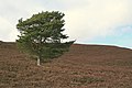 A lone Pine by Knock na Snaird - geograph.org.uk - 744755.jpg 640 × 426; 85 KB
-
 Buckpool - geograph.org.uk - 736769.jpg 640 × 430; 60 KB
-
 Buckpool - geograph.org.uk - 736789.jpg 640 × 480; 66 KB
-
 Buckpool - geograph.org.uk - 736806.jpg 640 × 480; 75 KB
-
 Disused Railway at Fochabers - geograph.org.uk - 732914.jpg 640 × 480; 112 KB
-
 Drainage Ditch at Windyridge - geograph.org.uk - 712328.jpg 427 × 640; 260 KB
-
 Former Railway at Fochabers - geograph.org.uk - 744905.jpg 640 × 480; 160 KB
-
 Former Railway Line - geograph.org.uk - 712263.jpg 640 × 427; 275 KB
-
 Former Railway Line - geograph.org.uk - 712299.jpg 427 × 640; 275 KB
-
 Looking towards the Hill of Maud - geograph.org.uk - 736741.jpg 640 × 480; 51 KB
-

-
 Milne's Primary School at Fochabers - geograph.org.uk - 732772.jpg 640 × 480; 67 KB
-
 Milne's Primary School at Fochabers - geograph.org.uk - 732794.jpg 640 × 480; 64 KB
-
 Portgordon - geograph.org.uk - 736144.jpg 640 × 480; 71 KB
-
 Porttannachy - geograph.org.uk - 736099.jpg 640 × 408; 46 KB
-
 Pumping House - geograph.org.uk - 712322.jpg 640 × 427; 302 KB
-
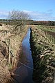
 Spynie Canal - geograph.org.uk - 712313.jpg 640 × 427; 241 KB
-
 Spynie Canal - geograph.org.uk - 712317.jpg 640 × 427; 237 KB
-
 The Bandstand at Keith - geograph.org.uk - 736253.jpg 640 × 480; 63 KB
-
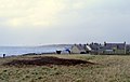
 The Estuary at Spey Bay - geograph.org.uk - 733037.jpg 640 × 480; 84 KB
-
 The Famous Fochaberians Gardens - geograph.org.uk - 732815.jpg 640 × 480; 85 KB
-
 The Famous Fochaberians Gardens - geograph.org.uk - 732845.jpg 640 × 452; 77 KB
-
 The Famous Fochaberians Gardens - geograph.org.uk - 732858.jpg 640 × 423; 77 KB
-
 The Famous Fochaberians Gardens - geograph.org.uk - 732872.jpg 640 × 480; 149 KB
-
 The Harbour at Portgordon - geograph.org.uk - 736125.jpg 640 × 480; 57 KB
-
 The High Street at Fochabers - geograph.org.uk - 732962.jpg 640 × 480; 62 KB
-
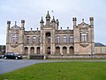
 The Museum at Fochabers - geograph.org.uk - 732762.jpg 480 × 640; 48 KB
-
 The Pig farm at Lower Auchenreath - geograph.org.uk - 736011.jpg 640 × 480; 64 KB
-
 The Pig farm at Lower Auchenreath - geograph.org.uk - 736025.jpg 640 × 528; 78 KB
-
 War Memorial at Portgordon - geograph.org.uk - 736162.jpg 640 × 506; 96 KB
-
 Windyridge - geograph.org.uk - 712325.jpg 640 × 427; 235 KB
-
 Altyre Burn - geograph.org.uk - 1000144.jpg 640 × 427; 98 KB


