Category:March 2007 in York
Jump to navigation
Jump to search
Deutsch: Bilder, die im März 2007 in York aufgenommen worden sind. Bitte beachten Sie, dass dies weder das Datum des Uploads noch das Datum des Scannens eines Fotos ist.
English: Images/pictures taken in York during March 2007. Note this is not the date of the upload, nor the date a photo was scanned.
Español: Fotografías o imágenes tomadas en York durante marzo 2007. No es la fecha de subida ni escaneo, sino la fecha en que las fotografías o imágenes se crearon.
Esperanto: Bildoj faritaj en York en marto 2007. Tio ne estas la dato, kiam la bildoj estis alŝutitaj aŭ skanitaj.
Français : Photographies ou images prises en York durant mars 2007. Ce n'est pas la date du téléchargement ou du scan.
Galego: Fotografías ou imaxes tomadas en York durante marzo 2007. Non é a data de subida nin escaneamento, senón a data na que se crearon as fotografías ou imaxes.
Italiano: Fotografie o immagini scattate a York nel marzo 2007. Nota bene: la data non si riferisce né a quella di upload né a quella in cui la foto è stata digitalizzata.
Norsk bokmål: Bilder tatt i York i løpet av mars 2007. Merk at dette ikke er datoen for opplasting, eller når et bilde har blitt skannet.
Norsk nynorsk: Bilete teke i York i løpet av mars 2007. Merk at dette ikkje er datoen for opplasting, eller når eit bilete har vorte skanna.
Русский: Изображения, сделанные в York в течение март 2007 (не дата загрузки изображения).
Українська: Зображення, зроблені в York протягом березень 2007. Зауважте, що це не дата завантаження чи дата сканування фотографії.
| March 2006 | ← | March 2007 | → | March 2008 | |||||||
| Jan | Feb | Mar | Apr | May | Jun | Jul | Aug | Sep | Oct | Nov | Dec |
| 30 | 64 | 59 | 102 | 53 | 60 | 49 | 88 | 107 | 25 | 39 | 16 |
|---|---|---|---|---|---|---|---|---|---|---|---|
Media in category "March 2007 in York"
The following 59 files are in this category, out of 59 total.
-
 Barn at Cheesecake Farm, Wheldrake - geograph.org.uk - 374554.jpg 640 × 480; 72 KB
-
 Bend in Agricultural Access Lane - geograph.org.uk - 380255.jpg 640 × 480; 81 KB
-

-
 Blue Beck Outfall - geograph.org.uk - 431738.jpg 640 × 480; 156 KB
-
 Boundary - geograph.org.uk - 380438.jpg 640 × 479; 64 KB
-
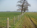
 Bridleway east to Escrick - geograph.org.uk - 375842.jpg 640 × 480; 101 KB
-
 Bridleway West To Moreby Wood - geograph.org.uk - 375847.jpg 640 × 480; 94 KB
-
 Broughton Way - geograph.org.uk - 387854.jpg 640 × 479; 93 KB
-
 Cliffords Tower.JPG 1,290 × 968; 307 KB
-
 Cliffords Tower11.JPG 2,816 × 2,112; 2.04 MB
-
 Cliffords Tower12.JPG 2,816 × 2,112; 2.01 MB
-
 Department of Chemistry - geograph.org.uk - 372693.jpg 640 × 479; 97 KB
-
 Driveway to Forest Hill Farm - geograph.org.uk - 380449.jpg 640 × 479; 60 KB
-

-
 Elvington Wood - geograph.org.uk - 374570.jpg 640 × 480; 69 KB
-

-

-
 Farm buildings near Wheldrake - geograph.org.uk - 371432.jpg 640 × 480; 84 KB
-

-
 Forest Hill Farm - geograph.org.uk - 380445.jpg 640 × 479; 38 KB
-

-
 Gilbertson House - geograph.org.uk - 371715.jpg 640 × 480; 137 KB
-
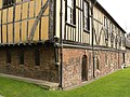
 Half timbered house in Wheldrake - geograph.org.uk - 353811.jpg 640 × 480; 96 KB
-
 Inquisitive sheep - geograph.org.uk - 380455.jpg 640 × 479; 55 KB
-

-
 Leonard Scales Lane near Wheldrake - geograph.org.uk - 371431.jpg 640 × 480; 105 KB
-
 Merchant Adventurers Hall1.JPG 2,816 × 2,112; 1.85 MB
-

-
 New Field Boundary near "The Parks" - geograph.org.uk - 380268.jpg 640 × 480; 103 KB
-

-

-
 Quad West entrance, York St John University (12 March 2007).jpg 2,448 × 3,264; 2.77 MB
-
 Rosecroft Farm buildings and yard - geograph.org.uk - 364540.jpg 640 × 480; 141 KB
-

-
 Stockton on the Forest - geograph.org.uk - 380368.jpg 640 × 479; 42 KB
-
 Stockton on the Forest - geograph.org.uk - 380380.jpg 640 × 479; 40 KB
-

-
 Terry's of York cropped.jpg 1,122 × 539; 306 KB
-
 Terry's of York.jpg 1,255 × 837; 529 KB
-
 The 'Alice Hawthorne' Wheldrake - geograph.org.uk - 353788.jpg 640 × 480; 69 KB
-
 The Old Post Office Wheldrake - geograph.org.uk - 353796.jpg 640 × 480; 97 KB
-
 The York - Selby Railway Path - geograph.org.uk - 375828.jpg 640 × 480; 92 KB
-

-
 View Down Raisdale - geograph.org.uk - 377659.jpg 640 × 426; 82 KB
-
 View from Cliffords Tower.JPG 2,816 × 2,112; 2.06 MB
-

-
 Wheldrake Grange - geograph.org.uk - 371717.jpg 640 × 480; 83 KB
-
 Wheldrake Primary School - geograph.org.uk - 353827.jpg 640 × 480; 107 KB
-

-
 YCP York Caravan Park - geograph.org.uk - 386328.jpg 640 × 480; 128 KB
-
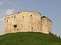
 York Castle 01.jpg 1,280 × 960; 749 KB
-
 York Castle 02.jpg 1,280 × 960; 643 KB
-
 York Minster - geograph.org.uk - 369187.jpg 640 × 480; 99 KB
-
 York Minster at night.jpg 2,048 × 1,536; 922 KB
-
 York railway station - geograph.org.uk - 386648.jpg 640 × 480; 89 KB
-
 York station platforms - geograph.org.uk - 386643.jpg 640 × 480; 112 KB
-
 York-view-from-YorkMinster2.JPG 2,816 × 2,112; 1.83 MB
-
 York-view-from-YorkMinster3.JPG 2,112 × 2,816; 1.89 MB
-
 York-view-from-YorkMinster4.JPG 2,112 × 2,816; 1.9 MB


_leading_to_Mount_Pleasant_Farm,_Wheldrake_-_geograph.org.uk_-_374528.jpg)


.jpg)


