Category:March 2007 in County Down
Jump to navigation
Jump to search
English: Images taken in County Down, Northern Ireland in this month of 2007 (not the date of the upload).
| Jan | Feb | Mar | Apr | May | Jun | Jul | Aug | Sep | Oct | Nov | Dec | ||
| ← | 32 | 14 | 70 | 47 | 139 | 43 | 36 | 57 | 72 | 42 | 38 | 30 | → |
|---|
Media in category "March 2007 in County Down"
The following 70 files are in this category, out of 70 total.
-
 A Caravan in a field - geograph.org.uk - 352287.jpg 640 × 426; 147 KB
-
 A filled-in railway bridge - geograph.org.uk - 352323.jpg 640 × 426; 138 KB
-
 A Filled-in railway cutting - geograph.org.uk - 352317.jpg 640 × 426; 139 KB
-
 A New House under construction - geograph.org.uk - 352294.jpg 640 × 426; 122 KB
-
 A New House^ - geograph.org.uk - 352249.jpg 640 × 418; 114 KB
-
 A Railway Bridge - geograph.org.uk - 352300.jpg 640 × 426; 137 KB
-
 A Rural Scene - geograph.org.uk - 353121.jpg 640 × 426; 138 KB
-
 Ballymullan Road - geograph.org.uk - 367237.jpg 640 × 480; 100 KB
-
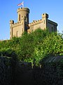
 Castle Park, Bangor (3) - geograph.org.uk - 364171.jpg 640 × 426; 183 KB
-
 Coney Island near Killough (1) - geograph.org.uk - 355705.jpg 640 × 426; 129 KB
-
 Coney Island near Killough (2) - geograph.org.uk - 355713.jpg 640 × 426; 140 KB
-
 Coney Island near Killough (3) - geograph.org.uk - 355724.jpg 640 × 426; 144 KB
-

-
 Ddeeharbourtown.jpg 2,048 × 1,536; 424 KB
-
 Ddeeparishchurch.jpg 1,536 × 2,048; 280 KB
-
 Ddeetown.jpg 1,024 × 768; 478 KB
-
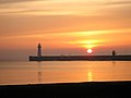 Deesouthpiersunset.jpg 1,280 × 960; 78 KB
-
 Departure from Moira - geograph.org.uk - 360135.jpg 640 × 426; 120 KB
-

-

-
 Disused Railway Trackbed - geograph.org.uk - 352307.jpg 640 × 426; 133 KB
-
 Donaghadeemoat.jpg 1,536 × 2,048; 533 KB
-
 Dow's Road joins Mealough Road. - geograph.org.uk - 373601.jpg 640 × 480; 98 KB
-
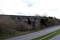 Dromore Viaduct - geograph.org.uk - 352401.jpg 640 × 426; 98 KB
-
 Drystone wall near Ballymartin - geograph.org.uk - 372903.jpg 640 × 426; 147 KB
-
 Dundrum Castle 03.jpg 1,280 × 960; 229 KB
-
 Dundrum Castle 04.jpg 1,280 × 960; 147 KB
-
 Dundrum Castle 05.jpg 2,272 × 1,704; 923 KB
-
 Farmhouse - geograph.org.uk - 352958.jpg 640 × 426; 119 KB
-
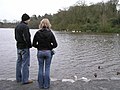
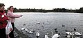 Feeding the birds. - geograph.org.uk - 354561.jpg 640 × 301; 33 KB
-
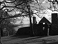
 Flatfield House, Ballyknock. - geograph.org.uk - 354592.jpg 640 × 479; 50 KB
-
 Former Andrews Mill, Comber - geograph.org.uk - 355652.jpg 640 × 426; 133 KB
-
 Grey Abbey - Ards.jpg 1,068 × 1,600; 328 KB
-
 Groomsport parish church - geograph.org.uk - 380147.jpg 640 × 426; 100 KB
-
 Hillsborough - geograph.org.uk - 354549.jpg 640 × 479; 82 KB
-
 Hillsborough - geograph.org.uk - 354565.jpg 640 × 479; 59 KB
-
 Hillsborough Castle.jpg 640 × 479; 66 KB
-
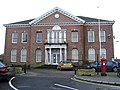 Hillsborough Council Offices - geograph.org.uk - 354590.jpg 640 × 479; 66 KB
-
 Hillsborough Fort - geograph.org.uk - 354502.jpg 640 × 335; 42 KB
-
 Hillsborough Lake - geograph.org.uk - 354501.jpg 640 × 479; 54 KB
-
 Hillsborough Lake - geograph.org.uk - 354551.jpg 640 × 479; 80 KB
-
 Hillsborough Lake - geograph.org.uk - 354558.jpg 640 × 278; 40 KB
-
 Hillsborough, County Down - geograph.org.uk - 354584.jpg 640 × 191; 18 KB
-
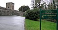
 Kiltonga nature reserve, Newtownards (3) - geograph.org.uk - 358053.jpg 640 × 426; 106 KB
-
 Kiltonga nature reserve, Newtownards (4) - geograph.org.uk - 358058.jpg 640 × 426; 113 KB
-
 Magherally parish church near Banbridge - geograph.org.uk - 372773.jpg 640 × 426; 153 KB
-
 Mill Dam - geograph.org.uk - 1096167.jpg 640 × 426; 43 KB
-
 Mill Road West joins Ballycoan Road. - geograph.org.uk - 373617.jpg 640 × 480; 107 KB
-
 Moira railway station in 2007.jpg 640 × 426; 139 KB
-

-

-

-
 Old railway at Coney Island near Killough - geograph.org.uk - 355734.jpg 640 × 426; 129 KB
-
 Plaque, Hillsborough - geograph.org.uk - 350581.jpg 640 × 426; 136 KB
-
 Plaque, Saintfield - geograph.org.uk - 355683.jpg 640 × 426; 156 KB
-
 Railway Arch - geograph.org.uk - 352231.jpg 640 × 419; 138 KB
-
 Railway Bridge - geograph.org.uk - 352282.jpg 640 × 426; 138 KB
-
 Railway Bridge - geograph.org.uk - 352389.jpg 640 × 426; 144 KB
-
 Railway Bridge - geograph.org.uk - 352391.jpg 640 × 426; 143 KB
-
 Railway Bridge remains - geograph.org.uk - 352259.jpg 640 × 426; 136 KB
-
 Railway Bridge remains - geograph.org.uk - 352271.jpg 640 × 426; 115 KB
-
 Railway Bridge remains - geograph.org.uk - 352274.jpg 640 × 426; 125 KB
-
 Railway Cutting - geograph.org.uk - 352383.jpg 426 × 640; 131 KB
-
 Railway Embankment - geograph.org.uk - 353249.jpg 640 × 426; 95 KB
-
 RNLI Mobile Training Unit at Donaghadee - geograph.org.uk - 378823.jpg 640 × 426; 115 KB
-
 SAR helicopter at Bangor - geograph.org.uk - 374873.jpg 640 × 426; 111 KB
-
 Sign near Holywood - geograph.org.uk - 354505.jpg 640 × 426; 165 KB
-

-
 The North Down coastal path at Grey Point - geograph.org.uk - 354446.jpg 640 × 426; 135 KB
-
 The Parade, Donaghadee - geograph.org.uk - 370696.jpg 640 × 426; 77 KB


_-_geograph.org.uk_-_364171.jpg)
_-_geograph.org.uk_-_355705.jpg)
_-_geograph.org.uk_-_355713.jpg)
_-_geograph.org.uk_-_355724.jpg)


_-_geograph.org.uk_-_377929.jpg)
_-_geograph.org.uk_-_377939.jpg)


_-_geograph.org.uk_-_358053.jpg)
_-_geograph.org.uk_-_358058.jpg)


_and_Ballynagarrick_Road_join_Mealough_Road_-_geograph.org.uk_-_373608.jpg)
_joins_Ballycoan_Road._-_geograph.org.uk_-_373614.jpg)


