Category:Maps with a scale of 1:25,000
Appearance
Subcategories
This category has the following 5 subcategories, out of 5 total.
Media in category "Maps with a scale of 1:25,000"
The following 124 files are in this category, out of 124 total.
-
Alland in 1-25.000, Stand 1901 in 600 dpi.jpg 18,950 × 14,412; 88.64 MB
-
Alland in 1-25.000, Stand 1901 kleine Datei.jpg 8,465 × 6,398; 20.18 MB
-
Amersfoort - NARA - 100306879.jpg 14,528 × 12,060; 44.21 MB
-
Arbeitsblatt 5254 1.jpg 9,537 × 7,186; 54.67 MB
-
Arbeitsblatt 5254 2.jpg 9,824 × 7,332; 45.95 MB
-
Arbeitsblatt 5254 3.jpg 9,528 × 7,204; 46.89 MB
-
Arbeitsblatt 5254 4.jpg 12,876 × 9,717; 56.33 MB
-
Aschendorf - NARA - 100306943.jpg 11,712 × 14,663; 21.4 MB
-
Aufnahmeblatt 4856-1 Gutenstein Myrafälle Grenze zur Doppelmaßaufnahme.jpg 10,311 × 7,427; 37.18 MB
-
Baden in 1-25.000, Stand 1901 in 600 dpi.jpg 19,332 × 14,545; 94.98 MB
-
Baden in 1-25.000, Stand 1901 kleine Datei.jpg 9,519 × 7,286; 18.91 MB
-
BaniSwifMap.jpg 2,319 × 1,782; 2.99 MB
-
Beuthenberg GK25, No. 96b - saxony.jpg 3,180 × 2,290; 2.34 MB
-
Borkum - NARA - 100306935.jpg 13,152 × 18,030; 10.54 MB
-
Bornstedt 1910.jpg 499 × 401; 66 KB
-
Brakzand - NARA - 100306931.jpg 13,344 × 18,015; 12.11 MB
-
Buren - NARA - 100306891.jpg 16,768 × 13,173; 10.31 MB
-
Corpo Truppe Volontarie 19.jpg 4,820 × 3,701; 8.09 MB
-
De Cocksdorp - NARA - 100306887.jpg 16,736 × 13,152; 11.36 MB
-
Delfzijl - NARA - 100306947.jpg 11,680 × 14,709; 15.87 MB
-
Delfzijl - NARA - 100306949.jpg 11,776 × 14,796; 41.83 MB
-
Delfzijl - NARA - 100306951.jpg 11,744 × 14,794; 26.48 MB
-
Den Hoorn - NARA - 100306883.jpg 17,984 × 13,197; 13.48 MB
-
Df dk 0004657.jpg 1,600 × 1,601; 1.42 MB
-
Doorn - NARA - 100306873.jpg 14,784 × 11,833; 42.37 MB
-
Dorpen - NARA - 100306941.jpg 11,648 × 14,614; 20.32 MB
-
Ede - NARA - 100306871.jpg 14,784 × 11,888; 23.02 MB
-
Emmerich - NARA - 100306899.jpg 11,744 × 14,779; 34.56 MB
-
Emmerich - NARA - 100306901.jpg 11,776 × 14,782; 30.74 MB
-
Emmerich - NARA - 100306903.jpg 11,776 × 14,830; 17.86 MB
-
Emmerich - NARA - 100306905.jpg 11,712 × 14,761; 36.57 MB
-
Emmerich - NARA - 100306907.jpg 11,744 × 14,834; 34.29 MB
-
Emmerich - NARA - 100306909.jpg 11,776 × 14,801; 23.54 MB
-
Emmerich - NARA - 100306911.jpg 14,752 × 11,780; 13.42 MB
-
Emmerich - NARA - 100306919.jpg 11,712 × 14,761; 36.22 MB
-
Emmerich - NARA - 100306921.jpg 11,744 × 14,752; 18.91 MB
-
Enschede - NARA - 100306937.jpg 11,776 × 14,808; 14.19 MB
-
FayoumMap.jpg 2,239 × 1,949; 3.24 MB
-
Garderen (West) - NARA - 100306881.jpg 14,815 × 11,776; 26.5 MB
-
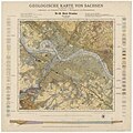
Geologische Spezialkarte des Königreichs Sachsen, Braunkohlenformation Nordwestsachsens.jpg 1,600 × 1,569; 1.41 MB
-
Geologische Spezialkarte des Königreichs Sachsen, Sektion Altenberg-Zinnwald.jpg 1,600 × 1,626; 1.44 MB
-
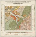
Geologische Spezialkarte des Königreichs Sachsen, Sektion Augustusburg-Flöha.jpg 1,600 × 1,622; 1.3 MB
-
Geologische Spezialkarte des Königreichs Sachsen, Sektion Chemnitz.jpg 1,600 × 1,651; 1.35 MB
-
Geologische Spezialkarte des Königreichs Sachsen, Sektion Frankenberg-Hainichen.jpg 1,600 × 1,620; 1.29 MB
-
Geologische Spezialkarte des Königreichs Sachsen, Sektion Hohenstein-Limbach.jpg 1,600 × 1,629; 1.24 MB
-
Geologische Spezialkarte des Königreichs Sachsen, Sektion Meerane-Crimmitschau.jpg 1,600 × 1,616; 1.29 MB
-
Geologische Spezialkarte des Königreichs Sachsen, Sektion Mittweida-Taura.jpg 1,600 × 1,613; 1.26 MB
-
Geologische Spezialkarte des Königreichs Sachsen, Sektion Nassau.jpg 1,600 × 1,626; 1.25 MB
-
Geologische Spezialkarte des Königreichs Sachsen, Sektion Olbernhau-Purschenstein.jpg 1,600 × 1,627; 1.46 MB
-
Geologische Spezialkarte des Königreichs Sachsen, Sektion Oschatz-Mügeln.jpg 1,600 × 1,625; 1.23 MB
-
Haarlem en Zandvoort 1905.jpg 3,487 × 2,421; 8.68 MB
-
Harskamp (East) - NARA - 100306877.jpg 14,818 × 11,840; 18.78 MB
-
Harskamp (West) - NARA - 100306875.jpg 14,784 × 11,791; 16.95 MB
-
Hollum - NARA - 100306893.jpg 18,016 × 13,303; 12.42 MB
-
Isselburg - NARA - 100306923.jpg 11,840 × 14,836; 16.82 MB
-
Isselburg - NARA - 100306925.jpg 11,840 × 14,794; 33.67 MB
-
Isselburg - NARA - 100306927.jpg 11,776 × 14,794; 31.14 MB
-
Isselburg - NARA - 100306929.jpg 11,744 × 14,716; 36.65 MB
-
Kart i 1-25000 over terrænet om Kleivevand, Høyfjellkommisjonen, 1909.jpg 5,108 × 5,229; 2.53 MB
-
Kart i 1-25000 over terrænet om Opset, Høyfjellkommisjonen, 1909.jpg 5,052 × 5,832; 3.07 MB
-
Kremmen.png 4,036 × 3,050; 14.1 MB
-
Lageplan von Pola, Meyers Lexikon. tom. 13, 1896.jpg 5,029 × 3,829; 3.45 MB
-
Le Ve. Corps d’armée, bataille de Frœschwiller.jpg 2,738 × 2,512; 1.54 MB
-
Loquard - NARA - 100306945.jpg 11,776 × 14,825; 25.85 MB
-
Mansuora-Talka-Map.jpg 1,799 × 1,184; 1.89 MB
-
Map of Bonn - NARA - 100384386 (page 2).jpg 8,680 × 6,618; 6.86 MB
-
Map of Gauray - NARA - 100384779.jpg 7,252 × 5,811; 5.43 MB
-
Map of German Defenses at Wallendorf - NARA - 100384389 (page 1).jpg 8,352 × 6,483; 5.59 MB
-
Map of Koblenz (West) - NARA - 100384398 (page 2).jpg 8,684 × 6,645; 7.07 MB
-
Map of Koblenz (West) - NARA - 100384398 (page 4).jpg 8,680 × 6,675; 7.05 MB
-
Map of Köln (East) - NARA - 100384403 (page 2).jpg 8,700 × 6,563; 6.69 MB
-
Map of pre World War II Germany TK25 Cloppenburg 3114.jpg 10,328 × 7,963; 22.34 MB
-
Map of pre World War II Germany TK25 Hemelingen 2919.jpg 9,688 × 7,784; 20.5 MB
-
Map of St.-Sauveur-Lendelin - NARA - 100384783.jpg 7,336 × 5,855; 5.08 MB
-
MCMWTC RTA MAP 25K 11MAY10 MIMS Background (1) (1).pdf 5,400 × 7,200; 4 MB
-
Peiping Map 1954.jpg 3,468 × 4,291; 14.32 MB
-
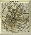
Plan von Dresden 1893 Ed. Gaebler.jpg 3,555 × 4,027; 2.82 MB
-
Potsdam in 1910.jpg 2,300 × 1,212; 1.04 MB
-
Rappenau-topo1902.jpg 1,523 × 1,083; 927 KB
-
Road and Bridge Data - Altenkirchen - NARA - 100385125.jpg 8,704 × 6,644; 5.58 MB
-
Road and Bridge Data - Bergheim - NARA - 100385103.jpg 8,712 × 6,605; 5.31 MB
-
Road and Bridge Data - Bitterfield (East) - NARA - 100385091.jpg 8,696 × 6,666; 5.62 MB
-
Road and Bridge Data - Bitterfield (West) - NARA - 100385133.jpg 8,688 × 6,646; 4.85 MB
-
Road and Bridge Data - Brevenbroich - NARA - 100385097.jpg 8,716 × 6,635; 4.44 MB
-
Road and Bridge Data - Freudenburg - NARA - 100385115.jpg 8,660 × 6,572; 4.69 MB
-
Road and Bridge Data - Gummersbach - NARA - 100385101.jpg 8,696 × 6,583; 5.05 MB
-
Road and Bridge Data - Hachenburg - NARA - 100385127.jpg 8,696 × 6,604; 5.13 MB
-
Road and Bridge Data - Leverkusen - NARA - 100385099.jpg 8,684 × 6,647; 4.65 MB
-
Road and Bridge Data - Morsbach - NARA - 100385113.jpg 8,708 × 6,666; 4.96 MB
-
Road and Bridge Data - Neuss - NARA - 100385093.jpg 8,696 × 6,651; 3.88 MB
-
Road and Bridge Data - Raguhn - NARA - 100385131.jpg 8,716 × 6,426; 4.66 MB
-
Road and Bridge Data - Selters - NARA - 100385129.jpg 8,720 × 6,592; 5.96 MB
-
Road and Bridge Data - Siegen - NARA - 100385117.jpg 8,724 × 6,614; 4.67 MB
-
Road and Bridge Data - Waldbröl - NARA - 100385111.jpg 8,716 × 6,603; 5.82 MB
-
Road and Bridge Data - Wenden - NARA - 100385107.jpg 8,700 × 6,588; 5.21 MB
-
Road and Bridge Data - Weyerbusch - NARA - 100385119.jpg 8,704 × 6,634; 5.64 MB
-
Road and Bridge Data - Wipperfurth - NARA - 100385095.jpg 8,644 × 6,618; 4.6 MB
-
Road and Bridge Data - Wissen - NARA - 100385121.jpg 8,700 × 6,629; 6.01 MB
-
Roma Plan.jpg 1,840 × 1,463; 2.5 MB
-
Route Intelligence Overlay Sheet L - Elbe Trave Canal - NARA - 100384415 (page 1).jpg 7,324 × 5,817; 3.16 MB
-
Route Intelligence Overlay Sheet L - Elbe Trave Canal - NARA - 100384415 (page 2).jpg 7,328 × 5,792; 3.1 MB
-
Rüthnicker Heide.png 4,024 × 3,064; 21.32 MB
-
Serpin.jpg 642 × 338; 228 KB
-
SooChow Map 1954.jpg 1,827 × 1,935; 3.53 MB
-
Swisstopo 6.jpg 800 × 800; 586 KB
-
TK 25000 1954 Emden 2609 - Ausschnitt Stadtgebiet.jpg 3,420 × 4,653; 14.66 MB
-
TK 25000 1954 Emden 2609.jpg 9,480 × 7,622; 11.45 MB
-
TK 25000 1955 Baltrum 2210 (Ausschnitt).jpg 4,062 × 2,533; 2.7 MB
-
TK 25000 1955 Baltrum 2210.jpg 9,400 × 7,727; 7.61 MB
-
TK 25000 1955 Burlage 2911.jpg 9,312 × 7,536; 12.96 MB
-
TK25 Germany 1952 Schlepzig 3949 Third Edition-AMS.jpg 11,536 × 8,738; 14.86 MB
-
TK25 Sachsen Äquidistantenkarte 66 Dresden 1904.jpg 7,680 × 7,680; 13.79 MB
-
Txu-oclc-6949452-nh36-9a.jpg 5,000 × 2,157; 2.01 MB
-
USSR map NJ 42-1 -verso- Samarkand and Vicinity.jpg 3,000 × 1,985; 673 KB
-
USSR map NN 48-11 -verso- Irkutsk and Vicinity.jpg 4,502 × 5,000; 3.09 MB
-
Victoria and Kowloon Map 1954.jpg 5,000 × 4,171; 11.74 MB
-
Wartha neu.jpg 1,627 × 922; 1.03 MB
-
Wien Süd in 1-25.000, Stand 1901 in 600 dpi.jpg 19,014 × 14,413; 82.49 MB
-
Wien Süd in 1-25.000, Stand 1901 kleine Datei.jpg 5,533 × 4,181; 8.25 MB
-
Wiener Pforte in 1-25.000, Stand 1901 in 600 dpi.jpg 19,140 × 15,067; 90.57 MB
-
Wiener Pforte in 1-25.000, Stand 1901 kleine Datei dpi.jpg 7,481 × 5,935; 12.5 MB


