Category:Maps with Lambert conformal conic projection
Jump to navigation
Jump to search
Maps with Lambert conformal conic projection:
Polar cone:
- Longitudes: strait
- Latitudes: portions of circles
- Global outer curve: circular sektor
English: This map-projection-related category exists in the following hierarchy:
- Category:Map projections
- Category:Maps by projection
- Category:Lambert conformal conic projection – media related to the Lambert conformal conic projection other than maps
- Category:Maps with Lambert conformal conic projection (“Category:Lambert conformal conic projections”) – maps made using the Lambert conformal conic projection
Subcategories
This category has only the following subcategory.
E
Media in category "Maps with Lambert conformal conic projection"
The following 200 files are in this category, out of 204 total.
(previous page) (next page)-
 1935 base rev2.png 2,078 × 1,561; 481 KB
-
 7.5 minute series orthophotomap (topographic).jpg 3,783 × 4,500; 3.38 MB
-
 Albania NATO Locator Lambert.svg 600 × 372; 144 KB
-
 Aphanius transgrediens distribution map.svg 1,828 × 1,577; 2.22 MB
-
 Armenia NATO Locator Lambert.svg 600 × 372; 144 KB
-
 Austria NATO Locator Lambert.svg 600 × 372; 160 KB
-
 Azerbaijan NATO Locator Lambert.svg 600 × 372; 160 KB
-
 Belarus NATO Locator Lambert.svg 600 × 372; 160 KB
-
 Blasons et régions de France.jpg 632 × 600; 259 KB
-
 Bosnia NATO Locator Lambert.svg 600 × 372; 160 KB
-
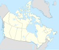 Canada location map 2 - lite.svg 1,114 × 942; 279 KB
-
 Canada location map 2.svg 1,114 × 942; 365 KB
-
 Canada NATO Locator Lambert.svg 600 × 372; 160 KB
-
 Canada Northwest Territories location map-lambert proj.svg 512 × 675; 1.03 MB
-
 Canada Northwest Territories location map-lambert proj2.svg 512 × 675; 1.03 MB
-
 Canada Nunavut location map-lambert proj.svg 512 × 638; 2.05 MB
-
 Canada Nunavut location map-lambert proj2.svg 512 × 638; 2.05 MB
-
 Canada Nunavut location map-lambert proj3.svg 512 × 638; 1,021 KB
-
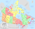 Canada political map - en.svg 1,114 × 942; 423 KB
-
 Canada political map - fr.svg 1,114 × 942; 424 KB
-
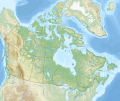 Canada relief map 2.svg 1,114 × 942; 1.47 MB
-
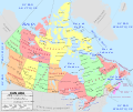
 Canada time zone map - fr.svg 1,114 × 942; 383 KB
-
 Canada time zone map.svg 1,114 × 942; 379 KB
-
 Carte Galette saucisse.png 3,067 × 2,600; 825 KB
-
 Centre of Europe.jpg 4,040 × 3,592; 1.14 MB
-
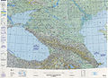
 Chart C-13.jpg 8,493 × 5,422; 20.9 MB
-
 Conformal Conic with Tissot's Indicatrices of Distortion.svg 1,600 × 815; 599 KB
-
 Croatia NATO Locator Lambert.svg 600 × 372; 160 KB
-
 Cyprus NATO Locator Lambert.svg 600 × 372; 160 KB
-
 Czechia NATO Locator Lambert.svg 600 × 372; 160 KB
-

-
 Europa EUR LAmbert conform kegel 10e meridiaan.PNG 447 × 459; 14 KB
-
 Europa EUR Lambert conform kegel 15emeridiaan.PNG 432 × 446; 14 KB
-
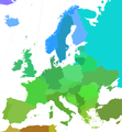 Europe-latcolors.png 1,897 × 2,048; 313 KB
-
Evolution of United States standard time zone boundaries.webm 29 s, 3,507 × 2,480; 4.58 MB
-
 Finland NATO Locator Lambert.svg 600 × 372; 160 KB
-
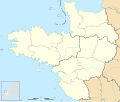 France - Grand Ouest - map-blank.svg 736 × 624; 452 KB
-
 France 1814 map-blank.svg 2,000 × 1,898; 303 KB
-
 France 5fleuves.svg 2,000 × 1,898; 869 KB
-
 France drainage basins mk.svg 2,000 × 1,898; 802 KB
-
 France drainage basins-es.svg 2,133 × 2,025; 893 KB
-
 France drainage basins.svg 2,000 × 1,898; 728 KB
-
 France map Lambert 93 with regions-hu.svg 2,000 × 1,898; 897 KB
-
 France map Lambert-93 topographic with regions and departements-blank.svg 2,000 × 1,898; 1.67 MB
-
 France map Lambert-93 topographic with regions-blank.svg 2,000 × 1,898; 1.61 MB
-
 France map Lambert-93 topographic-ancient Roman roads.svg 1,766 × 1,645; 1.6 MB
-
 France map Lambert-93 topographic-blank.svg 2,000 × 1,898; 1.56 MB
-
 France map Lambert-93 topographic-demarcation line.svg 2,000 × 1,898; 1.57 MB
-
 France map Lambert-93 with regions and departments polygons-blank.svg 2,000 × 1,898; 1.57 MB
-
 France map Lambert-93 with regions and departments-blank.svg 2,000 × 1,898; 808 KB
-
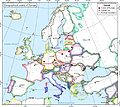
 France map Lambert-93 with regions and departments-occupation Belgium.png 1,996 × 1,894; 975 KB
-
 France map Lambert-93 with regions and departments-occupation He.svg 1,996 × 1,894; 921 KB
-
 France map Lambert-93 with regions and departments-occupation-de.svg 2,000 × 1,898; 902 KB
-
 France map Lambert-93 with regions and departments-occupation-el.svg 1,996 × 1,894; 718 KB
-
 France map Lambert-93 with regions and departments-occupation-eo.svg 2,000 × 1,898; 900 KB
-
 France map Lambert-93 with regions and departments-occupation-es.svg 2,000 × 1,898; 897 KB
-
 France map Lambert-93 with regions and departments-occupation-fr.svg 2,000 × 1,898; 902 KB
-
 France map Lambert-93 with regions and departments-occupation-hr.svg 1,996 × 1,894; 697 KB
-
 France map Lambert-93 with regions and departments-occupation-it.svg 2,000 × 1,898; 881 KB
-
 France map Lambert-93 with regions and departments-occupation-nl.svg 1,996 × 1,894; 693 KB
-
 France map Lambert-93 with regions and departments-occupation-no.svg 1,996 × 1,894; 708 KB
-
 France map Lambert-93 with regions and departments-occupation-pt.svg 1,996 × 1,894; 708 KB
-
 France map Lambert-93 with regions and departments-occupation-ru.svg 2,000 × 1,898; 1.54 MB
-
 France map Lambert-93 with regions and departments-occupation-sr.svg 1,996 × 1,894; 694 KB
-
 France map Lambert-93 with regions and departments-occupation.svg 1,996 × 1,894; 745 KB
-
 France map Lambert-93 with regions-blank.svg 2,000 × 1,898; 713 KB
-
 France map Lambert-93 with rivers and regions-blank.svg 2,000 × 1,898; 929 KB
-
 France map Lambert-93 with rivers-blank.svg 2,000 × 1,898; 875 KB
-
 France map Lambert-93-blank.svg 2,000 × 1,898; 642 KB
-
 France map Lambert-93-Maximum altitude.svg 2,000 × 1,898; 964 KB
-
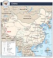 G219 China.jpg 2,008 × 2,212; 1.09 MB
-
 Gains territoriaux de la France en 1814.svg 2,000 × 1,898; 314 KB
-
 Geologic Map of Nevada 1978.jpg 13,800 × 20,100; 29.7 MB
-
 Georgia NATO Locator Lambert.svg 600 × 372; 144 KB
-
 Germania Land - crop of Operational Navigation Chart B-9, 1st edition.jpg 1,734 × 1,695; 1,000 KB
-
 Haras nationaux en France.svg 2,000 × 2,000; 2.79 MB
-
 Housingdensity.jpg 623 × 802; 216 KB
-
 Indre-et-Loire-ligne demarcation.png 340 × 293; 69 KB
-
 Ireland NATO Locator Lambert.svg 600 × 372; 145 KB
-
 Kosovo NATO Locator Lambert.svg 600 × 372; 144 KB
-
 Lambert conformal conic projection SW.jpg 2,058 × 1,291; 688 KB
-
 Lambert conformal conical projection 118.png 118 × 118; 12 KB
-
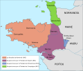
 Map Kingdom of Brittany 845-867-de.svg 736 × 624; 250 KB
-
 Map Kingdom of Brittany 845-867-es.svg 700 × 600; 179 KB
-
 Map Kingdom of Brittany 845-867-fr.svg 700 × 600; 39 KB
-
 Map Kingdom of Brittany 845-867-hu.svg 700 × 600; 41 KB
-
 Map Kingdom of Brittany 845-867-pt.svg 700 × 600; 41 KB
-
 Map of Bangladesh-de.svg 1,678 × 2,074; 3.72 MB
-
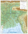
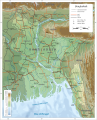 Map of Bangladesh-en.svg 1,678 × 2,074; 3.86 MB
-
 Map of Bangladesh-es.svg 1,678 × 2,074; 3.79 MB
-
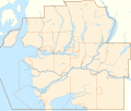
 Map of the Nunavut regions.png 1,700 × 2,120; 1.26 MB
-
 Moldova NATO Locator Lambert.svg 600 × 372; 144 KB
-
 Montenegro NATO Locator Lambert.svg 600 × 372; 160 KB
-
 Netherlands NATO Locator Lambert.svg 600 × 372; 160 KB
-
 North Macedonia NATO Locator Lambert.svg 600 × 372; 160 KB
-
 Norway NATO Locator Lambert.svg 600 × 372; 160 KB
-
 Nunavut adm location map.svg 560 × 720; 451 KB
-
 Nunavut topographic location map.svg 560 × 720; 1.62 MB
-
 Operational Navigation Chart B-1, 3rd edition.jpg 9,254 × 6,672; 10.24 MB
-
 Operational Navigation Chart B-2, 3rd edition.jpg 9,254 × 6,716; 13.42 MB
-
 Operational Navigation Chart B-3, 2nd edition.jpg 9,254 × 6,694; 16.37 MB
-
 Operational Navigation Chart B-4, 4th edition.jpg 9,254 × 6,667; 12.51 MB
-
 Operational Navigation Chart B-7, 5th edition.jpg 9,254 × 6,665; 17 MB
-
 Operational Navigation Chart B-8, 3rd edition.jpg 9,254 × 6,634; 14.14 MB
-
 Operational Navigation Chart B-9, 1st edition.jpg 9,254 × 6,650; 11 MB
-
 Operational Navigation Chart C-1, 1st edition.jpg 9,254 × 6,667; 10.96 MB
-
 Operational Navigation Chart C-10, 4th edition.jpg 9,254 × 6,677; 18.68 MB
-
 Operational Navigation Chart C-11, 2nd edition.jpg 9,254 × 6,640; 19.27 MB
-
 Operational Navigation Chart C-12, 4th edition.jpg 9,254 × 6,705; 17.03 MB
-
 Operational Navigation Chart C-13, 3rd edition.jpg 9,254 × 6,716; 15.77 MB
-
 Operational Navigation Chart C-2, 13th edition.jpg 9,040 × 6,591; 18.48 MB
-
 Operational Navigation Chart C-3, 6th edition.jpg 9,106 × 6,653; 15.26 MB
-
 Operational Navigation Chart C-4, 4th edition.jpg 9,049 × 6,621; 15.35 MB
-
 Operational Navigation Chart C-5, 2nd edition.jpg 9,087 × 6,580; 16.19 MB
-
 Operational Navigation Chart C-6, 3rd edition.jpg 9,069 × 6,618; 18.47 MB
-
 Operational Navigation Chart C-7, 5th edition.jpg 9,061 × 6,635; 17.92 MB
-
 Operational Navigation Chart C-8, 2nd edition.jpg 9,060 × 6,634; 14.37 MB
-
 Operational Navigation Chart C-9, 6th edition.jpg 9,053 × 6,596; 18.9 MB
-
 Operational Navigation chart D-10, 4th edition.jpg 9,254 × 6,676; 12.95 MB
-
 Operational Navigation Chart D-11, 5th edition.jpg 9,254 × 6,660; 20.53 MB
-
 Operational Navigation Chart D-12, 6th edition.jpg 9,254 × 6,698; 23 MB
-
 Operational Navigation Chart D-13, 4th edition.jpg 9,254 × 6,662; 16.54 MB
-
 Operational Navigation Chart D-14, 5th edition.jpg 9,254 × 6,680; 17.19 MB
-
 Operational Navigation Chart D-15, 4th edition.jpg 9,254 × 6,666; 16.56 MB
-
 Operational Navigation Chart D-2, 7th edition.jpg 9,254 × 6,633; 17.41 MB
-
 Operational Navigation Chart D-3, 7th edition.jpg 9,254 × 6,660; 21.89 MB
-
 Operational Navigation Chart D-4, 3rd edition.jpg 9,254 × 6,674; 22.75 MB
-
 Operational Navigation Chart D-5, 6th edition.jpg 9,254 × 6,649; 23.4 MB
-
 Operational Navigation Chart D-6, 6th edition.jpg 9,254 × 6,734; 26.86 MB
-
 Operational Navigation Chart D-7, 6th edition.jpg 9,254 × 6,670; 26.81 MB
-
 Operational Navigation Chart D-8, 4th edition.jpg 9,254 × 6,689; 19.35 MB
-
 Operational Navigation chart D-9, 5th edition (cropped).jpg 597 × 456; 149 KB
-
 Operational Navigation chart D-9, 5th edition.jpg 9,254 × 6,671; 15.84 MB
-
 Operational Navigation Chart E-10, 5th edition.jpg 9,254 × 6,658; 13.13 MB
-
 Operational Navigation Chart E-11, 4th edition.jpg 9,254 × 6,772; 8.08 MB
-
 Operational Navigation Chart E-12, 3rd edition.jpg 9,254 × 6,728; 7.61 MB
-
 Operational Navigation Chart E-13, 2nd edition.jpg 9,254 × 6,792; 6.99 MB
-
 Operational Navigation Chart E-15, 7th edition.jpg 9,254 × 6,789; 21.01 MB
-
 Operational Navigation Chart E-16, 11th edition.jpg 9,254 × 6,773; 17.9 MB
-
 Operational Navigation Chart E-17, 11th edition.jpg 9,254 × 6,777; 20.79 MB
-
 Operational Navigation Chart E-18, 7th edition.jpg 9,254 × 6,829; 16.14 MB
-
 Operational Navigation Chart E-19, 6th edition.jpg 9,254 × 6,721; 15.94 MB
-
 Operational Navigation Chart E-2, 15th edition.jpg 9,254 × 6,688; 20.2 MB
-
 Operational Navigation Chart E-3, 6th edition.jpg 9,254 × 6,671; 20.94 MB
-
 Operational Navigation Chart E-4, 2nd edition.jpg 9,254 × 6,729; 20.31 MB
-
 Operational Navigation Chart E-5, 4th edition.jpg 9,254 × 6,684; 16.86 MB
-
 Operational Navigation Chart E-6, 7th edition.jpg 9,254 × 6,742; 18.3 MB
-
 Operational Navigation Chart E-7, 5th edition.jpg 9,254 × 6,657; 22.26 MB
-
 Operational Navigation Chart E-8, 6th edition.jpg 8,066 × 5,841; 17.05 MB
-
 Operational Navigation Chart E-9, 4th edition (cropped to Sea of Ohotsk).jpg 4,000 × 3,000; 5.8 MB
-
 Operational Navigation Chart E-9, 4th edition.jpg 9,254 × 6,668; 21.7 MB
-
 Operational Navigation Chart F-1, 12th edition.jpg 9,254 × 6,727; 14.26 MB
-
 Operational Navigation Chart F-2, 13th edition.jpg 9,254 × 6,726; 20.82 MB
-
 Operational Navigation Chart F-4, 7th edition.jpg 9,254 × 6,681; 18.57 MB
-
 Operational Navigation Chart F-5, 6th edition.jpg 9,254 × 6,742; 19.02 MB
-
 Operational Navigation Chart F-6, 6th edition.jpg 9,254 × 6,706; 21.18 MB
-
 Operational Navigation Chart F-7, 4th edition.jpg 9,254 × 6,703; 17.31 MB
-
 Operational Navigation Chart G-6, 7th edition.jpg 9,254 × 6,700; 20.67 MB
-
 Operational Navigation Chart G-7, 6th edition.jpg 9,254 × 6,707; 20.89 MB
-
 Poland NATO Locator Lambert.svg 600 × 372; 160 KB
-
 Relief map of Canada.png 1,084 × 920; 1.82 MB
-
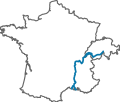 Rhone river course with France and Switzerland borders.svg 212 × 180; 117 KB
-
 Romania NATO Locator Lambert.svg 600 × 372; 160 KB
-
 Région métropolitaine de Montréal-blank.svg 1,667 × 1,511; 302 KB
-
 Région métropolitaine de Vancouver-blank.svg 2,008 × 1,702; 415 KB
-
 Río Espíritu Santo cerca de Río Grande, Puerto Rico.jpg 3,300 × 2,550; 3.01 MB
-
 Serbia NATO Locator Lambert.svg 600 × 372; 145 KB
-
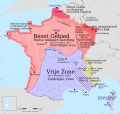
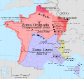
 Simplified map of occupied France 1940-1944 - grayscale-fr.svg 2,000 × 1,898; 869 KB
-
 Sweden LCC location map.jpg 981 × 2,161; 583 KB
-
 Sweden LCC relief location map.jpg 981 × 2,161; 754 KB
-
 Sweden NATO Locator Lambert.svg 600 × 372; 144 KB
-
 Switzerland NATO Locator Lambert.svg 600 × 372; 145 KB
-
 Turkey NATO Locator Lambert.svg 600 × 372; 144 KB
-
 Txu-pclmaps-oclc-22834566 a-2c.jpg 10,859 × 8,003; 26.8 MB
-
 Txu-pclmaps-oclc-22834566 a-2d.jpg 10,808 × 8,060; 14.06 MB
-
 Txu-pclmaps-oclc-22834566 b-1a.jpg 10,794 × 7,981; 16.68 MB
-
 Txu-pclmaps-oclc-22834566 b-1d.jpg 10,601 × 7,622; 10.94 MB
-
 Txu-pclmaps-oclc-22834566 b-2a.jpg 10,825 × 8,079; 26.02 MB
-
 Txu-pclmaps-oclc-22834566 b-2b.jpg 10,745 × 8,024; 14.82 MB
-
 Txu-pclmaps-oclc-22834566 b-2c.jpg 10,668 × 8,011; 17.65 MB
-
 Txu-pclmaps-oclc-22834566 b-2d.jpg 10,832 × 8,030; 26.91 MB
-
 Txu-pclmaps-oclc-22834566 b-3a.jpg 10,679 × 7,991; 17.94 MB
-
 Txu-pclmaps-oclc-22834566 b-3b.jpg 10,874 × 8,165; 16.75 MB
-
 Txu-pclmaps-oclc-22834566 b-3c.jpg 10,766 × 8,009; 21.7 MB
-
 Txu-pclmaps-oclc-22834566 b-3d.jpg 10,639 × 8,099; 20.97 MB
-
 Txu-pclmaps-oclc-22834566 b-4b.jpg 10,795 × 8,063; 15.06 MB
-
 Txu-pclmaps-oclc-22834566 b-4c.jpg 10,667 × 8,078; 18.17 MB
-
 Txu-pclmaps-oclc-22834566 b-4d.jpg 10,665 × 8,026; 20.84 MB
-
 Txu-pclmaps-oclc-22834566 b-8b.jpg 17,601 × 12,741; 38.3 MB
-
 Txu-pclmaps-oclc-22834566 c-13a.jpg 10,647 × 7,736; 11.86 MB
-
 Txu-pclmaps-oclc-22834566 c-13d.jpg 11,064 × 7,940; 13.84 MB
-
 Txu-pclmaps-oclc-22834566 c-1a.jpg 10,769 × 7,779; 14.38 MB
-
 Txu-pclmaps-oclc-22834566 c-1b.jpg 10,940 × 7,852; 10.69 MB
-
 Txu-pclmaps-oclc-22834566 c-1d.jpg 9,173 × 6,727; 14.52 MB
-
 Txu-pclmaps-oclc-22834566 c-2a.jpg 9,201 × 6,725; 13.3 MB
-
 Txu-pclmaps-oclc-22834566 c-2b.jpg 9,184 × 6,752; 17.08 MB
-
 Txu-pclmaps-oclc-22834566 c-2c.jpg 9,264 × 6,748; 22.52 MB
-
 Txu-pclmaps-oclc-22834566 c-3b.jpg 10,795 × 7,828; 18.46 MB
-
 Ukraine NATO Locator Lambert.svg 600 × 372; 144 KB
-
 Vallée de l'Ance map Lambert-93 topographic-blank.svg 327 × 584; 4.54 MB

.jpg)


.jpg)


.jpg)


