Category:Maps showing expeditions of the German East Africa Company
Jump to navigation
Jump to search
Media in category "Maps showing expeditions of the German East Africa Company"
The following 15 files are in this category, out of 15 total.
-

-
 Eastafrica blanc-map without borders gasi.jpg 600 × 840; 35 KB
-
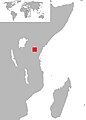
 Eastafrica blanc-map without borders khutu.jpg 600 × 840; 35 KB
-
 Eastafrica blanc-map without borders kilimantscharo.jpg 600 × 840; 35 KB
-
 Eastafrica blanc-map without borders komoren.jpg 600 × 840; 35 KB
-
 Eastafrica blanc-map without borders komoren2.jpg 600 × 840; 36 KB
-
 Eastafrica blanc-map without borders nyanza.jpg 600 × 840; 35 KB
-
 Eastafrica blanc-map without borders nyassa.jpg 600 × 840; 35 KB
-
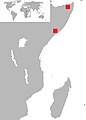 Eastafrica blanc-map without borders somali1.jpg 600 × 840; 36 KB
-
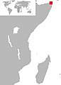 Eastafrica blanc-map without borders somali2.jpg 600 × 840; 35 KB
-
 Eastafrica blanc-map without borders somali3.jpg 600 × 840; 35 KB
-
 Eastafrica blanc-map without borders tana.jpg 600 × 840; 35 KB
-
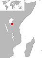
 Eastafrica blanc-map without borders usagara.jpg 600 × 840; 35 KB
-
 Eastafrica blanc-map without borders usaramo.jpg 600 × 840; 35 KB
-
 Karte von Central-Ost-Afrika (1886).png 7,928 × 7,991; 100.31 MB
.jpg)


.png)