Category:Maps showing 814
Jump to navigation
Jump to search
| 814 → |
English: Maps showing the year 814 (i.e. history maps)
See also category: 814 maps. and 810s maps for more maps showing this year usually created not long after the given year.
See also category: 814 maps. and 810s maps for more maps showing this year usually created not long after the given year.
Media in category "Maps showing 814"
The following 9 files are in this category, out of 9 total.
-
Péninsule ibérique en 814.png 2,000 × 1,500; 867 KB
-
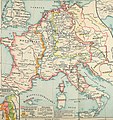
Europe 814.jpg 1,477 × 1,164; 302 KB
-
Bulgarian Empire 814.svg 500 × 380; 771 KB
-
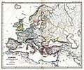
Europa zur Zeit Karls des Grossen (Spruner-Menke, map 3).jpg 3,292 × 2,750; 2.11 MB
-
Europe 814-it.svg 512 × 336; 910 KB
-
Europe 814.png 1,393 × 1,075; 169 KB
-
Europe 814.svg 1,399 × 919; 3.4 MB
-
Map of the Western Balkans around 814 AD.png 478 × 451; 231 KB
-
Putz25.jpg 2,651 × 2,806; 1.51 MB


