Category:Maps showing 1st-millennium BC history
Jump to navigation
Jump to search
English: Maps that can be properly attributed to one of the centuries within this millenia, should go there.
Subcategories
This category has the following 10 subcategories, out of 10 total.
M
Media in category "Maps showing 1st-millennium BC history"
The following 14 files are in this category, out of 14 total.
-
Agathyrsi in the Balkans - closeup.jpg 1,184 × 749; 1.28 MB
-
Agathyrsi in the Balkans.jpg 1,915 × 948; 2.66 MB
-
Agathyrsi in the Pontic steppe.jpg 1,915 × 948; 2.58 MB
-
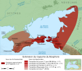
Bosporan Kingdom growth map-es.svg 675 × 575; 2.21 MB
-
Bosporan Kingdom growth map-fr.svg 675 × 575; 1.13 MB
-
Bosporan Kingdom growth map-pt.svg 675 × 575; 752 KB
-
Bosporan Kingdom growth map-uk.svg 675 × 575; 729 KB
-
Chariot spread.png 400 × 231; 154 KB
-
Cimmerian Migrations.jpg 1,554 × 948; 2.08 MB
-
Colònies gregues i fenícies 900-500ane.png 9,999 × 6,868; 5.95 MB
-
Scythian kingdom in the Pontic steppe - detailed.jpg 1,815 × 830; 2.02 MB
-
Scythian kingdom in the Pontic steppe.jpg 2,228 × 1,660; 2.84 MB
-
Scythian Kingdom in West Asia.jpg 1,554 × 948; 2.02 MB


