Category:Maps showing 1786
Jump to navigation
Jump to search
| ← 1780 1781 1782 1783 1784 1785 1786 1787 1788 1789→ |
English: Maps showing the year 1786 (i.e. history maps)
See also category: 1786 maps. and 1780s maps for more maps showing this year usually created not long after the given year.
See also category: 1786 maps. and 1780s maps for more maps showing this year usually created not long after the given year.
Subcategories
This category has only the following subcategory.
Media in category "Maps showing 1786"
The following 7 files are in this category, out of 7 total.
-
8FranklinCounties.png 1,340 × 1,029; 210 KB
-
C. 1786 Central Europe.jpg 1,736 × 1,347; 2.95 MB
-
Life-expectancy,Africa,1786.svg 850 × 691; 12 KB
-
Life-expectancy,World,1786.svg 850 × 691; 12 KB
-
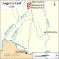
Logans Raid.png 3,083 × 3,083; 612 KB
-
Map of Tennessee highlighting Former State of Franklin.png 1,024 × 251; 84 KB
-
United States Central map 1784-05-12 to 1787-07-13.png 2,000 × 1,320; 249 KB


