Category:Maps showing 1777
Jump to navigation
Jump to search
| ← 1770 1771 1772 1774 1775 1776 1777 1778 1779→ |
English: Maps showing the year 1777 (i.e. history maps)
See also category: 1777 maps. and 1770s maps for more maps showing this year usually created not long after the given year.
See also category: 1777 maps. and 1770s maps for more maps showing this year usually created not long after the given year.
Subcategories
This category has only the following subcategory.
M
Media in category "Maps showing 1777"
The following 6 files are in this category, out of 6 total.
-

-
 Battle of Brandywine 1777, Map 1859.jpg 1,154 × 1,094; 353 KB
-
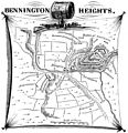 Bennington Heights, VT August 16, 1777.jpg 2,081 × 2,154; 1.74 MB
-
 Burgoyne's March on Albany, 1777.svg 595 × 694; 613 KB
-
 Diocèses et provinces ecclésiastiques de France en 1777 selon les frontières de 1789.svg 2,000 × 1,922; 787 KB
-
 Fort Washington (Cambridge, Massachusetts) - 00000a.tif 9,328 × 7,584; 341 KB
%27_(11227680284).jpg)


