Category:Maps showing 1716
Jump to navigation
Jump to search
| ← 1710 1711 1712 1714 1715 1716 |
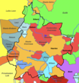
English: Maps showing the year 1716 (i.e. history maps)
See also category: 1716 maps. and 1710s maps for more maps showing this year usually created not long after the given year.
See also category: 1716 maps. and 1710s maps for more maps showing this year usually created not long after the given year.
Media in category "Maps showing 1716"
The following 6 files are in this category, out of 6 total.
-
Midden-Limburg omstreeks 1716.png 1,060 × 834; 327 KB
-
NLLimburg1716.png 528 × 1,192; 134 KB
-
Noord-Limburg omstreeks 1716..png 668 × 1,262; 323 KB
-
Noord-Limburg omstreeks 1716.png 668 × 1,262; 321 KB
-
Petrovaradin BV044698772.jpg 1,490 × 1,749; 790 KB
-
Zuid-Limburg omstreeks 1716.png 766 × 796; 366 KB


