Category:Maps showing 1477
Jump to navigation
Jump to search
| 1470 1475 1477 1479 |
English: Maps showing the year 1477 (i.e. history maps)
See also category: 1477 maps. and 1470s maps for more maps showing this year usually created not long after the given year.
See also category: 1477 maps. and 1470s maps for more maps showing this year usually created not long after the given year.
Media in category "Maps showing 1477"
The following 23 files are in this category, out of 23 total.
-
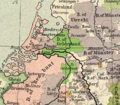 Gelre1477.png 772 × 673; 937 KB
-
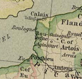 Bonen1477.png 237 × 230; 88 KB
-
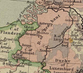 Brabant1477.png 409 × 362; 331 KB
-
 Brandenburg1477.png 596 × 392; 405 KB
-
 France location map-1477-blank.png 2,000 × 1,922; 313 KB
-
 France location map-1477-blank.svg 2,000 × 1,922; 820 KB
-
 França el 1477.png 602 × 644; 398 KB
-
 Hertogdom Berg in 1477.JPG 168 × 193; 11 KB
-
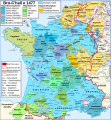
 Map Burgundian Netherlands 1477.png 591 × 657; 198 KB
-
 Map France 1477-br.svg 900 × 970; 1,021 KB
-
 Map France 1477-de.svg 900 × 970; 2.74 MB
-
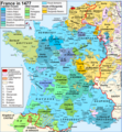
 Map France 1477-en accurate border.svg 900 × 970; 983 KB
-
 Map France 1477-en sovereign Béarn.png 900 × 970; 608 KB
-
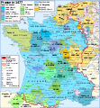 Map France 1477-en.svg 900 × 970; 1 MB
-
 Map France 1477-es.svg 900 × 970; 1.53 MB
-
 Map France 1477-fr sovereign Béarn.svg 900 × 970; 1.14 MB
-
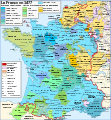
 Map France 1477-fr.svg 900 × 970; 1.16 MB
-
 Map France 1477-pt.svg 900 × 970; 1.22 MB
-
 Map France 1477-ru.svg 900 × 970; 1.16 MB
-
 Map France 1477-uk.svg 900 × 970; 1.14 MB
-
 Map Southern France 1477-ru.png 888 × 383; 270 KB
-
 Oostr1477.png 800 × 600; 1.38 MB
-
 Pays de Retz.jpg 222 × 171; 10 KB


