Category:Maps showing 1400
Jump to navigation
Jump to search
| 1400 1402 1404 1405 → |
English: Maps showing the year 1400 (i.e. history maps)
See also category: 1400 maps. and 1400s maps for more maps showing this year usually created not long after the given year.
See also category: 1400 maps. and 1400s maps for more maps showing this year usually created not long after the given year.
Media in category "Maps showing 1400"
The following 15 files are in this category, out of 15 total.
-
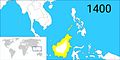 Brunei territories (1400).jpg 1,920 × 960; 398 KB
-
 Brunei territories (1400).png 1,920 × 960; 282 KB
-
 CoronadeCastilla1400.jpg 738 × 542; 188 KB
-
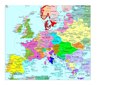 Europe en 1400.pdf 1,752 × 1,239; 513 KB
-
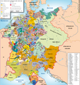 HRR 1400.png 3,735 × 3,957; 3.54 MB
-
 Iberian Kingdoms in 1400-he.svg 738 × 542; 987 KB
-
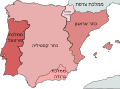
 Iberian Kingdoms in 1400.svg 738 × 542; 971 KB
-
 Modern history; Europe (1904) (14579066890).jpg 3,040 × 2,072; 1.88 MB
-
 Niedersachsen um 1400.jpg 1,948 × 1,644; 487 KB
-
 Niedersachsen um 1400.png 1,948 × 1,644; 3.38 MB
-
 South India in AD 1400.jpg 346 × 291; 96 KB
-
 Venice1400.png 647 × 563; 195 KB
-
 Venice1400.svg 647 × 562; 152 KB
-
 Wustrau Brandenburg-Preußen Museum-Königreiche 4006.jpg 3,389 × 3,587; 7.73 MB
-
 مملكة هرمز.png 1,530 × 1,645; 423 KB
.jpg)
.png)


_(14579066890).jpg)


