Category:Maps published by Justus Perthes’ Geographischer (Verlags)Anstalt Gotha
Jump to navigation
Jump to search
Subcategories
This category has the following 6 subcategories, out of 6 total.
Media in category "Maps published by Justus Perthes’ Geographischer (Verlags)Anstalt Gotha"
The following 3 files are in this category, out of 3 total.
-
 1891 SargassoSee Krummel Petermanns lores.jpg 1,500 × 1,130; 798 KB
-
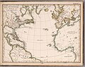 Der Atlantische Ocean, 1835.jpg 4,377 × 3,460; 2.36 MB
-
 Wilhelm Sieglin, Schulatlas zur Geschichte des Altertums, Buchdeckel.jpg 2,711 × 4,363; 6.32 MB


