Category:Maps of weather and climate of Argentina
Jump to navigation
Jump to search
Subcategories
This category has the following 2 subcategories, out of 2 total.
Media in category "Maps of weather and climate of Argentina"
The following 13 files are in this category, out of 13 total.
-
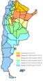
 Argentina climate map.png 180 × 290; 12 KB
-
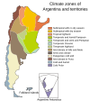 Argentina climate zones map.svg 512 × 615; 72 KB
-
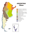 Argentina mapa climas.svg 512 × 615; 207 KB
-
 Average annual rainfall in Argentina.png 420 × 710; 300 KB
-
 Climate map of Argentina - fi.svg 448 × 503; 70 KB
-
 Desplazamiento de la tormenta del 13 de abril de 1993.png 400 × 317; 201 KB
-
 Mapa Argentina Tipos clima IGN.jpg 2,148 × 3,253; 1.25 MB
-
 Mapa de tipos de clima de la provincia del neuquen.svg 400 × 500; 349 KB
-

-

-
 TemperaturaMedia.png 530 × 1,004; 207 KB
-
 Temperature map of Argentina and Falkland Islands.png 530 × 1,004; 182 KB
-
 Tornados del 13 de abril de 1993.png 400 × 295; 193 KB


