Category:Maps of weather and climate in the 1990s
Jump to navigation
Jump to search
Subcategories
This category has the following 8 subcategories, out of 8 total.
- Maps of weather in 1991 (9 F)
- Maps of weather in 1995 (3 F)
- Maps of weather in 1997 (8 F)
- Maps of weather in 1998 (4 F)
Media in category "Maps of weather and climate in the 1990s"
The following 8 files are in this category, out of 8 total.
-
 Insolation.gif 540 × 632; 64 KB
-
 Solar land area.png 680 × 480; 208 KB
-
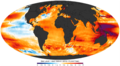
 NASA sea level change trend.jpg 662 × 504; 59 KB
-
 NOAA sea level trend 1993 2010.png 2,425 × 1,337; 1.5 MB
-
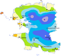
 Seasonal westafrica rainfall mean 20070501 20070930.gif 800 × 600; 25 KB
-
 Précipitation dept29.png 623 × 575; 29 KB
-
 Feb Avg Arctic ice 1985-2000 vs 2008.jpg 500 × 287; 50 KB
-
 Seasonal westafrica rainfall mean 20070501 20070930 Ar.gif 800 × 629; 68 KB


