Category:Maps of volcanoes in Germany
Jump to navigation
Jump to search
Subcategories
This category has the following 4 subcategories, out of 4 total.
K
- Maps of Kaiserstuhl (10 F)
M
- Maps of Laacher See Volcano (3 F)
- Maps of the Vogelsberg (7 F)
Media in category "Maps of volcanoes in Germany"
The following 5 files are in this category, out of 5 total.
-
 Kaiserstuhl-topographie.png 405 × 395; 180 KB
-
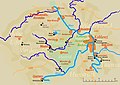 Mayen Koblenz.jpg 1,806 × 1,272; 377 KB
-
 Rhön - Deutsche Mittelgebirge, Serie A-de.png 1,800 × 2,000; 4.92 MB
-
 Schwaebischer-Vulkan Geo-Relief Urach-Kirchheim.jpg 1,600 × 1,200; 1.42 MB
-
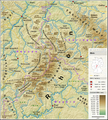
 Vogelsberg-Hoherodskopf-1b.png 3,080 × 2,000; 2.29 MB


