Category:Maps of villages in Miaoli
Jump to navigation
Jump to search
English: Maps of villages in Miaoli. Note: "Village" is an administrative division, and not to be confused with the definition of a "village" in a clustered human settlement or community.
中文(臺灣):苗栗縣各村里地圖
Subcategories
This category has only the following subcategory.
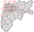
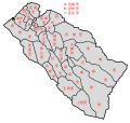
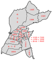
Media in category "Maps of villages in Miaoli"
The following 28 files are in this category, out of 28 total.
-
 Dahu villages.svg 2,400 × 2,100; 18 KB
-
 Gongguan villages.svg 2,100 × 2,900; 21 KB
-
 Gongguan villages2.svg 2,100 × 2,900; 38 KB
-
 Houlong villages.svg 2,500 × 2,200; 45 KB
-
 Houlong villages2.svg 2,500 × 2,200; 68 KB
-
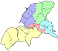
 HoulongSubdivisionArea.jpg 542 × 474; 32 KB
-
 Miaoli villages.svg 2,000 × 2,600; 87 KB
-
 Miaoli villages2.svg 2,000 × 2,600; 110 KB
-
 Miaoli villages3.svg 562 × 720; 62 KB
-
 Nanzhuang villages.svg 2,000 × 2,500; 13 KB
-
 Sanwan villages.svg 2,400 × 2,300; 18 KB
-
 Sanyi villages.svg 2,100 × 2,700; 13 KB
-
 Shitan villages.svg 2,100 × 3,200; 13 KB
-
 TaiAn villages.svg 3,000 × 2,000; 17 KB
-
 Tongluo villages.svg 1,800 × 3,000; 16 KB
-
 Tongxiao villages.svg 1,900 × 3,000; 26 KB
-
 Tongxiao villages2.svg 1,900 × 3,000; 46 KB
-
 Toufen villages.svg 2,200 × 2,000; 30 KB
-
 Toufen villages2.svg 2,200 × 2,000; 60 KB
-
 Touwu villages.svg 2,800 × 2,000; 14 KB
-
 Xihu villages.svg 2,000 × 3,000; 16 KB
-
 Yuanli villages.svg 1,900 × 1,800; 23 KB
-
 Yuanli villages2.svg 1,900 × 1,800; 53 KB
-
 Zaoqiao villages.svg 2,900 × 1,800; 16 KB
-
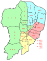
 Zhunan villages numbered.svg 842 × 710; 198 KB
-
 Zhunan villages.svg 1,800 × 2,050; 17 KB
-
 Zhunan villages2.svg 1,800 × 2,050; 40 KB
-
 Zhuolan villages.svg 3,000 × 1,800; 19 KB


