Category:Maps of vías pecuarias
Jump to navigation
Jump to search
Media in category "Maps of vías pecuarias"
The following 8 files are in this category, out of 8 total.
-
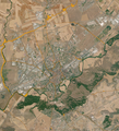 Alcalá de Henares (2020) vías pecuarias, mapa.png 1,242 × 1,365; 3.88 MB
-
 CanadasPuebla.jpg 691 × 751; 131 KB
-
 Cañada Leonesa Occidental.jpg 2,588 × 3,787; 2.67 MB
-
 Cañadas reales y ayuntamientos.png 794 × 1,122; 93 KB
-
 CRLeonesaOccidental ValleAmbles.png 2,333 × 2,333; 324 KB
-
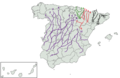 Principales vias pecuarias.png 1,202 × 780; 344 KB
-
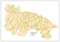 Vias pecuarias la rioja.png 3,506 × 2,481; 250 KB
-
 Vías pecuarias 2º nivel.png 1,202 × 780; 388 KB
_v%C3%ADas_pecuarias,_mapa.png)


