Category:Maps of the municipality of Pella
Jump to navigation
Jump to search
Media in category "Maps of the municipality of Pella"
The following 17 files are in this category, out of 17 total.
-
 2010 Dimos Archeas Pellas.svg 1,670 × 1,258; 36 KB
-
 2011 Dimos Archeas Pellas.png 1,200 × 883; 190 KB
-
 DE Giannitson.svg 790 × 617; 594 KB
-
 DE Kryas Vrysis.svg 790 × 617; 594 KB
-
 DE Kyrrou.svg 790 × 617; 594 KB
-
 DE Megalou Alexandrou.svg 790 × 617; 594 KB
-
 DE Pellas.svg 790 × 617; 594 KB
-
 Dimos Giannitson.png 500 × 377; 41 KB
-
 Dimos Kryas Vrysis.png 500 × 377; 41 KB
-
 Dimos Kyrrou.png 500 × 377; 41 KB
-
 Dimos Megalou Aleksandrou.png 500 × 377; 41 KB
-
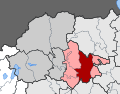
 Dimos Pellas - Central Macedonia.svg 707 × 627; 79 KB
-
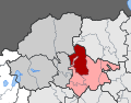
 Dimos Pellas Enotites.png 1,032 × 1,002; 93 KB
-
 Dimos Pellas Topo 2.png 1,191 × 1,019; 1.09 MB
-
 Dimos Pellas Topo.png 1,255 × 1,148; 975 KB
-
 Dimos Pellas.png 500 × 377; 41 KB
-
 Edessa and Environs 1890.jpg 3,496 × 4,464; 4.44 MB


