Category:Maps of the military history of Poland
Jump to navigation
Jump to search
Subcategories
This category has the following 5 subcategories, out of 5 total.
M
- Maps of battles of Poland (29 F)
- Maps of the Polish-Ukrainian War (16 F)
Media in category "Maps of the military history of Poland"
The following 42 files are in this category, out of 42 total.
-
 Busza-1648.jpg 400 × 292; 26 KB
-
 Butteroffensive-Map.jpg 1,274 × 979; 495 KB
-
 Campaigns of Stefan Batory (1578-82).png 963 × 603; 112 KB
-
 Czechoslovakia Poland Border adjustments 1919-1945 ES.svg 1,000 × 404; 52 KB
-
 Czechoslovakia Poland Border adjustments 1919-1945-pt.svg 1,000 × 404; 52 KB
-
 Czechoslovakia Poland Border adjustments 1919-1945.svg 1,000 × 404; 121 KB
-
 Działania podczas wojny polsko niemieckiej 1002-1005-es.svg 11,510 × 11,360; 2.66 MB
-
 Działania podczas wojny polsko niemieckiej 1002-1005-pt.svg 11,510 × 11,360; 2.37 MB
-
 Działania podczas wojny polsko niemieckiej 1002-1005.png 2,309 × 2,279; 1.19 MB
-
 Grody w okresie Mieszka I.png 1,600 × 1,529; 707 KB
-
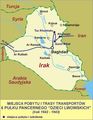
 Irak 11 bat laczn.png 2,017 × 2,598; 1.32 MB
-
 Irak 12 komp geogr.png 1,559 × 2,008; 949 KB
-
 Irak 12 puł pod.png 1,559 × 2,008; 878 KB
-
 Irak 15 puł pozn.png 1,559 × 2,008; 855 KB
-
 Irak 16 lwowski batstrz.png 1,559 × 2,008; 851 KB
-
 Irak 17 lwowski batstrz.png 1,559 × 2,008; 863 KB
-
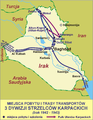 Irak 3 dyw strz karp.png 1,559 × 2,008; 1,004 KB
-
 Irak 4 ppanc skorpion.png 1,552 × 2,085; 1,021 KB
-
 Irak 5 kres dp.png 1,559 × 2,008; 894 KB
-
 Irak 6 ppanc dzlwowskich.png 1,559 × 2,008; 870 KB
-
 Irak armia polska.png 1,559 × 2,008; 822 KB
-
 Irak cmentarze.png 2,017 × 2,598; 1.3 MB
-
 Kampania Stefana Batorego (1578-82).png 963 × 603; 122 KB
-
 Katyn a.png 2,202 × 2,562; 988 KB
-
 Katyn.png 2,202 × 2,562; 787 KB
-
 Mapa okręgów zachodniogalicyjskich cmentarzy wojennych (1918).png 531 × 477; 11 KB
-
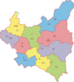 Okręgi Korpusów.PNG 2,684 × 2,985; 552 KB
-
 Panstwo mieclawa-es.svg 14,016 × 11,345; 5.08 MB
-
 Panstwo mieclawa.svg 700 × 567; 3.21 MB
-
 Pałuki 1848.PNG 414 × 426; 19 KB
-
 PB29 – Grenzschutz – Lissa.jpg 1,329 × 2,037; 1.03 MB
-
 POL theatrum europeanum Warszawa 1705.jpg 1,281 × 1,892; 1.43 MB
-
 Poland1020-pt2.svg 11,510 × 11,360; 1.01 MB
-
 Powstanie wielkopolskie w 1848.PNG 540 × 957; 213 KB
-
 Rotkowcze.jpg 424 × 285; 79 KB
-
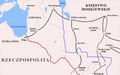
 Rzeczpospolita Dymitriads.png 2,000 × 1,568; 273 KB
-
 Sigismunds truppförflyttningar under Kriget mot Sigismund.gif 375 × 536; 122 KB
-
 Slovakia borderPoland uk.png 1,252 × 847; 140 KB
-
 Slovakia borderPoland.png 1,000 × 404; 46 KB
-
 Wojna polsko rosyjska 1830-1831 plan umocnień Warszawy.jpg 5,267 × 4,076; 11.43 MB
-
 Wolyn samoobrona.png 1,916 × 2,034; 492 KB
-
 Wolyn zbrodnie en.png 1,933 × 2,050; 469 KB


.png)


.png)


.png)


