Category:Maps of the metropolitan city of Genoa
Jump to navigation
Jump to search
Subcategories
This category has only the following subcategory.
M
Media in category "Maps of the metropolitan city of Genoa"
The following 18 files are in this category, out of 18 total.
-
 Genova mappa.png 750 × 493; 226 KB
-
 Genova posizione.png 350 × 424; 13 KB
-
 'ndrangheta in Provincia di Genova.jpg 665 × 401; 51 KB
-
 Fiorino in Genova.png 800 × 513; 111 KB
-
 Genova 04 24.png 1,071 × 486; 62 KB
-
 Genova in Italy.svg 1,034 × 1,299; 3 MB
-
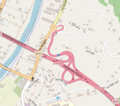 Mappa uscita autostradale Lavagna.png 473 × 418; 116 KB
-
 Mappa uscita autostradale Rapallo.png 857 × 733; 314 KB
-
 Parco naturale regionale dell'Antola-mappa comuni.png 800 × 513; 65 KB
-
 Parco naturale regionale dell'Aveto-mappa comuni.png 800 × 513; 66 KB
-
 Parco naturale regionale di Portofino-mappa comuni.png 800 × 513; 65 KB
-
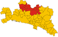
 Unione dei comuni del Golfo Paradiso-mappa.png 815 × 523; 79 KB
-
 Unione dei comuni della Valle del Tempo-mappa.png 815 × 523; 60 KB
-
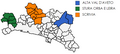
 Unione dei comuni montani dell'Alta Val d'Aveto-mappa.png 815 × 523; 61 KB
-
 Unione dei comuni montani delle Valli Graveglia e Sturla-mappa.png 815 × 523; 61 KB
-
 Unione dei comuni montani dell’Alta Val Trebbia-mappa.png 800 × 513; 59 KB
-
 Unioni Comuni Genova.png 1,071 × 486; 62 KB
-
 Valle Scrivia-Val Vobbia-Val Brevenna-mappa comuni.png 800 × 513; 65 KB


