Category:Maps of the history of the Italian Peninsula
Jump to navigation
Jump to search
Subcategories
This category has the following 3 subcategories, out of 3 total.
B
M
Media in category "Maps of the history of the Italian Peninsula"
The following 46 files are in this category, out of 46 total.
-
The Kingdom of naples with administrative divisions as they were in 1454.png 2,126 × 2,481; 478 KB
-
The Kingdom of Naples with administrative divisions in 1454-uk.png 2,126 × 2,481; 572 KB
-
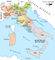
Map of Italy (1494)-ca.svg 3,245 × 3,948; 537 KB
-
Map of Italy (1494)-pl.svg 3,245 × 3,948; 534 KB
-
Map of Italy 1494-es.svg 3,245 × 3,948; 779 KB
-
Italy 1796 AD-ar.png 419 × 600; 90 KB
-
Italy 1796 AD-ko.png 1,007 × 1,442; 202 KB
-
Carte foyers renaissance italie.jpg 1,161 × 871; 180 KB
-
HDFRE V4 D380 Map of Italy.png 516 × 783; 102 KB
-
Italia 1796 - HE.svg 767 × 1,093; 256 KB
-
Italia 1796.svg 767 × 1,093; 70 KB
-
Italia 1843 ko.svg 3,500 × 4,200; 880 KB
-
Italia1860.png 387 × 387; 7 KB
-
Italie -800.png 4,488 × 4,840; 18.74 MB
-
Italie 1796.png 997 × 1,318; 221 KB
-
Italy 1796 AD-el.png 419 × 600; 91 KB
-
Italy 1796 AD-it.png 767 × 1,093; 231 KB
-
Italy 1796 AD-sv.png 1,007 × 1,442; 213 KB
-
Italy 1796 AD.png 1,007 × 1,442; 92 KB
-
Italy 1796 heb.jpg 1,251 × 1,814; 970 KB
-
Italy after 1924.PNG 454 × 510; 56 KB
-
Italy c 1000.png 1,580 × 2,340; 731 KB
-
Koenigreich Neapel Sizilien.jpg 1,482 × 1,899; 221 KB
-
Latin for beginners (1911).djvu-20.map-v2.png 2,216 × 3,380; 6.43 MB
-
Map of Italy (1402)-fr.png 3,321 × 3,837; 1.17 MB
-
Map of Italy Regno di Napoli-ca.svg 1,077 × 1,401; 717 KB
-
Map of Italy Regno di Napoli.svg 1,077 × 1,401; 790 KB
-
Member Cities of the Lombard Leagues.png 2,421 × 1,564; 861 KB
-
Peninsula Italica 1796.png 1,007 × 1,442; 84 KB
-
Regia Aeronautica 1943 map.svg 3,963 × 3,948; 739 KB
-
RomanItaly fr.svg 1,760 × 2,168; 2.28 MB
-
RomanItaly hu.svg 1,760 × 2,168; 2.39 MB
-
RomanItaly.png 720 × 887; 361 KB
-
RomanItaly.svg 1,760 × 2,168; 2.28 MB
-
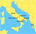
Rome against Taranto location-fr.png 253 × 240; 26 KB
-
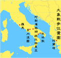
Rome against Taranto location-zh-classical.png 253 × 240; 31 KB
-
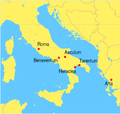
Rome against Taranto location.png 253 × 240; 24 KB
-
Verlauf der Via Amerina im Byzantinischen Korridor.jpg 1,484 × 1,765; 647 KB
-
Verlauf der Via Amerina von Rom nach Rimini.jpg 686 × 1,244; 237 KB
-
Völkerkarte von Mittel- und Südosteuropa. Italien 1815 bis zur Gegenwart (1905)-es.svg 2,722 × 2,998; 1.03 MB
-
Włochy 1494.png 1,261 × 1,757; 436 KB
-
Włochy 1796.jpg 1,007 × 1,397; 212 KB
-
Włochy 1810.png 1,251 × 1,755; 332 KB
-
Zh Italy 1494 v2.png 1,261 × 1,805; 125 KB


