Category:Maps of the history of Wales
Jump to navigation
Jump to search
Subcategories
This category has the following 27 subcategories, out of 27 total.
- Maps of 1st-century Wales (6 F)
- Maps of 2nd-century Wales (7 F)
- Maps of 3rd-century Wales (5 F)
- Maps of 4th-century Wales (8 F)
- Maps of 5th-century Wales (7 F)
- Maps of 6th-century Wales (2 F)
- Maps of 7th-century Wales (3 F)
- Maps of 8th-century Wales (1 F)
- Maps of 9th-century Wales (3 F)
- Maps of 10th-century Wales (1 F)
- Maps of 11th-century Wales (3 F)
- Maps of 12th-century Wales (2 F)
- Maps of 13th-century Wales (1 F)
- Maps of 14th-century Wales (4 F)
- Maps of 15th-century Wales (1 F)
- Maps of 16th-century Wales (1 F)
- Maps of 17th-century Wales (10 F)
- Maps of 18th-century Wales (6 F)
- Maps of 20th-century Wales (1 F)
- Maps of 21st-century Wales (18 F)
!
L
M
R
U
Media in category "Maps of the history of Wales"
The following 168 files are in this category, out of 168 total.
-
 1282 Edward I invasion with UNESCO sites.png 1,178 × 746; 1.15 MB
-
 341 of 'History of the Great Civil War. 1642-1649. (Sixth series.)' (11185538244).jpg 2,480 × 3,222; 1.66 MB
-
 Angleterre 1087.png 400 × 458; 89 KB
-
 Anglo-Norman advance into Wales.png 754 × 852; 181 KB
-
 Anglo-Saxon England 2.svg 900 × 1,100; 574 KB
-
 Britain in AD500 - Project Gutenberg eText 16790.jpg 606 × 1,000; 102 KB
-
 Britain peoples circa 600 de.svg 578 × 772; 1.78 MB
-
 Britain peoples circa 600 ru.svg 994 × 1,233; 1.32 MB
-
 Britain peoples circa 600-es.svg 994 × 1,233; 3.44 MB
-
 Britain peoples circa 600-hu.svg 994 × 1,233; 1.65 MB
-
 Britain peoples circa 600-ko.svg 994 × 1,233; 1.33 MB
-
 Britain peoples circa 600-pt.svg 994 × 1,233; 1.33 MB
-
 Britain peoples circa 600.svg 994 × 1,233; 1.88 MB
-
 Britain.4th.century.Roman.infrastructure.jpg 3,158 × 3,388; 961 KB
-
 Britain.Deisi.Laigin.jpg 1,880 × 2,386; 788 KB
-
 Britain.peoples.original.traditional.jpg 1,551 × 2,877; 571 KB
-
 British isles 802.jpg 1,076 × 1,127; 1.29 MB
-
 British isles history v2.png 765 × 565; 75 KB
-
 Britonen6JHundert.png 1,670 × 2,928; 441 KB
-
 Britonia6hcentury-ar.jpg 1,670 × 2,928; 375 KB
-
 Britonia6hcentury.png 1,670 × 2,928; 542 KB
-
 C. 1065 England and Wales (before Norman Conquest).jpg 2,979 × 3,972; 4.21 MB
-
 C. 1086 England and Wales.jpg 3,168 × 4,119; 4.46 MB
-
 C. 1135 Wales and the Borders.jpg 1,118 × 1,210; 1.19 MB
-
 C. 1190 France and Britain.jpg 785 × 1,326; 1.41 MB
-
 C. 1300 England and Wales.jpg 2,979 × 3,952; 3.6 MB
-
 C. 1300 England Ecclesiastical.jpg 2,979 × 3,952; 3.28 MB
-
 C. 1490 France and England.jpg 811 × 1,252; 1.26 MB
-
 C. 1540 England and Wales Ecclesiastical.jpg 2,979 × 3,921; 4.41 MB
-
 C. 350 Roman Britain.jpg 3,848 × 3,010; 2.54 MB
-
 C. 802 British Isles.jpg 1,254 × 1,316; 1.65 MB
-
 C. 886 England.jpg 913 × 1,023; 1.07 MB
-
 Cantrefi.Medieval.Wales-no.jpg 2,027 × 2,149; 497 KB
-
 Cantrefi.Medieval.Wales.jpg 2,027 × 2,149; 494 KB
-
 Castell LLys and medieval dykes.jpg 860 × 933; 199 KB
-
 Central.Britain.c550.jpg 1,674 × 1,794; 425 KB
-
 CeredigionKingdomMap.png 911 × 1,197; 443 KB
-
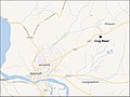 Crug Mawr.jpg 866 × 652; 290 KB
-
 Cymru blanc Tyner.png 336 × 412; 64 KB
-
 Cymru yn Oes y Tywysogion.jpg 3,247 × 3,985; 1.59 MB
-
 CymruLlwythi-es.png 514 × 566; 17 KB
-
 CymruLlwythi.PNG 514 × 566; 10 KB
-
 CymruLlywelyn.PNG 514 × 566; 12 KB
-
 CymruMap-ru.png 514 × 566; 26 KB
-
 CymruMap.PNG 514 × 566; 11 KB
-
 CymruMap1093.PNG 514 × 566; 12 KB
-
 Deheubarth 920 ru.svg 744 × 1,052; 455 KB
-
 Deheubarth.PNG 396 × 411; 9 KB
-
 Deheubarth1.PNG 570 × 591; 32 KB
-
 Deheubarth1190.PNG 570 × 591; 20 KB
-
 EngWalesRegistrationDivisions1888.png 5,138 × 5,520; 5.12 MB
-
 Ergyng.040.jpg 1,794 × 1,278; 393 KB
-
 Ergyng.500.jpg 1,794 × 1,278; 417 KB
-
 Ergyng.600.jpg 1,794 × 1,278; 389 KB
-
 Ergyng.700.jpg 1,794 × 1,278; 386 KB
-
 Gaels in Wales.jpg 800 × 1,015; 288 KB
-
 Glamorgan Administrative Map 1947.png 1,788 × 1,024; 268 KB
-
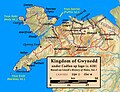
 Gwynedd 1217.jpg 1,864 × 2,264; 1.18 MB
-
 Gwynedd 1247 kart.png 2,000 × 1,432; 934 KB
-
 Gwynedd 1247 Map-EU.jpg 960 × 720; 121 KB
-
 Gwynedd 1247 Map.jpg 960 × 720; 70 KB
-
 Gwynedd after the Treaty of Aberconwy 1277 ru.svg 1,054 × 901; 467 KB
-
 Gwynedd after the Treaty of Aberconwy 1277.svg 1,054 × 901; 492 KB
-
 Gwynedd after the Treaty of Woodstock 1247 ru.svg 1,054 × 901; 408 KB
-
 Gwynedd.620.jpg 2,262 × 1,728; 373 KB
-
 Gwynedd.830.jpg 1,962 × 1,788; 333 KB
-
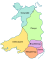
 Gwynedd.png 851 × 936; 33 KB
-
 Hafod map.jpg 970 × 849; 662 KB
-
 Wales Administration Map 1947.png 2,250 × 3,610; 1.79 MB
-
 Illas Britanicas (vèrs la fin dau sègle IX).png 801 × 956; 244 KB
-
 Illas Britanicas - Conquista normanda d'Anglatèrra.png 801 × 956; 282 KB
-
 Illas Britanicas - Conquista romana.png 801 × 956; 302 KB
-
 Illas Britanicas - Guèrra Civila Anglesa (1642-1651).png 801 × 956; 329 KB
-
 IronRing.png 758 × 762; 164 KB
-
 Kembre.jpg 815 × 505; 139 KB
-
 LDDyfedCantrefi.png 1,344 × 959; 61 KB
-
 Ludy Brytanii ok. 600.svg 994 × 1,233; 1.47 MB
-
 Map Gaels Brythons Picts patterns.png 778 × 829; 75 KB
-
 Map Gaels Brythons Picts.png 643 × 829; 66 KB
-
 Map of Celtic Nations (alternate).svg 675 × 1,300; 90 KB
-
 Map of Celtic Nations.svg 675 × 1,300; 97 KB
-
 Map of Mediaeval kingdoms of Wales 700-1000.svg 720 × 960; 98 KB
-
 Map of Mediaeval kingdoms of Wales c.1093.svg 720 × 960; 118 KB
-
 Map of Mediaeval kingdoms of Wales X-XI be.svg 720 × 960; 56 KB
-
 Map of Mediaeval kingdoms of Wales X-XI ru.svg 720 × 960; 92 KB
-
 Map of Owain Glyndŵr's Revolt.svg 739 × 884; 289 KB
-
 Map of the Cantrefs and Commotes of Rhwng Gwy a Hafren.svg 1,300 × 1,800; 554 KB
-
 Map of the Territory of the Corieltauvi.svg 744 × 1,052; 148 KB
-
 Map of the Territory of the Cornovii (Midlands).png 737 × 873; 126 KB
-
 Map of the Territory of the Cornovii (Midlands).svg 700 × 900; 117 KB
-
 Map of the Territory of the Dobunni.svg 744 × 1,052; 148 KB
-
 Map- Wars of the Roses.jpg 1,314 × 1,980; 545 KB
-
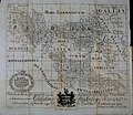 MappaBritanniaeFacie.jpg 2,954 × 2,557; 837 KB
-
 MappaBritanniaeFacie3.png 1,100 × 936; 2.13 MB
-
 MappaBritanniaeFacie4.png 1,400 × 1,690; 4.25 MB
-
 Maximus Wales 1.jpg 1,600 × 1,776; 300 KB
-
 Maximus Wales 2.jpg 1,600 × 1,776; 347 KB
-
 Medieval south-east Wales map Lloyd.jpg 893 × 1,071; 846 KB
-
 Medieval Wales map Lloyd.jpg 2,749 × 3,415; 6.96 MB
-
 Medieval Wales.JPG 1,203 × 1,581; 129 KB
-
 Monmouthshire Hundreds.jpg 615 × 800; 379 KB
-
 Nations of the UK (with some flags).svg 512 × 384; 401 KB
-
 Nations of the UK-id.svg 781 × 574; 633 KB
-
 Nations of the UK.png 720 × 540; 108 KB
-
 Nations of the UK.svg 512 × 384; 247 KB
-
 Northwales2.JPG 960 × 720; 67 KB
-
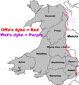 Offas Dyke Map.png 954 × 1,024; 214 KB
-
 Ogham map.png 1,155 × 1,279; 571 KB
-
 Ogham.Inscriptions.Wales.jpg 1,873 × 2,029; 364 KB
-
 Perfeddulad.jpg 1,134 × 1,414; 229 KB
-
 Powys 1190 localisation.png 1,662 × 1,965; 65 KB
-
 Powys.png 844 × 925; 31 KB
-
 Powys2 1190.JPG 370 × 445; 68 KB
-
 Powys3 1190.JPG 370 × 445; 68 KB
-
 Principality of Wales.jpg 720 × 960; 59 KB
-
 Principality of Wales.svg 720 × 960; 224 KB
-
 Principality of Wales2.svg 720 × 960; 224 KB
-
 Regional Types.png 628 × 819; 287 KB
-
 Rhwng.Gwy.a.Hafren.jpg 2,143 × 2,076; 681 KB
-
 Roman coins in Wales (2).jpg 2,481 × 3,506; 1.22 MB
-
 Roman Roads in Britannia de.svg 1,000 × 1,300; 961 KB
-
 Roman Roads in Britannia fr.svg 1,000 × 1,300; 1.03 MB
-
 Roman Roads in Britannia-es.svg 1,000 × 1,300; 1.01 MB
-
 Roman Roads in Britannia-hu.svg 1,000 × 1,300; 1.03 MB
-
 Roman Roads in Britannia.svg 1,000 × 1,300; 1.03 MB
-
 Roman.Britain.campaigns.43.to.60.jpg 3,030 × 2,906; 992 KB
-
 Roman.Britain.campaigns.43.to.84.jpg 2,240 × 4,186; 980 KB
-
 Roman.Britain.Romanisation.jpg 3,000 × 3,176; 924 KB
-
 Roman.Wales.Forts.Fortlets.Roads.jpg 2,092 × 2,798; 856 KB
-
 South.Britain.ancient.land.cover.jpg 2,537 × 2,903; 906 KB
-
 Territorial Evolution of Wales (844-1284).gif 504 × 713; 723 KB
-
 Territòris de Cnut lo Grand.png 722 × 665; 134 KB
-
 Tewdrig.Book.of.Llandaff.jpg 1,047 × 835; 144 KB
-
 Triparte division of England and Wales.png 613 × 755; 108 KB
-
 Wales 1039-63 (Gruffudd ap Llywelyn) ru.svg 744 × 1,052; 435 KB
-
 Wales 1039-63 (Gruffudd ap Llywelyn).svg 744 × 1,052; 464 KB
-
 Wales 1234 (Marchia Wallie and Pura Wallia).svg 744 × 1,052; 620 KB
-
 Wales 14C Map.png 3,399 × 3,610; 1.82 MB
-
 Wales 844-78 (Rhodri the Great) ru.svg 744 × 1,052; 458 KB
-
 Wales 844-78 (Rhodri the Great)-es.svg 744 × 1,052; 392 KB
-
 Wales 844-78 (Rhodri the Great).svg 744 × 1,052; 510 KB
-
 Wales 850-920.jpg 1,343 × 1,592; 282 KB
-
 Wales 900-950 (Hywel the Good).svg 744 × 1,052; 512 KB
-
 Wales 986-99 (Maredudd ab Owain).svg 744 × 1,052; 469 KB
-
 Wales Administrative 1974 WELSH.png 2,150 × 3,389; 1.03 MB
-
 Wales after the Statute of Rhuddlan 1284.svg 744 × 1,052; 452 KB
-
 Wales after the Treaty of Montgomery 1267 Colorblind.svg 744 × 1,052; 124 KB
-
 Wales after the Treaty of Montgomery 1267 EU.png 2,000 × 2,828; 934 KB
-
 Wales after the Treaty of Montgomery 1267 ru.svg 744 × 1,052; 387 KB
-
 Wales after the Treaty of Montgomery 1267-es.svg 744 × 1,052; 316 KB
-
 Wales after the Treaty of Montgomery 1267.svg 744 × 1,052; 423 KB
-
 Wales between 850 and 920.jpg 2,719 × 3,203; 1.31 MB
-
 Wales c. 850-920.jpg 2,692 × 3,185; 688 KB
-
 Wales in the Age of the Princes.jpg 3,247 × 3,985; 1.58 MB
-
 Wales Traditional Counties WELSH.png 2,150 × 2,338; 603 KB
-
 Wales.medieval.cymydau.jpg 2,378 × 2,441; 681 KB
-
 Wales.medieval.jpg 1,716 × 1,794; 513 KB
-
 Wales.post-Roman.jpg 1,717 × 1,794; 528 KB
-
 Wales.pre-Roman.jpg 1,727 × 1,794; 507 KB
-
 Wales.Roman.Conquest.jpg 3,076 × 3,080; 729 KB
-
 WalesCantrefiMap.png 2,354 × 2,501; 782 KB
-
 WalesCommotesMap.png 2,354 × 2,501; 1.12 MB
-
 WalesDeceangli.png 400 × 497; 35 KB
-
 WalesDemetae.png 400 × 497; 35 KB
-
 WalesOrdo.png 400 × 497; 34 KB
-
 Walia mapa.png 300 × 322; 36 KB
-
 WelshMarchesMap.png 310 × 333; 74 KB
-
 Yr.Hen.Ogledd.550.650.Koch.jpg 1,500 × 1,794; 510 KB

%27_(11185538244).jpg)


.jpg)


.png)


.png)


.svg)


.png)
.svg)


.svg)


.jpg)


.gif)


_ru.svg)
.svg)
.svg)

_ru.svg)
-es.svg)
.svg)

.svg)
.svg)


