Category:Maps of the history of Styria
Jump to navigation
Jump to search
Subcategories
This category has the following 3 subcategories, out of 3 total.
A
- A1 Ring circuit maps (9 F)
M
- Maps of the Duchy of Styria (12 F)
Ö
- Österreichring circuit maps (11 F)
Media in category "Maps of the history of Styria"
The following 25 files are in this category, out of 25 total.
-
 Aufnahmeblatt 4955-4 Mürzzuschlag Langenwang-Mürzzuschlag.jpg 3,704 × 3,104; 8.2 MB
-
 Aufnahmeblatt 4955-4 Mürzzuschlag.jpg 9,664 × 7,246; 47.52 MB
-
 Aufnahmeblatt 4956-3 Kirchberg Feistritz Wechsel Mönichkirchen.jpg 10,358 × 7,446; 58.11 MB
-
 Aufnahmeblatt 5155-3 1879.jpg 9,617 × 7,386; 43.11 MB
-
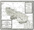
 AvI Cillier Kreis südliche Untersteiermark.jpg 11,988 × 10,236; 33.43 MB
-
 AvI Judenburger Kreis.jpg 8,994 × 7,650; 26.32 MB
-
 AvI Marburger Kreis mittlere Untersteiermark.jpg 10,344 × 8,947; 16.6 MB
-
 Grazer Kreis.jpg 7,474 × 5,447; 31.62 MB
-
 Great carantania.jpg 400 × 347; 34 KB
-
 Josephinische Landesaufnahme 098 Preitenegg.jpg 8,464 × 5,498; 17.69 MB
-
 Judenburger Kreis.jpg 7,468 × 5,429; 33.99 MB
-
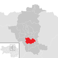 Kapfenberg im Bezirk BM.png 645 × 645; 24 KB
-
 Kapfenberg in BM new.gif 300 × 320; 5 KB
-
 Kapfenberg in BM.png 300 × 320; 6 KB
-
 Kapfenberg Katastralgemeinden (till end of 2014).jpg 834 × 536; 62 KB
-
 Korutánske vojvodstvo.png 4,091 × 4,216; 3.92 MB
-
 Kreiseinteilung Graz Marburg 1855.jpg 1,245 × 780; 512 KB
-
 Landgerichtskarte Marburg.jpg 5,821 × 4,398; 22.11 MB
-
 Marburger Kreis 1760.jpg 7,417 × 5,386; 16.87 MB
-
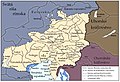
 Mark an der Sann locator map (1000).svg 1,615 × 1,200; 5.33 MB
-
 Parschlug im Bezirk BM.png 645 × 645; 24 KB
-
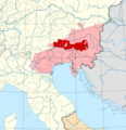
 Styria 1418.png 3,531 × 2,648; 1.85 MB
-
 Thunau Josephinische LA.jpg 1,175 × 752; 699 KB
-
 Veľká Karantánia.jpg 1,070 × 730; 544 KB
-
 Zistanesfeld locator map (1000).svg 1,615 × 1,200; 5.33 MB


.jpg)


.svg)


.svg)