Category:Maps of the history of Slovenia in the Middle Ages
Jump to navigation
Jump to search
Slovenščina: Zemljevidi zgodovine Slovenije v srednjem veku.
Subcategories
This category has the following 7 subcategories, out of 7 total.
Media in category "Maps of the history of Slovenia in the Middle Ages"
The following 28 files are in this category, out of 28 total.
-
 Bohemia under Otakar II and Karel IV CZ.svg 520 × 471; 1.36 MB
-
 Bohemia under Otakar II PL.svg 520 × 471; 1.36 MB
-
 Bohemia-ottokar2.jpg 596 × 496; 113 KB
-
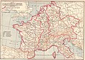 Carolingian Empire map 1895.jpg 5,697 × 4,050; 7.84 MB
-
 Celjski grofje ozemlje.PNG 714 × 464; 142 KB
-
 Central Europe in the late ninth century.png 511 × 289; 195 KB
-
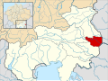
 Duchy of Carniola locator map (1250).svg 3,120 × 2,280; 3.52 MB
-
 Duernkrut3.jpg 722 × 773; 193 KB
-
 Eastern Adriatic 1089-es.svg 1,920 × 1,753; 2.68 MB
-
 Eastern Adriatic 1089.svg 1,920 × 1,753; 6.57 MB
-
 Empire carolingien.png 371 × 428; 44 KB
-
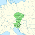
 Great carantania.jpg 400 × 347; 34 KB
-
 Karniola around 800.png 411 × 444; 334 KB
-
 Karte Böhmen unter Ottokar II.png 823 × 821; 187 KB
-
 Korutánske vojvodstvo.png 4,091 × 4,216; 3.92 MB
-
 Map of Catholic Dioceses in Eastern Adriatic in 15th Century - Croatian.svg 685 × 578; 1.43 MB
-
 Map Suebia550pChrn.png 400 × 363; 82 KB
-
 Marca Vinedorum-en.PNG 656 × 538; 64 KB
-
 Marca Vinedorum-sl.PNG 648 × 536; 64 KB
-
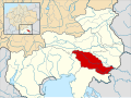 March of Carniola locator map (1000).svg 1,615 × 1,200; 5.33 MB
-
 Mark an der Sann locator map (1000).svg 1,615 × 1,200; 5.33 MB
-
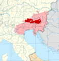
 Patriarchate of Aquileia locator map (1250).svg 1,615 × 925; 3.23 MB
-
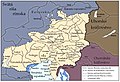
 Slovanske knezevine v Vzhodnih Alpah.PNG 441 × 334; 28 KB
-
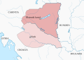 Territory governed by Braslav-es.svg 601 × 424; 305 KB
-
 Territory governed by Braslav-hu.svg 601 × 424; 261 KB
-
 Territory governed by Braslav.png 736 × 518; 66 KB
-
 Veľká Karantánia.jpg 1,070 × 730; 544 KB
-
 Zistanesfeld locator map (1000).svg 1,615 × 1,200; 5.33 MB


.svg)


.svg)
.svg)
.svg)


.svg)