Category:Maps of the history of La Guajira Department
Jump to navigation
Jump to search
Media in category "Maps of the history of La Guajira Department"
The following 16 files are in this category, out of 16 total.
-
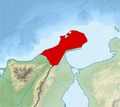
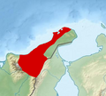
 ComisariaLaGuajira.JPG 301 × 281; 11 KB
-
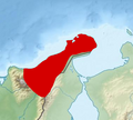
 Intendencia&ComisariaLaGuajira.PNG 741 × 659; 547 KB
-
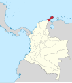
 La Guajira in Colombia (1912).svg 2,024 × 2,291; 441 KB
-
 La Guajira in Colombia (1928).svg 2,023 × 2,290; 452 KB
-
 La Guajira in New Granada (1850).svg 2,029 × 2,242; 1,023 KB
-
 La Guajira in United States of Colombia.svg 2,085 × 2,260; 1.68 MB
-
 Magdalena in Gran Colombia (1824).svg 2,843 × 2,461; 1.19 MB
-
 Magdalena in Granadine Confederation.svg 2,029 × 2,242; 417 KB
-
 Magdalena in United States of Colombia.svg 2,029 × 2,241; 424 KB
-
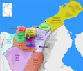 Map of the Government of Magdalena (1500).png 455 × 390; 300 KB
-
 Provincia Riohacha.PNG 288 × 235; 7 KB
-
 ProvinciaPadilla1.PNG 378 × 339; 150 KB
-
 ProvinciaPadilla2.PNG 378 × 339; 156 KB
-
 ProvinciaPadilla3.PNG 378 × 339; 161 KB
-
 Riohacha in New Granada (1810).svg 2,029 × 2,241; 1.08 MB
-
 Riohacha in New Granada (1855).svg 2,029 × 2,242; 836 KB


.svg)
.svg)
.svg)

.svg)


.png)


.svg)
.svg)