Category:Maps of the history of Dublin
Jump to navigation
Jump to search
Use the appropriate category for maps showing all or a large part of Dublin. See subcategories for smaller areas:
| If the map shows | Category to use |
|---|---|
| Dublin on a recently created map | Category:Maps of Dublin or its subcategories |
| Dublin on a map created more than 70 years ago | Category:Old maps of Dublin or its subcategories |
| the history of Dublin on a recently created map | Category:Maps of the history of Dublin or its subcategories |
| the history of Dublin on a map created more than 70 years ago | Category:Old maps of the history of Dublin or its subcategories |
Media in category "Maps of the history of Dublin"
The following 12 files are in this category, out of 12 total.
-
 Dublin800.png 3,060 × 2,131; 548 KB
-
 Dublin900.svg 3,526 × 2,906; 246 KB
-
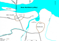
 Early Scandinavian Dublin - Carlingford.png 3,072 × 1,739; 442 KB
-
 Early Scandinavian Dublin - Carlingford.svg 922 × 522; 213 KB
-
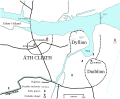
 Early Scandinavian Dublin - Dyflinn.svg 947 × 907; 75 KB
-
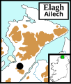 Early Scandinavian Dublin - Elagh.svg 686 × 808; 201 KB
-
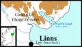
 Early Scandinavian Dublin - Moy.svg 873 × 1,213; 291 KB
-
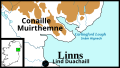
 Early Scandinavian Dublin - South-East.svg 762 × 789; 555 KB
-
 Early Scandinavian Dublin - South-West.svg 663 × 743; 913 KB
-
 Early Scandinavian Dublin - Southern Ui Neill.svg 1,181 × 741; 860 KB
-
 Early Scandinavian Dublin - Strangford.svg 671 × 804; 168 KB
-
 Early Scandinavian Dublin - Tirawley.svg 655 × 655; 195 KB


