Category:Maps of the history of Delta Amacuro
Jump to navigation
Jump to search
Federal territory: Capital District · Federal Dependencies · Territorial claim: Guayana Esequiba
| NO WIKIDATA ID FOUND! Search for Maps of the history of Delta Amacuro on Wikidata | |
| Upload media |

Media in category "Maps of the history of Delta Amacuro"
The following 4 files are in this category, out of 4 total.
-
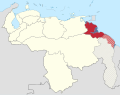 Delta Amacuro in Venezuela (1891).svg 1,870 × 1,479; 740 KB
-
 Guayana in Venezuela (1856).svg 1,870 × 1,479; 777 KB
-
 Territorio Federal Delta Amacuro (1884 - 1893).PNG 2,000 × 1,583; 40 KB
-
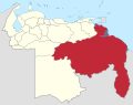
 Territorio Federal Delta Amacuro (1901 - 1991).PNG 1,772 × 1,583; 38 KB
.svg)
.svg)
.PNG)
.PNG)