Category:Maps of the history of Caldas Department
Jump to navigation
Jump to search
Media in category "Maps of the history of Caldas Department"
The following 25 files are in this category, out of 25 total.
-
 Antioquia in New Granada (1810).svg 2,029 × 2,241; 1.08 MB
-
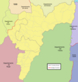 Caldas 1908.png 1,204 × 1,265; 227 KB
-
 Caldas 1912.png 1,204 × 1,265; 220 KB
-
 Caldas in Colombia (1958).svg 2,029 × 2,296; 439 KB
-
 Caldas1537.png 2,273 × 1,710; 162 KB
-
 Caldas1538.png 1,002 × 752; 91 KB
-
 Caldas1550.png 2,273 × 1,710; 152 KB
-
 Caldas1552.png 1,002 × 752; 130 KB
-
 Caldas1600.png 1,002 × 752; 132 KB
-
 Caldas1700.png 996 × 748; 143 KB
-
 Caldas1756.png 1,002 × 749; 131 KB
-
 Caldas1813.png 1,002 × 749; 131 KB
-
 Caldas1830.png 996 × 748; 151 KB
-
 Caldas1851.png 996 × 748; 152 KB
-
 Caldas1860.png 996 × 748; 155 KB
-
 Caldas1905.png 1,204 × 936; 193 KB
-
 Caldas1906.png 1,204 × 936; 194 KB
-
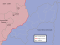
 Córdova in New Granada (1855).svg 2,029 × 2,242; 836 KB
-
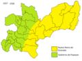
 Gran Caldas.PNG 606 × 740; 28 KB
-
 Manizales in Colombia (1908).svg 2,029 × 2,241; 447 KB
-
 Mapa de Caldas (configuración territorial).svg 992 × 1,059; 525 KB
-
 Mapa de la colonización antioqueña (expansión poblacional).svg 961 × 1,352; 429 KB
-
 Mapa de la colonización antioqueña (rutas).svg 961 × 1,352; 409 KB
-
 Mariquita in New Granada (1810).svg 2,029 × 2,241; 1.08 MB
-
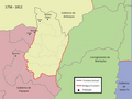
 Mariquita in New Granada (1855).svg 2,029 × 2,242; 836 KB
.svg)


.svg)


.svg)

.svg)
.svg)
.svg)
.svg)
.svg)
.svg)