Category:Maps of the history of Boston
Jump to navigation
Jump to search
Subcategories
This category has the following 5 subcategories, out of 5 total.
M
O
Media in category "Maps of the history of Boston"
The following 25 files are in this category, out of 25 total.
-

-
 146 of 'Cassell's History of the United States ... Illustrated' (11104130714).jpg 1,762 × 2,385; 1.06 MB
-

-

-
 253 of 'Antique Views of ye Towne of Boston. (With plates.)' (11154442813).jpg 3,152 × 3,703; 2.18 MB
-
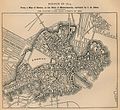
 Plan showing the principal portion of Boston, from the oldest authorities (3856484222).jpg 2,000 × 1,883; 3.82 MB
-
 Boston, the place and the people (1903) (14763949052).jpg 1,851 × 2,859; 437 KB
-
 Oldandnewboston.jpg 291 × 410; 32 KB
-

-
 17thcMap CourtSt SchoolSt Boston Drake1917.png 306 × 539; 47 KB
-

-
 Antique views of ye towne of Boston (1882) (14767154321).jpg 2,697 × 2,060; 1.67 MB
-
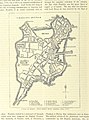
 Boston 1630 1675.jpg 1,566 × 1,450; 648 KB
-
 Boston 1814.jpg 1,580 × 1,444; 573 KB
-
 Boston Harbor (3120131485).jpg 2,000 × 1,710; 2.98 MB
-
 Boston, Massachusetts (ASTER).jpg 1,200 × 465; 218 KB
-
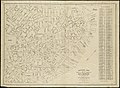 Historical map of the north and central parts of Old Boston (3121051224).jpg 2,000 × 1,461; 3.03 MB
-
-

-

-
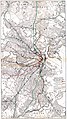 Map of 1926 proposals for Boston rapid transit extensions.jpg 842 × 1,500; 540 KB
-
 Map of Boston Horsecar Lines 1886.svg 2,289 × 2,232; 394 KB
-
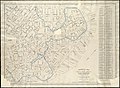
 Plan of Boston Proper Showing Changes in Street and Wharf Lines 1795 to 1895.jpg 2,000 × 1,163; 2.34 MB
-

-
.jpg)
.jpg)
.jpg)

%27_(11154442813).jpg)
.jpg)
_(14763949052).jpg)


.jpg)
_(14767154321).jpg)


.jpg)
.jpg)
.jpg)
%27_(15968009014).jpg)
%27_(16589512952).jpg)


.jpg)
.jpg)
.jpg)