Category:Maps of the canton of Thurgau to 1918
Jump to navigation
Jump to search
Media in category "Maps of the canton of Thurgau to 1918"
The following 5 files are in this category, out of 5 total.
-
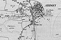 Arbon 1896.jpg 1,559 × 1,039; 533 KB
-
 Arbon 1904.jpg 1,533 × 1,022; 590 KB
-
 Karte Gemeinden des Kantons Thurgau 1871.png 2,952 × 1,786; 856 KB
-
 Karte Gemeinden des Kantons Thurgau farbig 1900.png 2,952 × 1,786; 1.16 MB
-
 Karte Kanton Thurgau Bezirke 1918.png 1,476 × 993; 461 KB


