Category:Maps of the canton of Fribourg to 2021
Jump to navigation
Jump to search
Media in category "Maps of the canton of Fribourg to 2021"
The following 17 files are in this category, out of 17 total.
-
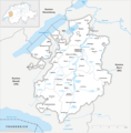
Karte Kanton Freiburg 2010.png 2,066 × 2,099; 948 KB
-
Karte Kanton Freiburg Bezirke 2010.png 2,066 × 2,099; 1.01 MB
-
Karte Kanton Freiburg.png 1,771 × 1,605; 430 KB
-
Karte Kanton Freiburg Bezirke.png 944 × 956; 193 KB
-
Karte Kanton Freiburg Bezirke notext.png 590 × 659; 122 KB
-
Karte Bezirk Broye.png 885 × 972; 237 KB
-
Karte Bezirk Glâne.png 885 × 972; 234 KB
-
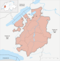
Carte districts canton fribourg.png 590 × 659; 113 KB
-
Districts of Canton Freiburg.png 590 × 659; 114 KB
-
Karte Bezirk Greyerz.png 885 × 972; 238 KB
-
Karte Gemeinden des Kantons Freiburg 2021.png 2,952 × 3,308; 1.91 MB
-
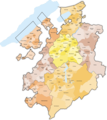
Karte Gemeinden des Kantons Freiburg farbig 2021.png 2,952 × 3,308; 2.26 MB
-
Karte Kanton Freiburg Bezirke 2010 clair.png 2,066 × 2,099; 725 KB
-
Karte Bezirk Saane.png 885 × 972; 236 KB
-
Karte Bezirk See.png 885 × 972; 235 KB
-
Karte Bezirk Sense.png 885 × 972; 237 KB
-
Karte Bezirk Vivisbach.png 885 × 972; 233 KB
