Category:Maps of the battle of Agincourt
Jump to navigation
Jump to search
Media in category "Maps of the battle of Agincourt"
The following 26 files are in this category, out of 26 total.
-
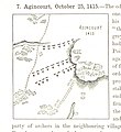
AgincourtKaart.jpg 344 × 275; 15 KB
-
AgincourtMap-pl.svg 313 × 250; 24 KB
-
AgincourtMap.svg 313 × 250; 25 KB
-
AgincourtMap2.png 344 × 275; 51 KB
-
AgincourtMapCS.jpg 344 × 275; 16 KB
-
Agindraft.png 360 × 482; 112 KB
-
AzincourtMap cs.svg 313 × 250; 25 KB
-
Map Agincort mk.svg 1,052 × 744; 134 KB
-
Map Agincort.svg 1,052 × 744; 19 KB
-
Map Agincourt ca.svg 1,052 × 744; 63 KB
-
Map Agincourt no.svg 1,052 × 744; 63 KB
-
Mapa de Agincourt.jpg 564 × 583; 73 KB
-
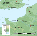
Places featured in Henry V's campaign of 1415-16.svg 700 × 686; 1.57 MB
-
Position troupes bataille d'Azincourt.jpg 745 × 879; 724 KB
-
Schéma bataille d'Azincourt ca.svg 313 × 250; 25 KB
-
Schéma bataille d'Azincourt.svg 313 × 250; 25 KB
-
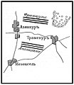
Иллюстрация к статье «Азинкур». Военная энциклопедия Сытина. Том 1 (СПб., 1911—1915).jpg 1,864 × 2,143; 327 KB


