Category:Maps of the Yucatan Peninsula
Jump to navigation
Jump to search
Media in category "Maps of the Yucatan Peninsula"
The following 83 files are in this category, out of 83 total.
-
 Yucatan Conquest.jpg 2,594 × 2,710; 1.1 MB
-

-
 1882 Map Yucatan Charnay.jpg 1,500 × 1,395; 2.39 MB
-
 203433W sm.png 895 × 716; 33 KB
-

-
 America.jpeg 257 × 196; 8 KB
-

-

-
 Bay of Honduras.jpg 3,500 × 2,780; 2.27 MB
-
 Bulletin (1904) (20415109992).jpg 3,048 × 2,516; 1.25 MB
-
 Cacicazgos mayas - es.svg 600 × 600; 377 KB
-
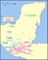
 Cacicazgos mayas.jpg 1,755 × 1,275; 216 KB
-
 Carretera Federal 293.svg 658 × 622; 58 KB
-
 Classic Maya Dialects.png 467 × 532; 342 KB
-
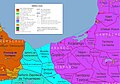
 Conflicto Limitrofe Yucatan Campeche Quintana Roo.PNG 1,471 × 1,188; 87 KB
-
 D450- N° 389. Péninsules de Yucatan et de Honduras. - liv3-ch13.png 1,456 × 1,900; 185 KB
-
 D451- N° 390. Langues de l’Amérique Centrale. - liv3-ch13.png 1,440 × 1,804; 275 KB
-

-
 ECDM 20200603 Central-America TCs.pdf 1,625 × 1,125; 758 KB
-
 ECDM 20200824 TCs LAURA MARCO.pdf 1,625 × 1,125; 602 KB
-
 ECDM 20200831 TC LAURA Overview.pdf 1,625 × 1,125; 542 KB
-
 ECDM 20200903 TC NANA.pdf 1,625 × 1,125; 1.87 MB
-
 ECDM 20201007 TCs DELTA GAMMA.pdf 1,625 × 1,125; 641 KB
-
 ECDM 20201028 TC ZETA.pdf 1,625 × 1,125; 720 KB
-
 ECDM 20201112 TC-ETA.pdf 1,625 × 1,125; 639 KB
-
 ECDM 20201116 TC-IOTA(1).pdf 1,625 × 1,125; 635 KB
-
 Intendencia de yucatán.PNG 237 × 375; 28 KB
-
 Itza Kingdom.svg 1,800 × 1,500; 496 KB
-
 Itzá Confederacy at its height.png 1,271 × 1,751; 472 KB
-
 Karibik 14.png 1,352 × 791; 511 KB
-
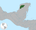
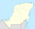
 Location of Yucatán Peninsula.png 1,002 × 641; 49 KB
-
 Location Republic of Yucatan (1841-1848).png 1,291 × 901; 112 KB
-
 LocationBahíadeGuantánamo.png 800 × 400; 60 KB
-
 Maaya t-aan.jpg 210 × 230; 15 KB
-
 Map of Yucatan by Juan José de León 1798.jpg 650 × 707; 120 KB
-
 Mapa Geografico De La Peninsula Y Provincia De Yucatan 1801.jpg 2,000 × 1,681; 540 KB
-
 Maya Block USGS OF-97-470-L 1-2.tif 4,044 × 4,826; 80 MB
-
 Maya IV.png 790 × 986; 103 KB
-
 Maya kuchkabals in Yucatan.tif 3,252 × 4,186; 12.99 MB
-
 Maya Languages.png 500 × 568; 357 KB
-
 Maya site northern Yucatan 800 AD-es.svg 1,788 × 1,273; 67 KB
-
 Maya site northern Yucatan 800 AD.svg 1,788 × 1,273; 88 KB
-
 Mayamap1.gif 790 × 1,020; 23 KB
-
 Mayanlanguageslocations.png 484 × 676; 41 KB
-
 Mayapan 1200.svg 1,800 × 1,500; 496 KB
-
 Mayisk språkkart.png 1,508 × 1,880; 298 KB
-
 Means 1917 Plate VI.djvu 2,437 × 2,936; 85 KB
-
 Means 1917 Plate VI.png 594 × 648; 416 KB
-
 MOM D031 The gulf of Mexico.jpg 2,209 × 1,208; 258 KB
-
 Mutul Controled Territory.svg 1,800 × 1,500; 496 KB
-
 Old Yucatan Map.png 782 × 589; 495 KB
-
 Península de Yucatán.svg 923 × 753; 183 KB
-
 Poniente Peninsula Yucatan.jpg 649 × 800; 94 KB
-
 Province of Chetumal map.tif 1,644 × 2,238; 3.51 MB
-
 PROVINCIAS YUCATAN 1549.jpg 400 × 300; 21 KB
-
 PROVINCIAS YUCATÁN 1549.svg 1,768 × 1,981; 246 KB
-
 Puuc Map.svg 1,800 × 1,500; 496 KB
-
 Puuc Region.png 3,760 × 2,946; 16.94 MB
-
 Péninsule du Yucatan.png 5,560 × 4,420; 232 KB
-
-
 Republic of Yucatan.svg 923 × 753; 295 KB
-
 Roys Provinces.png 2,049 × 2,080; 1.43 MB
-
 Sierra Madre de Chiapas-Peten Foldbelt Geologic Province 5310.png 1,486 × 1,553; 523 KB
-
 South Mexico.png 961 × 625; 144 KB
-
 The Maya Forest Transboundary Conservation Complex.jpg 1,500 × 1,945; 776 KB
-
 Vacaciones Cancún-415.jpg 1,024 × 683; 147 KB
-
 Vacaciones Cancún-416.jpg 1,024 × 683; 153 KB
-
 Yucatan Bewuchs.jpg 585 × 541; 66 KB
-
 Yucatan Geologie.jpg 569 × 527; 171 KB
-
 Yucatan Maya civilization places.svg 793 × 387; 80 KB
-
 Yucatan Peninsula.png 560 × 420; 42 KB
-
 Yucatan Platform geologic view.svg 765 × 990; 3.67 MB
-
 Yucatan Platform political view.svg 765 × 990; 3.45 MB
-
 Yucatan- maya.jpg 1,551 × 1,914; 582 KB
-
 Yucatan-Balankanche2.jpg 800 × 374; 80 KB
-
 Yucatan-Peninsula-1822 Map.jpg 592 × 674; 71 KB
-
 Yucatan.PNG 612 × 370; 92 KB
-
 Yucatan1910s.jpg 388 × 401; 79 KB
-
 Yucatanta.xcf 11,585 × 5,792; 68.13 MB
-
 YucatanWaldec1838Map.jpg 772 × 1,237; 791 KB
-
 Yucatn Peninsula.png 448 × 354; 8 KB
-
 Yucatán Peninsula.png 448 × 354; 19 KB
-


.jpg)


.jpg)

_(20953017630).jpg)


_(20415109992).jpg)


.png)


.jpg)