Category:Maps of the White Sea-Baltic Canal
Jump to navigation
Jump to search
Media in category "Maps of the White Sea-Baltic Canal"
The following 16 files are in this category, out of 16 total.
-
Bilomorkanal ukr.png 1,000 × 858; 255 KB
-
Map of the White Sea-Baltic Canal en.png 800 × 1,249; 209 KB
-
Map of the White Sea-Baltic Canal hu.svg 1,174 × 1,833; 259 KB
-
Map of the White Sea-Baltic Canal.png 1,174 × 1,833; 49 KB
-
Profil des Weißmeer-Ostsee-Kanals.svg 770 × 630; 13 KB
-
Profil White Sea Canal.jpg 4,002 × 2,743; 540 KB
-
USSR map NQ 35-16 Kem'.jpg 5,740 × 4,372; 6.91 MB
-
Valge mere – Läänemere kanal.png 1,000 × 858; 259 KB
-
Vienanmeren-Itameren kanavan kartta.PNG 1,000 × 858; 224 KB
-
White Sea Canal map german.png 990 × 848; 181 KB
-
White Sea Canal map hr.svg 1,004 × 861; 328 KB
-
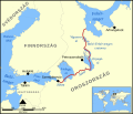
White Sea Canal map hu.svg 1,333 × 1,144; 302 KB
-
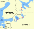
White Sea Canal map-he.svg 3,392 × 2,911; 369 KB
-
White Sea Canal map.png 1,000 × 858; 351 KB
-
Беломорско-Балтийский водный путь.png 726 × 545; 207 KB
-
Мапа Беломорско-балтичког канала.png 1,000 × 858; 228 KB


